Old Maps of Airport Addition Colonia, Texas for Genealogy
Trace your family roots with 10 historic maps of Airport Addition Colonia. These high-res maps reveal old neighborhoods, homesites, landmarks, and streets — helping you uncover where your ancestors lived and how the area evolved over time.
- Explore historic neighborhoods: Identify where your relatives may have lived in the 1800s or 1900s.
- Compare maps over time: Trace the changes in streets, buildings, and landmarks for multi-generational research.
- Perfect for genealogy & ancestry research: Used by family historians and researchers to map out lineage and migration.
These maps are an incredible resource for exploring your personal connection to Airport Addition Colonia's past.
Airport Addition Colonia, TX maps
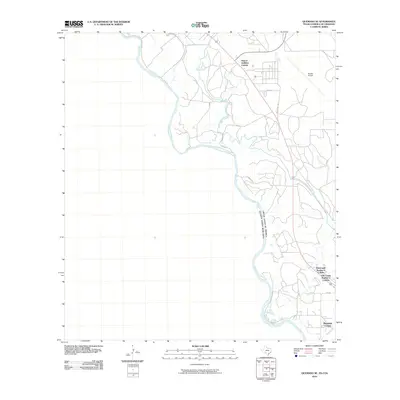
(10)- 1940 Map of Quemado, 1959 Print
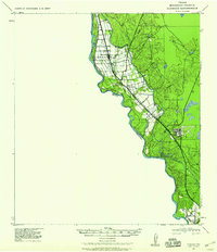 1940 Quemado1959 Print · USGSMaverick County sits along the Rio Grande during the early years of the war, showcasing a landscape of riverside irrigation and military expansion. Researchers can find family-named sites like Lehmann Ranch, the local Hydro Elec Plant, and the layout of the Eagle Pass Army Airfield.
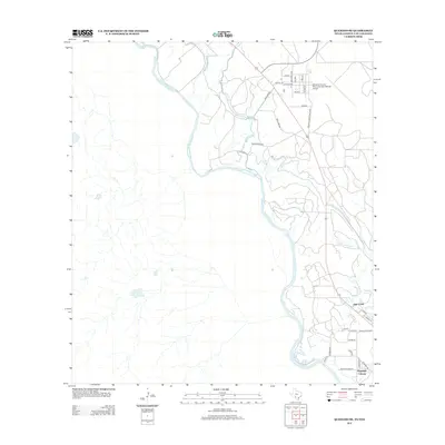
 - 1958 Map of Eagle Pass, 1969 Print
 1958 Eagle Pass1969 Print · USGSThe borderlands of South Texas come alive in this mid-century look at the ranching and rail corridor along the Rio Grande. Genealogists and historians can trace legacy holdings like San Pedro Ranch, find the Maverick Canal network, and locate rail sidings at Darling.2 unique versions available
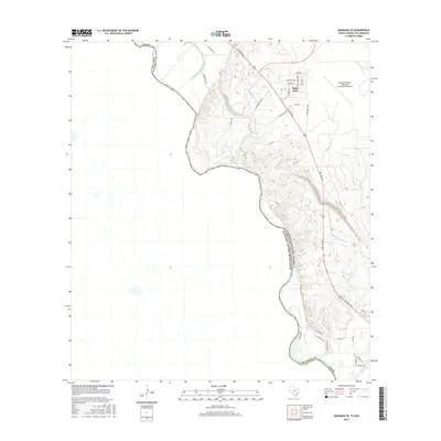
 - 1965 Map of Eagle Pass
 1965 Eagle Pass1965 Print · USGSThe Texas-Mexico borderlands come into focus in the mid-1960s, centered on the river life and ranching culture of Maverick County. Researchers can trace the legacy of major landholdings like Burr Ranch and Loma Linda Ranch alongside landmarks like the Hydroelectric Plant.
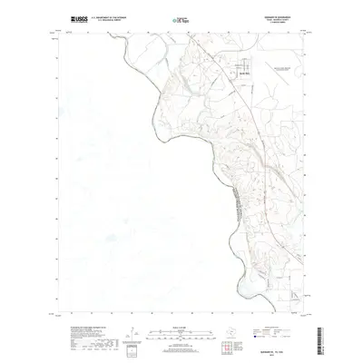
 - 1974 Map of Quemado SE, 1977 Print
 1974 Quemado SE1977 Print · USGSMaverick County sits along the international border in the mid-1970s, where the river bend dictates the reach of Texas ranch and utility lands. Researchers can trace the extensive water infrastructure of the Maverick County Canal or locate early industrial sites like the Mine and local Gravel Pits.
 - 1985 Map of Eagle Pass
 1985 Eagle Pass1985 Print · USGSThe Texas-Mexico borderlands come into focus in the mid-1980s as Eagle Pass grows along the Rio Grande. Genealogists and historians can trace the rail corridor of the Southern Pacific and locate rural communities like Normandy and El Indio.
 - 2010 Map of Quemado SE, 2010 Print
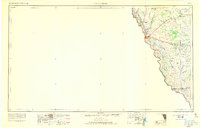
 2010 Quemado SE2010 Print · USGSCovers Airport Addition Colonia, including La Navaja, San Isidro, and other nearby areas
 - 2012 Map of Quemado SE, 2012 Print
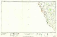
 2012 Quemado SE2012 Print · USGSCovers Airport Addition Colonia, including La Navaja, San Isidro, and other nearby areas
 - 2016 Map of Quemado SE, 2016 Print
 2016 Quemado SE2016 Print · USGSCovers Airport Addition Colonia, including La Navaja, San Isidro, and other nearby areas
 - 2019 Map of Quemado SE, 2019 Print
 2019 Quemado SE2019 Print · USGSCovers Airport Addition Colonia, including La Navaja, San Isidro, and other nearby areas
 - 2022 Map of Quemado SE, 2022 Print
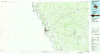
 2022 Quemado SE2022 Print · USGSMaverick County at the border with Mexico is shown here as it appeared in the early 2020s, dominated by the winding Rio Grande. Local researchers can trace the infrastructure of the Maverick Irrigation District Canal or locate the Radar Base and Maverick County Memorial International Airport.
End of results
Showing maps 1-10 of 10
Top cities near Airport Addition Colonia
Frequently asked questions
- What are the different types of historical maps available for Airport Addition Colonia?
- What is the oldest map of Airport Addition Colonia?
- Where can I purchase historical maps of Airport Addition Colonia for my home or office?
- Where can I download high-res historical maps of Airport Addition Colonia?
- Are there historical topographic maps available for Airport Addition Colonia?
- Is there historical aerial imagery available for Airport Addition Colonia?
- Where are historical maps of Airport Addition Colonia sourced from?