2020s Maps of Lorena, Texas
Explore 2 historic maps of Lorena from the 2020s. These maps offer a rare glimpse into what life looked like during the 2020s — showing old roads, neighborhoods, homes, and landmarks that have changed or disappeared over time.
Whether you're researching your family's past, planning a metal detecting trip, or studying how Lorena's landscape evolved across the 2020s, these high-resolution maps are a powerful tool for exploring the history of this region.
- Focus on a specific era: All maps on this page are from the 2020s, giving you a focused view of this time period.
- See what’s changed: Compare century-old streets, trails, and buildings to today's modern landscape using overlays and satellite layers.
- Research with precision: Use these maps for genealogy, historical research, land use analysis, or educational projects.
- View, download, or print: Maps are fully viewable online in high resolution, and can be downloaded or printed for your own records.
Start exploring Lorena's history through authentic maps from the 2020s. This is your window into the past.
Lorena, TX maps
(2)- 2022 Map of Lorena, 2022 Print
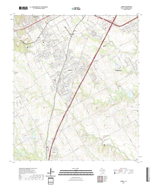 2022 Lorena2022 Print · USGSModern McLennan County comes into focus as the suburban growth of Hewitt and Lorena meets the winding banks of Bull Hide Cr. Genealogists can locate family landmarks such as Stanford Chapel Cem and Lawson Cem among the evolving residential grids.
 - 2022 Map of Bruceville, 2022 Print
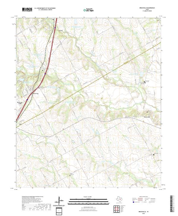 2022 Bruceville2022 Print · USGSSettled along the McLennan and Falls County line in the early twenty-first century, this area shows a landscape of bayous and reservoirs. Researchers can locate family heritage sites like Bruceville - Moore Cem and the settlement of Mooreville.
End of results
Showing maps 1-2 of 2
Top cities near Lorena
- Waco historical maps
- Temple historical maps
- Hewitt historical maps
- Robinson historical maps
- Bellmead historical maps
- Woodway historical maps
See more
Frequently asked questions
- What are the different types of historical maps available for Lorena?
- What is the oldest map of Lorena?
- Where can I purchase historical maps of Lorena for my home or office?
- Where can I download high-res historical maps of Lorena?
- Are there historical topographic maps available for Lorena?
- Is there historical aerial imagery available for Lorena?
- Where are historical maps of Lorena sourced from?