1900s (20th Century) Maps of Midland County, Texas
Explore 33 historic maps of Midland County from the 1900s (20th Century). These maps offer a rare glimpse into what life looked like during the 1900s — showing old roads, neighborhoods, homes, and landmarks that have changed or disappeared over time.
Whether you're researching your family's past, planning a metal detecting trip, or studying how Midland County's landscape evolved across the 1900s, these high-resolution maps are a powerful tool for exploring the history of this region.
- Focus on a specific era: All maps on this page are from the 1900s, giving you a focused view of this time period.
- See what’s changed: Compare century-old streets, trails, and buildings to today's modern landscape using overlays and satellite layers.
- Research with precision: Use these maps for genealogy, historical research, land use analysis, or educational projects.
- View, download, or print: Maps are fully viewable online in high resolution, and can be downloaded or printed for your own records.
Start exploring Midland County's history through authentic maps from the 1900s. This is your window into the past.
Midland County, TX maps
(33)- 1954 Map of Hobbs, 1963 Print
 1954 Hobbs1963 Print · USGSThe High Plains and Permian Basin transition is captured here at the height of the mid-century energy boom. Genealogists and industrial historians can trace the foundations of Humble City, locate the Potash Mine and Plant, and follow the Texas-New Mexico RR.2 unique versions available
 - 1954 Map of Pecos, 1964 Print
 1954 Pecos1964 Print · USGSMid-century West Texas reveals a landscape of expanding oil fields and cattle ranching along the winding Pecos River. Local historians can trace family ranch lands like Goodrich Ranch, follow the Texas and Pacific rails, or locate the historic Horsehead Crossing.3 unique versions available
 - 1954 Map of Big Spring, 1965 Print
 1954 Big Spring1965 Print · USGSWest Texas in the mid-1950s shows a landscape of growing oil towns and vital rail links along the Texas and Pacific RR. Researchers can trace the development of Big Spring, find smaller settlements like Knott and Lomax, or locate landmarks such as Boyds Chapel and Signal Mountain.4 unique versions available
 - 1954 Map of San Angelo, 1967 Print
 1954 San Angelo1967 Print · USGSThe Concho Valley and eastern Permian Basin transition from ranching to a burgeoning oil economy during the mid-twentieth century. Trace the expansion of San Angelo near Goodfellow AFB and locate old crossroads like Stiles, Texon, and Barnhart along the SANTA FE railroad.2 unique versions available
 - 1957 Map of Pecos
 1957 Pecos1957 Print · USGSWest Texas in the mid-fifties is a landscape of desert oil fields and vital rail corridors. Researchers can trace the sprawling Pyote Air Force Base, the historic Horsehead Crossing, and the rail stops at Mentone and Saragosa.
 - 1958 Map of San Angelo
 1958 San Angelo1958 Print · USGSWest Texas in the late fifties centers on the growing hub of San Angelo and its vital river confluences. Genealogists and historians can trace the paths of the Santa Fe railroad to outposts like Fort Chadbourne, Big Lake, and the specialized community of Sanatorium.
 - 1958 Map of Big Spring
 1958 Big Spring1958 Print · USGSThe West Texas oil boom was in full swing during the late fifties, transforming the landscape around Howard and Mitchell counties. Genealogists and historians can trace the growth of Big Spring and Snyder alongside industrial landmarks like the Kelly-Snyder Oil Field and the Santa Fe rail lines.
 - 1958 Map of Hobbs
 1958 Hobbs1958 Print · USGSThe High Plains of the Texas-New Mexico border are shown here during the height of the mid-century oil boom. Genealogists and historians can trace the development of Hobbs, Lovington, and Jal, alongside ranching landmarks like James Ranch and the early Texas-New Mexico Railway.
 - 1964 Map of Bryant Ranch, 1966 Print
 1964 Bryant Ranch1966 Print · USGSMidland County ranching and oil production intersect in the mid-1960s, showing a landscape partitioned by pipelines and vital water infrastructure. Researchers can trace the layout of the Bryant Ranch and a network of numbered watering stations including Windmill No 5 and Windmill No 14.2 unique versions available
 - 1964 Map of Odessa NE, 1966 Print
 1964 Odessa NE1966 Print · USGSOdessa and the Permian Basin plains are seen here during a period of rapid mid-century growth. Researchers can trace the development of neighborhood institutions like Permian High Sch and Sunset Memorial Gardens or the limits of the Headlee Field.4 unique versions available
 - 1964 Map of Odessa SE, 1966 Print
 1964 Odessa SE1966 Print · USGSThe expansion of the Permian Basin energy sector is on full display in the mid-1960s as residential neighborhoods push into the West Texas scrub. Trace the local infrastructure from Blackshear Stadium to the sprawling Headlee Oil Field and the Walters Ranch.3 unique versions available
 - 1964 Map of Parks, 1967 Print
 1964 Parks1967 Print · USGSMidland County's ranching and energy landscape is captured here in the mid-1960s as petroleum infrastructure expanded across the plains. Genealogists and historians can trace family-named landmarks like the Hi Estes Windmill and the expansive Parks Oil Field.2 unique versions available
 - 1965 Map of San Angelo
 1965 San Angelo1965 Print · USGSWest Texas in the mid-sixties reveals a landscape shaped by the petroleum industry and strategic water management. Genealogists and historians can trace the rail corridor through Texon and Big Lake, or locate military landmarks like Goodfellow AFB and Broome Air Force Auxiliary Airfield.
 - 1965 Map of Southeast Midland, 1966 Print
 1965 Southeast Midland1966 Print · USGSMidland during the mid-sixties mid-century boom shows a rapidly expanding urban grid meeting the rural plains. Genealogists and local historians can trace neighborhood growth through Sandy Acres, locate the Cotton Flat Ch, or find vanished landmarks like the local Raceway.3 unique versions available
 - 1965 Map of Spraberry, 1966 Print
 1965 Spraberry1966 Print · USGSMidland and Glasscock Counties were dominated by the Permian Basin's energy boom in the mid-sixties. Researchers can trace the layout of the Spraberry Oil Field and Germania Oil Field alongside the Tex-Harvey Camp and Spraberry Ch.
 - 1965 Map of Salt Lake, 1966 Print
 1965 Salt Lake1966 Print · USGSMidland County ranching and energy development converge in the mid-1960s, showing a landscape defined by water and oil. Trace family-named water sources and landholdings like Franklin Ranch, Hutt Ranch, and the Reynolds Windmill.
 - 1965 Map of Pecks Lake, 1966 Print
 1965 Pecks Lake1966 Print · USGSThe West Texas ranchlands along the Midland and Glasscock county line appear here during a period of expanding energy infrastructure. Researchers can locate the Pioneer Memorial Ch and trace the path of the regional Aqueduct near the Spraberry Gas Plant.
 - 1965 Map of Southwest Midland, 1966 Print
 1965 Southwest Midland1966 Print · USGSMidland and the surrounding Permian Basin are shown during a period of rapid mid-century growth and industrial development. Researchers can trace local landmarks like Midland Air Terminal, the Warfield Oil Field, and schools like Jane Long Sch.2 unique versions available
 - 1965 Map of Stephenson Lake, 1966 Print
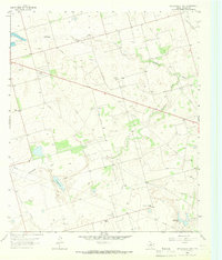 1965 Stephenson Lake1966 Print · USGSMidland's rural outskirts come alive in the mid-1960s, showing a landscape defined by ranching and the burgeoning oil industry. Researchers can trace local landmarks like Willis Ranch, the Stephenson Community Sch, and Conaway Lake.2 unique versions available
 - 1965 Map of South Cowden Ranch, 1967 Print
 1965 South Cowden Ranch1967 Print · USGSThe West Texas range meets the mid-century oil boom in the mid-1960s, where vast energy fields intersect with historic cattle operations. Genealogists and historians can trace ranch boundaries and water sources like South Cowden Ranch, Hillbilly Windmill, and Railway Ranch.2 unique versions available
 - 1965 Map of Northeast Midland, 1968 Print
 1965 Northeast Midland1968 Print · USGSMid-century Midland is shown during its oil-fueled expansion, where a dense street grid meets the high plains. Researchers can trace family history through neighborhood schools like Fannin Sch or visit the Fairview Cemetery and County Fairground.2 unique versions available
 - 1966 Map of Germania, 1968 Print
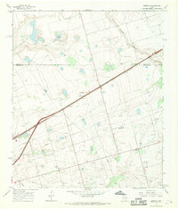 1966 Germania1968 Print · USGSMid-1960s West Texas comes alive along the boundary of Martin and Midland counties as the oil industry shapes the landscape. Trace the diagonal route of the Texas and Pacific railroad through the settlements of Germania and Greenwood.2 unique versions available
 - 1966 Map of Northwest Midland, 1968 Print
 1966 Northwest Midland1968 Print · USGSMidland expands northward during the mid-sixties, showcasing a landscape where local ranching and early suburban growth meet. Trace the development of neighborhood schools like Lee High Sch, the Drive-in Theater, and the unique High Sky Girls Ranch.3 unique versions available
 - 1966 Map of Stanton SE, 1969 Print
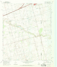 1966 Stanton SE1969 Print · USGSThe oil fields of the Permian Basin are in full development during the mid-sixties, marking the landscape with wells and pipelines. Genealogists and historians can trace the early industrial footprint of Stanton and Dix, locating landmarks like Evergreen Cem and Mustang Draw.
 - 1967 Map of Midkiff, 1970 Print
 1967 Midkiff1970 Print · USGSMidland and Upton counties are shown during a peak of mid-century industrial growth. Local historians can trace energy development through the Midkiff settlement, the Midkiff Gas Plant, and a sprawling network of Oil Wells.2 unique versions available
Showing maps 1-25 of 33
Top cities of Midland County
Frequently asked questions
- What are the different types of historical maps available for Midland County?
- What is the oldest map of Midland County?
- Where can I purchase historical maps of Midland County for my home or office?
- Where can I download high-res historical maps of Midland County?
- Are there historical topographic maps available for Midland County?
- Is there historical aerial imagery available for Midland County?
- Where are historical maps of Midland County sourced from?