Old Maps of SEA District, Corpus Christi for Academic Research
Study the evolution of SEA District with 15 high-resolution historic maps. Whether you're teaching, researching, or modeling changes in land use, these maps provide essential visual documentation of urban, environmental, and geographic change.
- Analyze long-term change: Track patterns in development, transportation, and natural features.
- Ideal for environmental or urban studies: Support academic projects with primary historical map data.
- Use in the classroom or lab: Educators and researchers rely on these maps to bring historical context to life.
These maps are a powerful tool for teaching, research, and visualizing how SEA District has changed over the decades.
SEA District, Corpus Christi maps
(15)- 1925 Map of Corpus Christi, 1949 Print
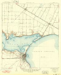 1925 Corpus Christi1949 Print · USGSCorpus Christi and the surrounding coastal plains are captured here in the 1920s, showing the early rail-and-port network of the Texas coast. Researchers can trace rural school locations like Sodville School and early industry at the West Portland Gin.
 - 1950 Map of Corpus Christi, 1953 Print
 1950 Corpus Christi1953 Print · USGSThe South Texas coast comes into focus during the early fifties, showing the interplay between booming oil fields and expansive ranching operations. Genealogists and historians can trace the Texas Mexican rail line through Kingsville or locate heritage sites like Chapman Ranch and Riviera Beach.
 - 1951 Map of Corpus Christi, 1952 Print
 1951 Corpus Christi1952 Print · USGSCorpus Christi at the dawn of the fifties showcases a bustling deep-water port and a rapidly expanding Texas coastal city. Genealogists and local historians can trace family locations through dozens of neighborhood landmarks, including Rose Hill Cem, St Therese Sch, and Cliff Maus Airport.
 - 1951 Map of Corpus Christi, 1952 Print
 1951 Corpus Christi1952 Print · USGSCorpus Christi and its surrounding bays were undergoing significant industrial and maritime growth in the early fifties. Genealogists and local historians can trace family roots at Bellevue Cem or locate former landmarks like Rosita Ranch and the Cliff Maus Airport.2 unique versions available
 - 1956 Map of Corpus Christi
 1956 Corpus Christi1956 Print · USGSThe South Texas coast and the burgeoning port of Corpus Christi are captured here during the mid-fifties. Genealogists and historians can trace the rail-and-oil economy through labels like Robstown Airpark, Chapman Ranch, and the Missouri Pacific railroad.
 - 1960 Map of Corpus Christi
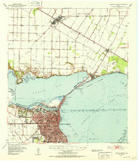
 1960 Corpus Christi1960 Print · USGSCoastal South Texas and the Nueces County hinterlands are detailed in this mid-century survey. Genealogists and historians can trace early settlement patterns and rural landmarks like Casa Blanca during a period of steady regional growth.
 - 1966 Map of Corpus Christi
 1966 Corpus Christi1966 Print · USGSThe Texas Coastal Bend in the mid-1960s reveals a landscape where massive cattle empires and strategic military bases meet the Gulf. Trace the vast reaches of King Ranch or locate aviation history at the Corpus Christi Air Station and Kingsville Air Station.
 - 1968 Map of Corpus Christi, 1971 Print
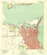
 1968 Corpus Christi1971 Print · USGSCorpus Christi emerged as a major industrial and maritime center in the late sixties. Genealogists and historians can trace the development of local neighborhoods through dozens of schools, Old Bayview Cem, and the Del Mar Technical Institute.2 unique versions available
 - 1984 Map of Corpus Christi
 1984 Corpus Christi1984 Print · USGSThe Texas Coastal Bend in the 1980s reveals a landscape defined by deep-water ports and sprawling ranchlands. Researchers can trace the rail lines of the Texas Mexican railroad or locate historical landmarks like the Chapman Ranch and Seaside Memorial Cem.
 - 1989 Map of Corpus Christi, 1991 Print
 1989 Corpus Christi1991 Print · USGSCoastal South Texas and its deep bays are captured here in the late eighties, showcasing a landscape of military aviation and barrier island preservation. Researchers can trace family roots in Petronila or Vattmannville and locate landmarks like Cabaniss Field and Baffin.
 - 2010 Map of Corpus Christi, 2010 Print
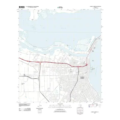 2010 Corpus Christi2010 Print · USGSCovers SEA District, including Corpus Christi, Nueces, and other nearby areas
 - 2013 Map of Corpus Christi, 2013 Print
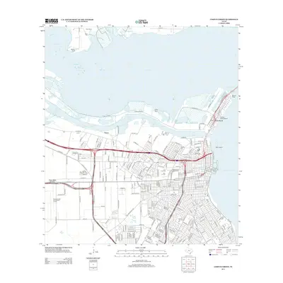 2013 Corpus Christi2013 Print · USGSCovers SEA District, including Corpus Christi, Nueces, and other nearby areas
 - 2016 Map of Corpus Christi, 2016 Print
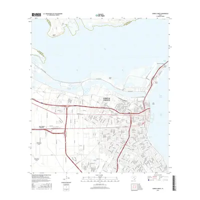 2016 Corpus Christi2016 Print · USGSCovers SEA District, including Corpus Christi, Nueces, and other nearby areas
 - 2019 Map of Corpus Christi, 2019 Print
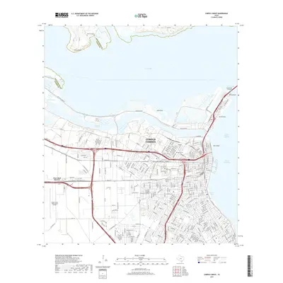 2019 Corpus Christi2019 Print · USGSCovers SEA District, including Corpus Christi, Nueces, and other nearby areas
 - 2022 Map of Corpus Christi, 2022 Print
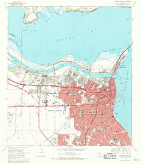
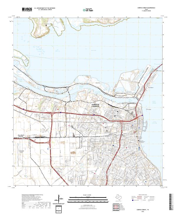 2022 Corpus Christi2022 Print · USGSThe Texas coastline at Corpus Christi comes into sharp focus in this 2022 survey, showcasing the massive maritime infrastructure that drives the regional economy. Local historians can trace the city's growth from Old Bayview Cem to the industrial works at Avery Point and Flour Bluff Junction.
End of results
Showing maps 1-15 of 15
Frequently asked questions
- What are the different types of historical maps available for SEA District?
- What is the oldest map of SEA District?
- Where can I purchase historical maps of SEA District for my home or office?
- Where can I download high-res historical maps of SEA District?
- Are there historical topographic maps available for SEA District?
- Is there historical aerial imagery available for SEA District?
- Where are historical maps of SEA District sourced from?