Old Maps of Robstown, Texas
Explore 22 old maps of Robstown, spanning from 1924 to today. These high-resolution historic maps reveal how streets, neighborhoods, landmarks, and natural features evolved over time — perfect for genealogy, metal detecting, research, and local history exploration.
What you can do with these maps:
- See how Robstown changed over time: Compare historical maps to modern-day views to trace roads, homesites, rail lines & more.
- View detailed metadata: Each map includes creators, publishers, year, scale, and archive source.
- Overlay maps with satellite & LiDAR: Visualize the past alongside modern tools to explore terrain & human change.
- Trusted historical sources: Maps sourced from the USGS, Library of Congress, and other archives.
- Access maps your way: View online, download high-res files, or order prints for personal or research use.
Start exploring old maps of Robstown to uncover forgotten places, hidden landmarks, and the deep history beneath your feet.
Robstown, TX maps
(22)- 1924 Map of Petronilla
 1924 Petronilla1924 Print · USGSCoastal Texas ranching and cotton farming come to life in the twenties as rail lines connected these plains to wider markets. Trace family lands and rural school sites like Norwood School alongside cattle operations at Ratamosa Ranch and Santa Cruz Ranch.2 unique versions available
 - 1925 Map of Robstown
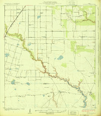
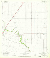
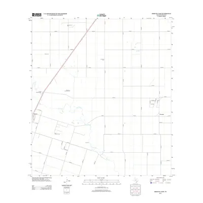
 1925 Robstown1925 Print · USGSCoastal Texas near the Nueces River delta was a landscape of rail junctions and riverine wetlands during the mid-1920s. Genealogists can locate family landmarks like Ward 1 School or trace the early development of Robstown and Nuecestown.3 unique versions available
 - 1950 Map of Corpus Christi, 1953 Print
 1950 Corpus Christi1953 Print · USGSThe South Texas coast comes into focus during the early fifties, showing the interplay between booming oil fields and expansive ranching operations. Genealogists and historians can trace the Texas Mexican rail line through Kingsville or locate heritage sites like Chapman Ranch and Riviera Beach.
 - 1954 Map of Robstown, 1956 Print
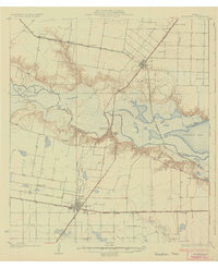
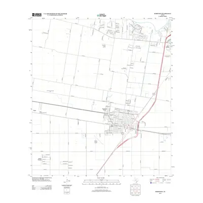
 1954 Robstown1956 Print · USGSCoastal Texas in the mid-fifties comes alive through this detailed survey of the rail and petroleum corridor between Robstown and Odem. Genealogists and historians can trace family-named sites like Hudson Acres, old schools like Tuloso-Midway Sch, and the Moravian Community Hall.
 - 1954 Map of Petronila, 1956 Print
 1954 Petronila1956 Print · USGSThe South Texas coastal plain during the mid-fifties shows a fascinating transition from ranching to a landscape of oil fields and naval aviation. Researchers can trace historic properties like Laureles Ranch alongside petroleum landmarks like the Luby Oil Field and numerous inactive training sites such as Naval Auxiliary Field 22.
 - 1956 Map of Corpus Christi
 1956 Corpus Christi1956 Print · USGSThe South Texas coast and the burgeoning port of Corpus Christi are captured here during the mid-fifties. Genealogists and historians can trace the rail-and-oil economy through labels like Robstown Airpark, Chapman Ranch, and the Missouri Pacific railroad.
 - 1960 Map of Corpus Christi
 1960 Corpus Christi1960 Print · USGSCoastal South Texas and the Nueces County hinterlands are detailed in this mid-century survey. Genealogists and historians can trace early settlement patterns and rural landmarks like Casa Blanca during a period of steady regional growth.
 - 1966 Map of Corpus Christi
 1966 Corpus Christi1966 Print · USGSThe Texas Coastal Bend in the mid-1960s reveals a landscape where massive cattle empires and strategic military bases meet the Gulf. Trace the vast reaches of King Ranch or locate aviation history at the Corpus Christi Air Station and Kingsville Air Station.
 - 1969 Map of Driscoll East, 1972 Print
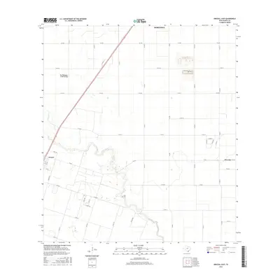
 1969 Driscoll East1972 Print · USGSCoastal Texas oil and gas production thrives during the late sixties near the communities of Driscoll and Petronila. Researchers can trace the sprawling Clara Driscoll Oil Field, find the Flinn Cem, and locate Coastal Bend Youth City.2 unique versions available
 - 1969 Map of Robstown, 1972 Print
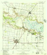
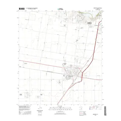
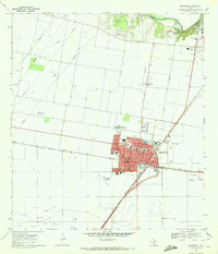 1969 Robstown1972 Print · USGSRobstown and the surrounding Nueces County coastal plains are captured here in the late sixties as a thriving rail and oil hub. Genealogists and historians can trace family-named landmarks and essential community sites like Robstown Memorial Park, Wilma Magee Sch, and the Robstown Labor Camp.3 unique versions available
 - 1984 Map of Corpus Christi
 1984 Corpus Christi1984 Print · USGSThe Texas Coastal Bend in the 1980s reveals a landscape defined by deep-water ports and sprawling ranchlands. Researchers can trace the rail lines of the Texas Mexican railroad or locate historical landmarks like the Chapman Ranch and Seaside Memorial Cem.
 - 1989 Map of Corpus Christi, 1991 Print
 1989 Corpus Christi1991 Print · USGSCoastal South Texas and its deep bays are captured here in the late eighties, showcasing a landscape of military aviation and barrier island preservation. Researchers can trace family roots in Petronila or Vattmannville and locate landmarks like Cabaniss Field and Baffin.
 - 2010 Map of Driscoll East, 2010 Print
 2010 Driscoll East2010 Print · USGSCovers Robstown, including Driscoll, Petronila, and other nearby areas
 - 2010 Map of Robstown, 2010 Print
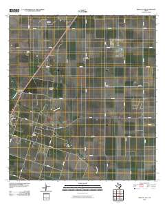
 2010 Robstown2010 Print · USGSCovers Robstown, including Corpus Christi, Nueces County, and other nearby areas
 - 2013 Map of Driscoll East, 2013 Print
 2013 Driscoll East2013 Print · USGSCovers Robstown, including Driscoll, Petronila, and other nearby areas
 - 2013 Map of Robstown, 2013 Print
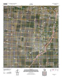
 2013 Robstown2013 Print · USGSCovers Robstown, including Corpus Christi, Nueces County, and other nearby areas
 - 2016 Map of Driscoll East, 2016 Print
 2016 Driscoll East2016 Print · USGSCovers Robstown, including Driscoll, Petronila, and other nearby areas
 - 2016 Map of Robstown, 2016 Print
 2016 Robstown2016 Print · USGSCovers Robstown, including Corpus Christi, Nueces County, and other nearby areas
 - 2019 Map of Driscoll East, 2019 Print
 2019 Driscoll East2019 Print · USGSCovers Robstown, including Driscoll, Petronila, and other nearby areas
 - 2019 Map of Robstown, 2019 Print
 2019 Robstown2019 Print · USGSCovers Robstown, including Corpus Christi, Nueces County, and other nearby areas
 - 2022 Map of Driscoll East, 2022 Print
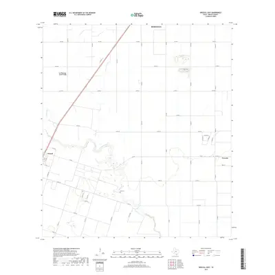
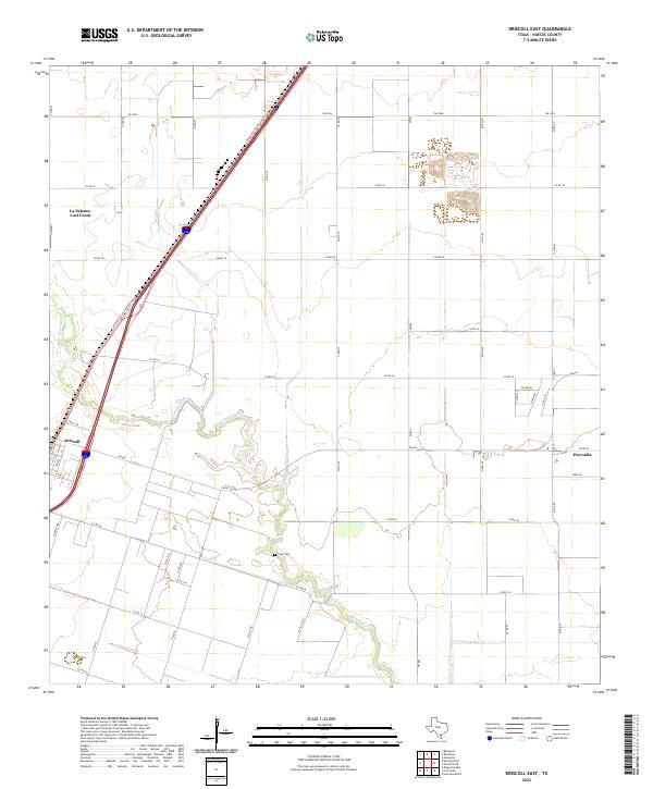 2022 Driscoll East2022 Print · USGSAgricultural lands in Nueces County come into focus in the early 2020s as the modern highway system expands. Researchers can trace family sites near the Flinn Cem and follow the route of Petronila Creek past Driscoll and Petronila.
 - 2022 Map of Robstown, 2022 Print
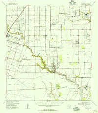
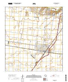
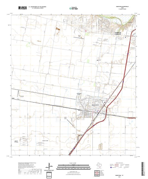 2022 Robstown2022 Print · USGSCoastal bend Texas at the start of the 2020s shows the continued growth of Robstown and its suburban neighbors. Researchers can trace family history through sites like Robstown Cem or explore aviation landmarks like Nueces County Airport and Rabb.
End of results
Showing maps 1-22 of 22
Top cities near Robstown
- Corpus Christi historical maps
- Bishop historical maps
- Odem historical maps
- Driscoll historical maps
- Agua Dulce historical maps
- Petronila historical maps
Top neighborhoods of Robstown
Frequently asked questions
- What are the different types of historical maps available for Robstown?
- What is the oldest map of Robstown?
- Where can I purchase historical maps of Robstown for my home or office?
- Where can I download high-res historical maps of Robstown?
- Are there historical topographic maps available for Robstown?
- Is there historical aerial imagery available for Robstown?
- Where are historical maps of Robstown sourced from?