1900s (20th Century) Maps of Corner Windmill, Texas
Explore 4 historic maps of Corner Windmill from the 1900s (20th Century). These maps offer a rare glimpse into what life looked like during the 1900s — showing old roads, neighborhoods, homes, and landmarks that have changed or disappeared over time.
Whether you're researching your family's past, planning a metal detecting trip, or studying how Corner Windmill's landscape evolved across the 1900s, these high-resolution maps are a powerful tool for exploring the history of this region.
- Focus on a specific era: All maps on this page are from the 1900s, giving you a focused view of this time period.
- See what’s changed: Compare century-old streets, trails, and buildings to today's modern landscape using overlays and satellite layers.
- Research with precision: Use these maps for genealogy, historical research, land use analysis, or educational projects.
- View, download, or print: Maps are fully viewable online in high resolution, and can be downloaded or printed for your own records.
Start exploring Corner Windmill's history through authentic maps from the 1900s. This is your window into the past.
Corner Windmill, TX maps
(4)- 1954 Map of Tucumcari, 1965 Print
 1954 Tucumcari1965 Print · USGSThe high plains along the New Mexico and Texas border come alive in this mid-century survey, just as the regional highway network was maturing. Trace the historic route of U.S. 66 through Glenrio and San Jon or locate remote rail sidings like Rehm Station and Obar.2 unique versions available
 - 1958 Map of Tucumcari
 1958 Tucumcari1958 Print · USGSEastern New Mexico and the Texas Panhandle meet in this mid-century survey of the high plains ranching and rail corridor. Researchers can trace the path of Mother Road travelers through Tucumcari and Glenrio or locate remote rail stops like Nara Visa Station and Hartley Station.
 - 1971 Map of Romero SE, 1973 Print
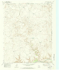 1971 Romero SE1973 Print · USGSThe Texas Panhandle breaks along the Canadian River are documented here in the early seventies, showing a ranching landscape centered on remote water sources. Researchers can trace the ranching infrastructure of the era through sites like Old Santa Fe Windmill, East Chavez Windmill, and Horseshoe Tank.
 - 1985 Map of Hartley, 1986 Print
 1985 Hartley1986 Print · USGSThe Texas Panhandle in the mid-eighties was a land of sprawling cattle ranches and emerging energy fields linked by deep-rooted rail lines. Genealogists and historians can trace the paths of the Burlington Northern through Channing or locate riverside landmarks like Tascosa and Boys Ranch.2 unique versions available
End of results
Showing maps 1-4 of 4
Frequently asked questions
- What are the different types of historical maps available for Corner Windmill?
- What is the oldest map of Corner Windmill?
- Where can I purchase historical maps of Corner Windmill for my home or office?
- Where can I download high-res historical maps of Corner Windmill?
- Are there historical topographic maps available for Corner Windmill?
- Is there historical aerial imagery available for Corner Windmill?
- Where are historical maps of Corner Windmill sourced from?