Old Maps of Orange County, Texas
Explore 103 old maps of Orange County, spanning from 1926 to today. These high-resolution historic maps reveal how streets, neighborhoods, landmarks, and natural features evolved over time — perfect for genealogy, metal detecting, research, and local history exploration.
What you can do with these maps:
- See how Orange County changed over time: Compare historical maps to modern-day views to trace roads, homesites, rail lines & more.
- View detailed metadata: Each map includes creators, publishers, year, scale, and archive source.
- Overlay maps with satellite & LiDAR: Visualize the past alongside modern tools to explore terrain & human change.
- Trusted historical sources: Maps sourced from the USGS, Library of Congress, and other archives.
- Access maps your way: View online, download high-res files, or order prints for personal or research use.
Start exploring old maps of Orange County to uncover forgotten places, hidden landmarks, and the deep history beneath your feet.
Orange County, TX maps
(103)- 1926 Map of Terry
 1926 Terry1926 Print · USGSCoastal Orange County was a hub of energy and rail transit in the mid-twenties, centered on the Neches River wetlands. Researchers can trace early infrastructure like the Southern Pacific tracks and the Mansfield Gulf Ferry Road.
 - 1926 Map of Lakeview
 1926 Lakeview1926 Print · USGSThe Neches River lowlands are captured here in the mid-1920s, showing a landscape defined by marshy sloughs and emerging industry. Genealogists and historians can locate family landmarks like the Williamson Church or trace old routes to Colliers Ferry.
 - 1926 Map of Vidor
 1926 Vidor1926 Print · USGSThe Neches River basin in the mid-1920s shows a landscape of winding waterways and emerging rail corridors. Researchers can trace the early footprint of Vidor and find rural landmarks like the Magnolia Grove School alongside the Kansas City Southern line.
 - 1926 Map of Texla
 1926 Texla1926 Print · USGSCoastal Texas in the mid-1920s is defined by its winding waterways and expanding rail lines. Genealogists and industrial historians can trace the Kansas City Southern route past the Linscomb Cem and the settlement at Texla.
 - 1926 Map of Mauriceville
 1926 Mauriceville1926 Print · USGSSoutheast Texas at the height of the mid-twenties rail era shows a landscape of timber-driven settlements and winding waterways. Genealogists and researchers can locate early schools and junctions like Little Cypress School, Lemonville, and Hartburg.
 - 1932 Map of Beaumont
 1932 Beaumont1932 Print · USGSThe Neches River lowlands and the growing settlement of Vidor are captured here during the early thirties. Genealogists can locate family landmarks like Magnolia Grove Sch, Williamson Ch, and the river crossing at Colliers Ferry.2 unique versions available
 - 1932 Map of Orange
 1932 Orange1932 Print · USGSSoutheastern Texas at the dawn of the 1930s is defined by the bustling riverfront of Orange and the intricate bends of the Sabine River. Researchers can trace the early street plan of the city, the Southern Pacific rail lines, and river landmarks like Morgan Bluff.2 unique versions available
 - 1932 Map of Port Arthur NE
 1932 Port Arthur NE1932 Print · USGSThe Louisiana coast near the Texas border comes alive in this early Depression-era survey of the coastal marshes. Local historians can trace the foundations of Rosenthal-Brown Camp and the reach of the Willow Bayou Canal along the edges of Sabine Lake.
 - 1943 Map of West of Greens Bayou, 1952 Print
 1943 West of Greens Bayou1952 Print · USGSThe Gulf Coast at the height of the Second World War was a vital corridor of shipping and natural marshlands. Researchers can trace the industrial waterway through Sabine Lake and find remote family-named landmarks like Stewts Island and Marceaux Island.
 - 1943 Map of Orangefield, 1953 Print
 1943 Orangefield1953 Print · USGSSoutheastern Texas in the early 1940s reveals a landscape of industrial expansion and historic river crossings. Researchers can trace family sites like Jett Cemetery or locate early infrastructure such as oil wells and the Old Mansfield Ferry Rd.
 - 1943 Map of Mauriceville, 1953 Print
 1943 Mauriceville1953 Print · USGSSoutheast Texas at the dawn of the 1940s reveals a rural landscape defined by logging railroads and bayou drainage. Genealogists and historians can trace family locations near Wilkinson Cem, the Little Cypress Sch, and the junction at Mauriceville.
 - 1943 Map of Port Arthur North, 1953 Print
 1943 Port Arthur North1953 Print · USGSSoutheast Texas at the height of its mid-century industrial growth shows a landscape defined by petrochemical hubs and new suburban neighborhoods. Local researchers can trace family roots through landmarks like Thomas Jefferson High School, Calvary Cem, and the enclave of Pear Ridge.
 - 1943 Map of Terry, 1953 Print
 1943 Terry1953 Print · USGSCoastal Texas during the war years reveals a landscape of industrial waterways and remote rail outposts along the Orange and Jefferson County line. Researchers can trace the Southern Pacific line through Terry and locate historic sites like Wallace Cem and Evergreen Ch.
 - 1943 Map of Texla, 1953 Print
 1943 Texla1953 Print · USGSSoutheast Texas at the height of the Second World War shows a landscape defined by the intersection of new rail lines and older timber mill roads. Genealogists can locate family sites like Singleton Cem and Linscomb Cem near the banks of Cow Bayou.
 - 1943 Map of Beaumont East, 1960 Print
 1943 Beaumont East1960 Print · USGSIn the midst of the Second World War, the Texas Gulf Coast's industrial heart thrived along the Neches River and its vital shipping channels. Genealogists and historians can trace the early layout of Lamar College, the famous Spindletop Oil Field, and family plots in Anthony Cem.
 - 1946 Map of Phoenix Lake
 1946 Phoenix Lake1946 Print · USGSThe Louisiana-Texas borderlands along the Sabine River are captured here in the mid-1940s, showing a transition from swampy wilderness to industrial waterway. Researchers can trace the development of the Intracoastal Waterway and locate named landmarks like Sassafras Island and Perry Ridge.
 - 1946 Map of Port Arthur NE
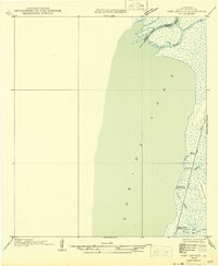 1946 Port Arthur NE1946 Print · USGSCoastal Cameron Parish at the state border shows a landscape of tidal marshes and seasonal outposts in the mid-1940s. Genealogists and historians can trace old camps and waterways like Rosenthal-Brown Camp, Willow Camp, and Pines Ridge.
 - 1947 Map of Toomey
 1947 Toomey1947 Print · USGSCalcasieu Parish at the Texas border is seen here in the late 1940s, where the winding river bottoms meet the railroad corridor. Researchers can trace family sites like Comier Cemetery and the settlement at Toomey along the Southern Pacific line.
 - 1952 Map of Lake Charles
 1952 Lake Charles1952 Print · USGSSouthwest Louisiana is captured here in the mid-fifties, showing a landscape defined by the rise of the petrochemical industry and deep-water navigation. Researchers can trace family roots through numerous small-town settlements and oil developments like Nibletts Bluff, the Lockport Oil Field, and Starks.
 - 1954 Map of Toomey
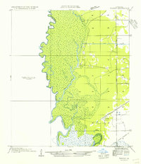 1954 Toomey1954 Print · USGSThe Louisiana-Texas borderlands in the mid-fifties are defined here by the winding Sabine River and the marshes of Calcasieu Parish. Researchers can locate Nibletts Bluff on the riverbank or trace family names at the Comier Cemetery near Toomey.
 - 1954 Map of Phoenix Lake
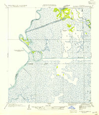 1954 Phoenix Lake1954 Print · USGSThe Louisiana-Texas borderlands are captured here in the mid-fifties, showing a landscape defined by wetlands and the Sabine River. Researchers can trace early infrastructure like Burton Shell Road and named landmarks such as Sassafras Island or Phoenix Lake.
 - 1954 Map of Port Arthur
 1954 Port Arthur1954 Print · USGSThe Texas and Louisiana coastlines meet here in the mid-fifties, showing the industrial rise of Port Arthur alongside vast wildlife preserves. Researchers can trace remote coastal settlements and infrastructure like Pecan Island, the Sabine Pass Lighthouse, and the North Island School.
 - 1954 Map of Lake Charles, 1964 Print
 1954 Lake Charles1964 Print · USGSSouthwest Louisiana in the mid-fifties is defined by its massive petroleum industry and its complex network of bayous and rail lines. Researchers can trace the development of the Sulphur Mines Oil Field or locate historic settlements like Longville and De Quincy.3 unique versions available
 - 1954 Map of Beaumont, 1964 Print
 1954 Beaumont1964 Print · USGSSoutheast Texas in the mid-fifties reveals a landscape of massive national forests, emerging reservoirs, and a booming oil economy. Genealogists and researchers can trace rural settlements like Dallardsville and Village Mills or locate early drilling sites at Sour Lake Oil Field.3 unique versions available
 - 1955 Map of Orange, 1956 Print
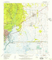 1955 Orange1956 Print · USGSThe Texas-Louisiana borderlands in the mid-fifties center on the industrial hubs and vast marshlands of the Sabine River. Genealogists and historians can locate community sites like Reed Cem, Crossroad Ch, and the Gum Cove Ferry crossing.
Showing maps 1-25 of 103
Top cities of Orange County
- Orange historical maps
- Vidor historical maps
- Bridge City historical maps
- West Orange historical maps
- Pinehurst historical maps
- Pine Forest historical maps
See more
Frequently asked questions
- What are the different types of historical maps available for Orange County?
- What is the oldest map of Orange County?
- Where can I purchase historical maps of Orange County for my home or office?
- Where can I download high-res historical maps of Orange County?
- Are there historical topographic maps available for Orange County?
- Is there historical aerial imagery available for Orange County?
- Where are historical maps of Orange County sourced from?