1900s (20th Century) Maps of Woods, Texas
Explore 6 historic maps of Woods from the 1900s (20th Century). These maps offer a rare glimpse into what life looked like during the 1900s — showing old roads, neighborhoods, homes, and landmarks that have changed or disappeared over time.
Whether you're researching your family's past, planning a metal detecting trip, or studying how Woods's landscape evolved across the 1900s, these high-resolution maps are a powerful tool for exploring the history of this region.
- Focus on a specific era: All maps on this page are from the 1900s, giving you a focused view of this time period.
- See what’s changed: Compare century-old streets, trails, and buildings to today's modern landscape using overlays and satellite layers.
- Research with precision: Use these maps for genealogy, historical research, land use analysis, or educational projects.
- View, download, or print: Maps are fully viewable online in high resolution, and can be downloaded or printed for your own records.
Start exploring Woods's history through authentic maps from the 1900s. This is your window into the past.
Woods, TX maps
(6)- 1945 Map of Socagee Bayou
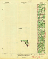 1945 Socagee Bayou1945 Print · USGSThe Texas-Louisiana borderlands come alive in the mid-1940s as the Sabine River winds past rural homesteads and timber tracks. Researchers can trace the foundations of local life through the Southern Pacific rail line at Logansport and historic sites like Hogeye Cem and Shiloh Sch.2 unique versions available
 - 1956 Map of Tyler
 1956 Tyler1956 Print · USGSEast Texas was a powerhouse of oil production and rail transport during the mid-fifties, centered on the sprawling East Texas Oil Field. Researchers can trace the heritage of industrial hubs like Kilgore, military sites such as the Longhorn Ordnance Works, and many rural landmarks like Mount Enterprise.5 unique versions available
 - 1956 Map of Deadwood, 1957 Print
 1956 Deadwood1957 Print · USGSThe Texas-Louisiana borderlands along the Sabine River are shown here in the mid-fifties as the Carthage Gas Field reshaped the local landscape. Genealogists can trace family roots through numerous rural landmarks, including the Centennial Cem, Shiloh Baptist Ch, and the settlement at Deadwood.4 unique versions available
 - 1983 Map of Old Center
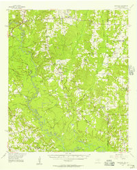
 1983 Old Center1983 Print · USGSPanola County's river-bottom landscape is captured here in the early eighties, centered on the winding Sabine River and its many tributaries. Genealogists can trace family footprints near Old Center, Woods, and the remote river bend known as Buzzard Roost Bend.
 - 1984 Map of Tyler
 1984 Tyler1984 Print · USGSEast Texas at the peak of its reservoir-building era shows a landscape defined by new lakes and established rail corridors. Trace the path of the St Louis Southwestern RR or locate industrial sites like the Longhorn Ordnance Works.3 unique versions available
 - 1986 Map of Henderson
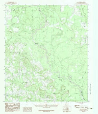
 1986 Henderson1986 Print · USGSEast Texas and the Louisiana borderlands come into focus in the 1980s as industrial energy production meets quiet rural townships. Researchers can trace family sites and local landmarks from Elysian Fields to Old Panola, alongside major features like the Strip Mine and Martin Lake State Park.2 unique versions available
End of results
Showing maps 1-6 of 6
Top cities near Woods
- Carthage historical maps
- Center historical maps
- Timpson historical maps
- Tenaha historical maps
- Joaquin historical maps
- Beckville historical maps
Frequently asked questions
- What are the different types of historical maps available for Woods?
- What is the oldest map of Woods?
- Where can I purchase historical maps of Woods for my home or office?
- Where can I download high-res historical maps of Woods?
- Are there historical topographic maps available for Woods?
- Is there historical aerial imagery available for Woods?
- Where are historical maps of Woods sourced from?