1970s Maps of Fort Stockton, Texas
Explore 3 historic maps of Fort Stockton from the 1970s. These maps offer a rare glimpse into what life looked like during the 1970s — showing old roads, neighborhoods, homes, and landmarks that have changed or disappeared over time.
Whether you're researching your family's past, planning a metal detecting trip, or studying how Fort Stockton's landscape evolved across the 1970s, these high-resolution maps are a powerful tool for exploring the history of this region.
- Focus on a specific era: All maps on this page are from the 1970s, giving you a focused view of this time period.
- See what’s changed: Compare century-old streets, trails, and buildings to today's modern landscape using overlays and satellite layers.
- Research with precision: Use these maps for genealogy, historical research, land use analysis, or educational projects.
- View, download, or print: Maps are fully viewable online in high resolution, and can be downloaded or printed for your own records.
Start exploring Fort Stockton's history through authentic maps from the 1970s. This is your window into the past.
Fort Stockton, TX maps
(3)- 1970 Map of Fort Stockton West, 1973 Print
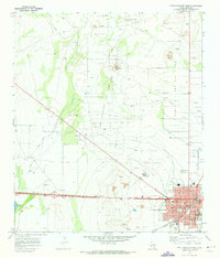 1970 Fort Stockton West1973 Print · USGSFort Stockton is captured during a period of significant growth and energy expansion in the early 1970s. Researchers can trace the town's roots through the Old Fort Cem and Comanche Springs while exploring the surrounding Fort Stockton Oil and Gas Field.
 - 1970 Map of Fort Stockton East, 1973 Print
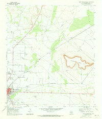 1970 Fort Stockton East1973 Print · USGSFort Stockton and its high-desert surroundings come into focus during the early seventies, showing a town balancing its railroad heritage with new industrial growth. Genealogists and local historians can trace East Hill Cem, the Atchison Topeka and Santa Fe rail line, and landmarks like James Rooney Memorial Park.
 - 1973 Map of Fort Stockton, 1974 Print
 1973 Fort Stockton1974 Print · USGSThe Trans-Pecos region of West Texas comes alive in the early seventies, from the desert flats of the Stockton Plateau to the heights of the Davis Mountains. Researchers can trace the legacy of frontier outposts and rail lines through Fort Davis Nat Hist Site, Alpine, and the Southern Pacific RR.
End of results
Showing maps 1-3 of 3
Frequently asked questions
- What are the different types of historical maps available for Fort Stockton?
- What is the oldest map of Fort Stockton?
- Where can I purchase historical maps of Fort Stockton for my home or office?
- Where can I download high-res historical maps of Fort Stockton?
- Are there historical topographic maps available for Fort Stockton?
- Is there historical aerial imagery available for Fort Stockton?
- Where are historical maps of Fort Stockton sourced from?