Old Maps of Refugio County, Texas
Explore 157 old maps of Refugio County, spanning from 1952 to today. These high-resolution historic maps reveal how streets, neighborhoods, landmarks, and natural features evolved over time — perfect for genealogy, metal detecting, research, and local history exploration.
What you can do with these maps:
- See how Refugio County changed over time: Compare historical maps to modern-day views to trace roads, homesites, rail lines & more.
- View detailed metadata: Each map includes creators, publishers, year, scale, and archive source.
- Overlay maps with satellite & LiDAR: Visualize the past alongside modern tools to explore terrain & human change.
- Trusted historical sources: Maps sourced from the USGS, Library of Congress, and other archives.
- Access maps your way: View online, download high-res files, or order prints for personal or research use.
Start exploring old maps of Refugio County to uncover forgotten places, hidden landmarks, and the deep history beneath your feet.
Refugio County, TX maps
(157)- 1952 Map of Tivoli, 1953 Print
 1952 Tivoli1953 Print · USGSCoastal prairie life in Refugio County during the early fifties revolved around the railroad and river systems. Genealogists and local historians can trace the development of Tivoli and Maudlowe, alongside ranching landmarks like Red Mill Tank and Anaqua Tank.3 unique versions available
 - 1952 Map of Bloomington SW, 1953 Print
 1952 Bloomington SW1953 Print · USGSThe lower reaches of the Guadalupe and San Antonio rivers met in the early fifties amidst a growing coastal oil economy. Trace family landmarks like Rudolph Cem or follow the Missouri Pacific railroad as it crosses Cushman Bayou.4 unique versions available
 - 1952 Map of Tivoli SE, 1953 Print
 1952 Tivoli SE1953 Print · USGSThe Blackjack Peninsula and its coastal marshes are captured in the early fifties, shortly after the establishment of the wildlife refuge. Researchers can find old ranching landmarks like Buzzard Windmill and follow the shoreline from Webb Point to Mustang L.2 unique versions available
 - 1952 Map of Austwell, 1953 Print
 1952 Austwell1953 Print · USGSThe Texas Gulf Coast near the Refugio and Calhoun county line is captured here in the early fifties, showing a land defined by water and rail. Trace the railhead at Austwell, locate the Austwell Cem, and explore the marshes of Mission Lake.3 unique versions available
 - 1952 Map of Tivoli SW, 1953 Print
 1952 Tivoli SW1953 Print · USGSThe coastal prairie of Refugio and Aransas counties is captured here in the early fifties, showcasing the vital water systems of the Texas coast. Researchers can trace historic ranching infrastructure through named sites like Spanish Village, Lucky Windmill, and Lake Burgentine.
 - 1953 Map of Beeville
 1953 Beeville1953 Print · USGSThe Texas Coastal Bend in the early fifties shows a landscape of growing regional hubs and vital maritime corridors. Trace the rail-and-river economy through Goliad, locate the Matagorda Lighthouse, and explore the sprawling Aransas National Wildlife Refuge.
 - 1954 Map of Rockport, 1956 Print
 1954 Rockport1956 Print · USGSThe Aransas County coast comes to life in the mid-fifties, showing the growth of Rockport and the expansion of the Fulton Beach Oil Field. Researchers can locate family landmarks like Mc Lester Cem and trace the early layout of the Aransas County Airport.2 unique versions available
 - 1954 Map of Woodsboro, 1956 Print
 1954 Woodsboro1956 Print · USGSCoastal Texas in the mid-fifties reveals a landscape defined by the booming oil industry and traditional cotton farming. Researchers can trace the layout of Woodsboro and Sinton, or locate rural landmarks like St Bernard Cem, the Baldwin Cotton Gin, and Roche Ranch.
 - 1954 Map of Vidaurri, 1956 Print
 1954 Vidaurri1956 Print · USGSCoastal Texas ranching and petroleum industry collide in the mid-fifties as massive oil fields expanded across Refugio County. Genealogists and historians can trace family-named sites like Welder Ranch, Lambert Ranch, and the settlements of Vidaurri and Greta.2 unique versions available
 - 1954 Map of Sinton, 1956 Print
 1954 Sinton1956 Print · USGSSan Patricio County at the height of the mid-century oil boom is centered on the rail junction at Sinton. You can trace energy and transport history through the Plymouth Oil Camp, Papalote Cem, and the Sinton Oil Field.2 unique versions available
 - 1954 Map of Refugio, 1956 Print
 1954 Refugio1956 Print · USGSIn the mid-1950s, this portion of the Texas Coastal Bend was a landscape defined by the growing energy sector and deep-rooted ranching traditions. Researchers can trace family landmarks and rural infrastructure including Blanconia, the Refugio Oil Field, and McQuill Cem.
 - 1956 Map of Beeville
 1956 Beeville1956 Print · USGSCoastal Texas and the brush country interior are shown in the mid-fifties, from the coastal bays to the inland oil fields. Trace the old rail lines of the Southern Pacific RR or locate the historic Matagorda Lighthouse and the Aransas National Wildlife Refuge.2 unique versions available
 - 1960 Map of Beeville
 1960 Beeville1960 Print · USGSCoastal Texas in the mid-fifties reveals a landscape of growing towns and vital military outposts like Foster AFB. Researchers can trace old rail lines including the Missouri Pacific and explore the vast Aransas National Wildlife Refuge.
 - 1962 Map of Lott Lake, 1963 Print
 1962 Lott Lake1963 Print · USGSIn the early sixties, the San Antonio River meanders through the borders of Goliad and Victoria counties. Researchers can trace family history through sites like Lott Cem and Mt Zion Ch or locate old river crossings at Duke Bridge.2 unique versions available
 - 1962 Map of McFaddin, 1964 Print
 1962 McFaddin1964 Print · USGSThe Texas coastal prairie comes alive in the early sixties as energy extraction meets historic ranchlands along the winding San Antonio River. Genealogists and historians can trace local roots through De la Garza Cem, the settlement of McFaddin, and the extensive Anaqua Oil Field.3 unique versions available
 - 1978 Map of Woodsboro
 1978 Woodsboro1978 Print · USGSCoastal Texas prairie life in the late seventies is defined here by the intersection of cattle country, rail lines, and the oil industry. Genealogists and historians can trace family plots at St Bernard Cem or map the growth of Woodsboro and Bonnie View near the Mission River.
 - 1978 Map of Ryanville, 1979 Print
 1978 Ryanville1979 Print · USGSThe South Texas brush country at the Goliad and Refugio county line comes into focus in the late 1970s, showing a landscape defined by ranching and oil. Researchers can trace the development of Ryanville and find local landmarks like Willow Lake, Roadside Park, and Ninemile Flat.
 - 1978 Map of Vidaurri, 1979 Print
 1978 Vidaurri1979 Print · USGSCoastal Texas ranching and energy production intersect in the late 1970s as the Missouri Pacific rail line connects small prairie outposts. Traces of the Tom O'Connor Oil Field and the Welder Ranch reveal the region's industrial and agricultural roots.
 - 1978 Map of Twin Mott Lake, 1979 Print
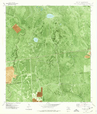 1978 Twin Mott Lake1979 Print · USGSThe coastal plains of Refugio and Aransas counties are captured here in the late seventies, showing a landscape defined by ranching and energy. Researchers can trace the extensive Tom Oconnor Oil Field and numerous named artesian sites like Rainey Well and Cavasso Pens.
 - 1978 Map of Cranell, 1979 Print
 1978 Cranell1979 Print · USGSCoastal Texas ranching and energy production meet in the late seventies along the winding Aransas River. Researchers can trace family-named sites like Rooke Ranch and Alders Camp Windmill or follow the Missouri Pacific rail line through Cranell.
 - 1978 Map of Refugio SW, 1991 Print
 1978 Refugio SW1991 Print · USGSCoastal Texas ranchlands met industrial expansion in the late seventies as energy production intensified near the Bee County line. Researchers can trace land use patterns across the Blanconia Oil Field and locate rural landmarks like Medio Creek and a local Cem.
 - 1979 Map of Mission Bay
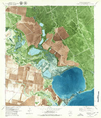 1979 Mission Bay1979 Print · USGSThe Refugio County coastline in the late 1970s shows a landscape of tidal marshes and energy production. Researchers can trace historical well sites like Estaquillo Well and coastal landmarks from Mission Lake to Copano Reef.
 - 1979 Map of Refugio
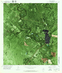 1979 Refugio1979 Print · USGSThe South Texas coastal plains are shown during the late seventies, centered on the historic town of Refugio as it expanded alongside the energy industry. Researchers can locate family landmarks like Mt Calvary Cem, trace the oxbows of the Mission River, and identify the early layouts of Rooke Field and the County Fairground.
 - 1979 Map of Lamar
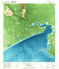 1979 Lamar1979 Print · USGSTexas's coastal bend comes into focus during the late seventies as the petroleum industry and residential growth expanded along the shore. Researchers can trace land use from the Copano Bay Oil and Gas Field to the Plumbers Cem and Lamar community.
 - 1979 Map of Blanconia
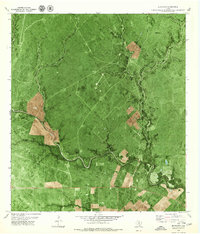 1979 Blanconia1979 Print · USGSDeep in South Texas during the late 1970s, this quadrangle shows the rural intersection of Goliad and Bee counties. Researchers can trace the development of the Blanconia Oil Field and locate landmarks like the local Cem and Blanconia settlement.
Showing maps 1-25 of 157
Top cities of Refugio County
Frequently asked questions
- What are the different types of historical maps available for Refugio County?
- What is the oldest map of Refugio County?
- Where can I purchase historical maps of Refugio County for my home or office?
- Where can I download high-res historical maps of Refugio County?
- Are there historical topographic maps available for Refugio County?
- Is there historical aerial imagery available for Refugio County?
- Where are historical maps of Refugio County sourced from?