1950s Maps of Refugio County, Texas
Explore 12 historic maps of Refugio County from the 1950s. These maps offer a rare glimpse into what life looked like during the 1950s — showing old roads, neighborhoods, homes, and landmarks that have changed or disappeared over time.
Whether you're researching your family's past, planning a metal detecting trip, or studying how Refugio County's landscape evolved across the 1950s, these high-resolution maps are a powerful tool for exploring the history of this region.
- Focus on a specific era: All maps on this page are from the 1950s, giving you a focused view of this time period.
- See what’s changed: Compare century-old streets, trails, and buildings to today's modern landscape using overlays and satellite layers.
- Research with precision: Use these maps for genealogy, historical research, land use analysis, or educational projects.
- View, download, or print: Maps are fully viewable online in high resolution, and can be downloaded or printed for your own records.
Start exploring Refugio County's history through authentic maps from the 1950s. This is your window into the past.
Refugio County, TX maps
(12)- 1952 Map of Tivoli, 1953 Print
 1952 Tivoli1953 Print · USGSCoastal prairie life in Refugio County during the early fifties revolved around the railroad and river systems. Genealogists and local historians can trace the development of Tivoli and Maudlowe, alongside ranching landmarks like Red Mill Tank and Anaqua Tank.3 unique versions available
 - 1952 Map of Bloomington SW, 1953 Print
 1952 Bloomington SW1953 Print · USGSThe lower reaches of the Guadalupe and San Antonio rivers met in the early fifties amidst a growing coastal oil economy. Trace family landmarks like Rudolph Cem or follow the Missouri Pacific railroad as it crosses Cushman Bayou.4 unique versions available
 - 1952 Map of Tivoli SE, 1953 Print
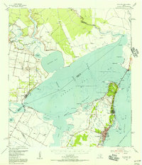
 1952 Tivoli SE1953 Print · USGSThe Blackjack Peninsula and its coastal marshes are captured in the early fifties, shortly after the establishment of the wildlife refuge. Researchers can find old ranching landmarks like Buzzard Windmill and follow the shoreline from Webb Point to Mustang L.2 unique versions available
 - 1952 Map of Austwell, 1953 Print
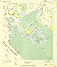 1952 Austwell1953 Print · USGSThe Texas Gulf Coast near the Refugio and Calhoun county line is captured here in the early fifties, showing a land defined by water and rail. Trace the railhead at Austwell, locate the Austwell Cem, and explore the marshes of Mission Lake.3 unique versions available
 - 1952 Map of Tivoli SW, 1953 Print
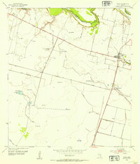
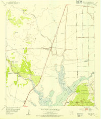 1952 Tivoli SW1953 Print · USGSThe coastal prairie of Refugio and Aransas counties is captured here in the early fifties, showcasing the vital water systems of the Texas coast. Researchers can trace historic ranching infrastructure through named sites like Spanish Village, Lucky Windmill, and Lake Burgentine.
 - 1953 Map of Beeville
 1953 Beeville1953 Print · USGSThe Texas Coastal Bend in the early fifties shows a landscape of growing regional hubs and vital maritime corridors. Trace the rail-and-river economy through Goliad, locate the Matagorda Lighthouse, and explore the sprawling Aransas National Wildlife Refuge.
 - 1954 Map of Rockport, 1956 Print
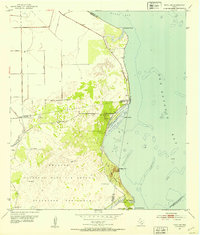
 1954 Rockport1956 Print · USGSThe Aransas County coast comes to life in the mid-fifties, showing the growth of Rockport and the expansion of the Fulton Beach Oil Field. Researchers can locate family landmarks like Mc Lester Cem and trace the early layout of the Aransas County Airport.2 unique versions available
 - 1954 Map of Woodsboro, 1956 Print
 1954 Woodsboro1956 Print · USGSCoastal Texas in the mid-fifties reveals a landscape defined by the booming oil industry and traditional cotton farming. Researchers can trace the layout of Woodsboro and Sinton, or locate rural landmarks like St Bernard Cem, the Baldwin Cotton Gin, and Roche Ranch.
 - 1954 Map of Vidaurri, 1956 Print
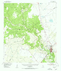
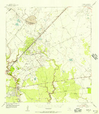 1954 Vidaurri1956 Print · USGSCoastal Texas ranching and petroleum industry collide in the mid-fifties as massive oil fields expanded across Refugio County. Genealogists and historians can trace family-named sites like Welder Ranch, Lambert Ranch, and the settlements of Vidaurri and Greta.2 unique versions available
 - 1954 Map of Sinton, 1956 Print
 1954 Sinton1956 Print · USGSSan Patricio County at the height of the mid-century oil boom is centered on the rail junction at Sinton. You can trace energy and transport history through the Plymouth Oil Camp, Papalote Cem, and the Sinton Oil Field.2 unique versions available
 - 1954 Map of Refugio, 1956 Print
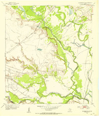
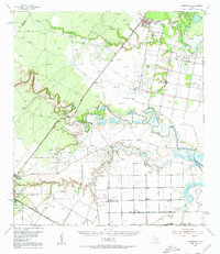
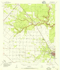
 1954 Refugio1956 Print · USGSIn the mid-1950s, this portion of the Texas Coastal Bend was a landscape defined by the growing energy sector and deep-rooted ranching traditions. Researchers can trace family landmarks and rural infrastructure including Blanconia, the Refugio Oil Field, and McQuill Cem.
 - 1956 Map of Beeville
 1956 Beeville1956 Print · USGSCoastal Texas and the brush country interior are shown in the mid-fifties, from the coastal bays to the inland oil fields. Trace the old rail lines of the Southern Pacific RR or locate the historic Matagorda Lighthouse and the Aransas National Wildlife Refuge.2 unique versions available
End of results
Showing maps 1-12 of 12
Top cities of Refugio County
Frequently asked questions
- What are the different types of historical maps available for Refugio County?
- What is the oldest map of Refugio County?
- Where can I purchase historical maps of Refugio County for my home or office?
- Where can I download high-res historical maps of Refugio County?
- Are there historical topographic maps available for Refugio County?
- Is there historical aerial imagery available for Refugio County?
- Where are historical maps of Refugio County sourced from?