1960s Maps of Refugio County, Texas
Explore 3 historic maps of Refugio County from the 1960s. These maps offer a rare glimpse into what life looked like during the 1960s — showing old roads, neighborhoods, homes, and landmarks that have changed or disappeared over time.
Whether you're researching your family's past, planning a metal detecting trip, or studying how Refugio County's landscape evolved across the 1960s, these high-resolution maps are a powerful tool for exploring the history of this region.
- Focus on a specific era: All maps on this page are from the 1960s, giving you a focused view of this time period.
- See what’s changed: Compare century-old streets, trails, and buildings to today's modern landscape using overlays and satellite layers.
- Research with precision: Use these maps for genealogy, historical research, land use analysis, or educational projects.
- View, download, or print: Maps are fully viewable online in high resolution, and can be downloaded or printed for your own records.
Start exploring Refugio County's history through authentic maps from the 1960s. This is your window into the past.
Refugio County, TX maps
(3)- 1960 Map of Beeville
 1960 Beeville1960 Print · USGSCoastal Texas in the mid-fifties reveals a landscape of growing towns and vital military outposts like Foster AFB. Researchers can trace old rail lines including the Missouri Pacific and explore the vast Aransas National Wildlife Refuge.
 - 1962 Map of Lott Lake, 1963 Print
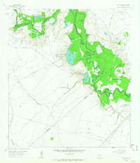 1962 Lott Lake1963 Print · USGSIn the early sixties, the San Antonio River meanders through the borders of Goliad and Victoria counties. Researchers can trace family history through sites like Lott Cem and Mt Zion Ch or locate old river crossings at Duke Bridge.2 unique versions available
 - 1962 Map of McFaddin, 1964 Print
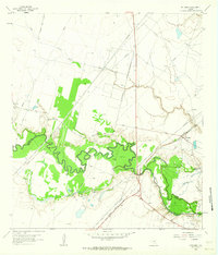 1962 McFaddin1964 Print · USGSThe Texas coastal prairie comes alive in the early sixties as energy extraction meets historic ranchlands along the winding San Antonio River. Genealogists and historians can trace local roots through De la Garza Cem, the settlement of McFaddin, and the extensive Anaqua Oil Field.3 unique versions available
End of results
Showing maps 1-3 of 3
Top cities of Refugio County
Frequently asked questions
- What are the different types of historical maps available for Refugio County?
- What is the oldest map of Refugio County?
- Where can I purchase historical maps of Refugio County for my home or office?
- Where can I download high-res historical maps of Refugio County?
- Are there historical topographic maps available for Refugio County?
- Is there historical aerial imagery available for Refugio County?
- Where are historical maps of Refugio County sourced from?