Old Maps of Rockwall County, Texas
Explore 48 old maps of Rockwall County, spanning from 1891 to today. These high-resolution historic maps reveal how streets, neighborhoods, landmarks, and natural features evolved over time — perfect for genealogy, metal detecting, research, and local history exploration.
What you can do with these maps:
- See how Rockwall County changed over time: Compare historical maps to modern-day views to trace roads, homesites, rail lines & more.
- View detailed metadata: Each map includes creators, publishers, year, scale, and archive source.
- Overlay maps with satellite & LiDAR: Visualize the past alongside modern tools to explore terrain & human change.
- Trusted historical sources: Maps sourced from the USGS, Library of Congress, and other archives.
- Access maps your way: View online, download high-res files, or order prints for personal or research use.
Start exploring old maps of Rockwall County to uncover forgotten places, hidden landmarks, and the deep history beneath your feet.
Rockwall County, TX maps
(48)- 1891 Map of Dallas
 1891 Dallas1891 Print · USGSThe Dallas area during the late nineteenth century was a rapidly growing rail hub still defined by its river crossings and rural outposts. Genealogists and historians can trace the foundations of the metroplex through early landmarks like Oak Cliff, Doddy's Ferry, and Haughts Store.
 - 1893 Map of Dallas
 1893 Dallas1893 Print · USGSDallas was a rising railroad power in the 1890s, when iron rails and river crossings dictated the growth of North Texas. Genealogists can locate vanished landmarks and rural hubs like Oak Cliff, Doddy's Ferry, and Haught's Store before the city's modern sprawl.5 unique versions available
 - 1912 Map of Rockwall
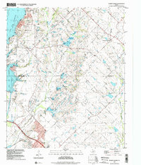
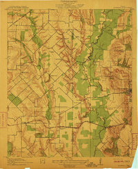 1912 Rockwall1912 Print · USGSTexas blackland prairie and river bottoms are captured here in the years before the landscape was transformed by suburban expansion. Genealogists can locate family homesites near rural landmarks like Lewis Store, Wards Chapel, and the Elm Grove School.2 unique versions available
 - 1919 Map of Royse City
 1919 Royse City1919 Print · USGSThe agricultural heart of Northeast Texas is captured here just after the Great War, as the Blackland Prairie was crisscrossed by essential rail lines. Trace the locations of early rural landmarks like Locust Grove School, the Randle Ranch, and the vanished stop at Rockwall Station.
 - 1954 Map of Dallas, 1963 Print
 1954 Dallas1963 Print · USGSNorth Texas in the mid-fifties and early sixties reveals a landscape of rapid urban growth and water management. Genealogists and historians can trace the evolution of the metroplex through landmarks like Hensley Field, Boles Orphan Home, and the Texas & Pacific RR.4 unique versions available
 - 1958 Map of Dallas
 1958 Dallas1958 Print · USGSNorth Texas in the late fifties shows the dramatic expansion of the Metroplex as it absorbs surrounding farm towns. Genealogists and historians can trace old rail lines like the Missouri-Kansas-Texas and locate early lakefront developments at Eagle Mountain Lake and Lake Worth Village.
 - 1959 Map of Mesquite, 1960 Print
 1959 Mesquite1960 Print · USGSMesquite and Sunnyvale are documented during a period of rapid suburbanization as residential grids began to meet rural bottomlands. Genealogists can trace family footprints at Macedonia Ch, Tripp, and the Florence Black Sch.4 unique versions available
 - 1959 Map of Rowlett, 1960 Print
 1959 Rowlett1960 Print · USGSThe Rowlett and Garland area of North Texas is captured here in the late fifties, showcasing a rural landscape before its rapid suburban transformation. Genealogists and historians can trace family-named sites like Watson Sch, McShan Cem, and the settlement of Dalrock.6 unique versions available
 - 1959 Map of Garland, 1963 Print
 1959 Garland1963 Print · USGSEastern Dallas County is captured in the late fifties as small towns begin to merge into a growing suburban landscape. Genealogists and historians can trace local family roots at Blewett Cem and see the early footprints of Richardson, Sunnyvale, and the White Rock Airport.
 - 1962 Map of Terrell North, 1966 Print
 1962 Terrell North1966 Print · USGSKaufman County in the early sixties reveals a landscape of small farming communities and the steady growth of Terrell. Trace historical footprints at Chisholm and Colquitt, or follow the Texas and Pacific Railroad line.
 - 1963 Map of Forney North, 1966 Print
 1963 Forney North1966 Print · USGSKaufman and Rockwall Counties are captured here in the early sixties as rural farm life met new infrastructure. You can trace family roots at Chisholm Cem, locate the Mt Rose Ch, or follow the Texas and Pacific rail line through Forney.3 unique versions available
 - 1963 Map of Rockwall, 1966 Print
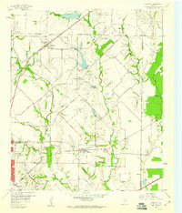
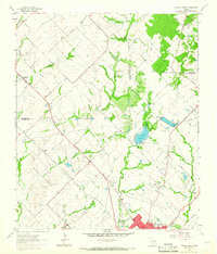
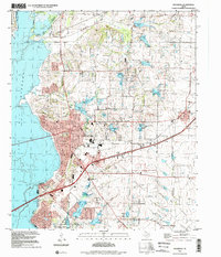
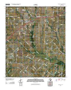
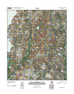
 1963 Rockwall1966 Print · USGSRockwall and the surrounding Blackland Prairie terrain are captured here in the early sixties as the region transitioned toward modern development. Researchers can trace family sites near Mt Zion Cem, the old Fate depot area, and the tracks of the Texas and Pacific Railroad.4 unique versions available
 - 1963 Map of Royse City, 1966 Print
 1963 Royse City1966 Print · USGSThe Blackland Prairies of Rockwall and Collin counties are seen here in the early sixties as rural life began to meet modern infrastructure. Genealogists can trace early family sites like Zollner Ranch or locate burials at Blackland Cem and the village Cemetery near Royse City.2 unique versions available
 - 1986 Map of Dallas
 1986 Dallas1986 Print · USGSThe North Texas metropolitan landscape comes into focus during the mid-eighties as urban growth expands toward the eastern reservoirs. Researchers can trace historic cemeteries like Oak Cliff Cem, rail corridors of the Texas & Pacific RR, and landmarks such as Southern Methodist University.3 unique versions available
 - 1995 Map of Rowlett, 2002 Print
 1995 Rowlett2002 Print · USGSRowlett and the surrounding lakefront communities are shown in a period of rapid growth during the mid-nineties. Genealogists and local historians can trace legacy sites like Pleasant Valley Cem and Liberty Grove alongside the developing shores of Lake Ray Hubbard.
 - 1995 Map of Mesquite, 2002 Print
 1995 Mesquite2002 Print · USGSMesquite and Garland expand toward the shores of Lake Ray Hubbard during the mid-nineties as suburban development meets older rural settlements. Researchers can trace the evolution of local landmarks from Rose Hill Church to the Long Creek Cemetery and Town East Mall.
 - 1995 Map of Rockwall, 2002 Print
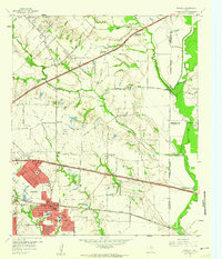
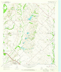
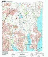
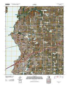
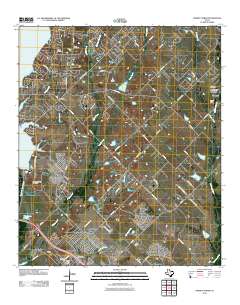
 1995 Rockwall2002 Print · USGSRockwall County witnessed significant suburban expansion toward the end of the century as it oriented itself around the reservoir. Researchers can trace land development and historic family sites like Mt Zion Cem, Zollner Ranch, and the Old Railroad Grade.
 - 1995 Map of Forney North, 2002 Print
 1995 Forney North2002 Print · USGSThe outskirts of Dallas saw rapid transformation in the mid-nineties as suburban growth pushed into Kaufman and Rockwall Counties. Researchers can trace the heritage of early settlers at Peek Cem, Chisholm Cem, and the historic Mt Rose Ch.
 - 2010 Map of Royse City, 2010 Print
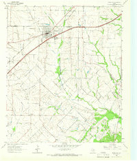
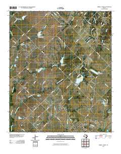
 2010 Royse City2010 Print · USGSCovers Rockwall County, including Rockwall, Fate, and other nearby areas
 - 2010 Map of Rockwall, 2010 Print
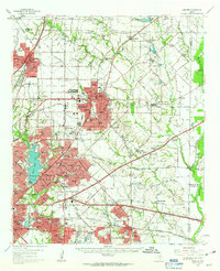
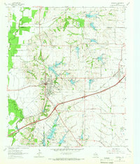
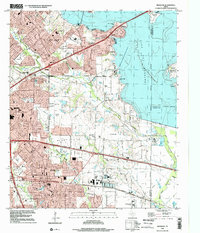
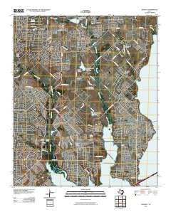
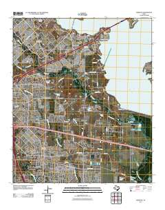
 2010 Rockwall2010 Print · USGSCovers Rockwall County, including Dallas, Rockwall, and other nearby areas
 - 2010 Map of Terrell North, 2010 Print
 2010 Terrell North2010 Print · USGSCovers Rockwall County, including Rockwall, Terrell, and other nearby areas
 - 2010 Map of Rowlett, 2010 Print
 2010 Rowlett2010 Print · USGSCovers Rockwall County, including Dallas, Garland, and other nearby areas
 - 2011 Map of Mesquite, 2011 Print
 2011 Mesquite2011 Print · USGSCovers Rockwall County, including Dallas, Garland, and other nearby areas
 - 2011 Map of Forney North, 2011 Print
 2011 Forney North2011 Print · USGSCovers Rockwall County, including Dallas, Rockwall, and other nearby areas
 - 2012 Map of Forney North, 2012 Print
 2012 Forney North2012 Print · USGSCovers Rockwall County, including Dallas, Rockwall, and other nearby areas
Showing maps 1-25 of 48
Top cities of Rockwall County
- Rockwall historical maps
- Fate historical maps
- Heath historical maps
- McLendon-Chisholm historical maps
- Mobile City historical maps
Frequently asked questions
- What are the different types of historical maps available for Rockwall County?
- What is the oldest map of Rockwall County?
- Where can I purchase historical maps of Rockwall County for my home or office?
- Where can I download high-res historical maps of Rockwall County?
- Are there historical topographic maps available for Rockwall County?
- Is there historical aerial imagery available for Rockwall County?
- Where are historical maps of Rockwall County sourced from?