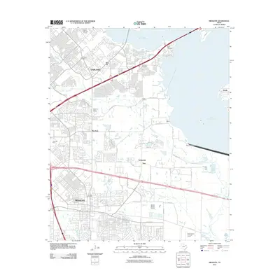
2011 Map of Mesquite
USGS Topo · Published 2011About this map
The growing suburban landscape of Dallas County is captured here, centered on the expansion of Mesquite and Garland in the early 21st century. While the map shows significant residential development, it preserves several markers of an earlier rural era, such as the Lyons Cemetery and Pleasant Ridge Cemetery. The eastern edge of the quadrangle is dominated by the waters of Lake Ray Hubbard, which are contained by the Rockwall-Forney Dam. A complex network of modern infrastructure, including the Chaha Road Interchange and Zion Road Interchange, facilitates travel through the region.
Find a feature on this map
48 named features on this map. Tap any name to fly to it.
Don’t see what you’re looking for? This feature index may not catch every label — zoom into the map to look around manually.
Map Details
Editions of this 2011 Mesquite Map
This is the sole edition of this map. No revisions or reprints were ever made.
Other maps of this area

1891 · Dallas
USGS Topo · 1:125,000

1893 · Dallas
USGS Topo · 1:125,000

1912 · Rockwall
USGS Topo · 1:31,680

1919 · Royse City
USGS Topo · 1:62,500

1954 · Dallas
USGS Topo · 1:250,000

1956 · Kaufman
USGS Topo · 1:62,500

1957 · White Rock Lake
USGS Topo · 1:24,000

1958 · Dallas
USGS Topo · 1:250,000

1958 · Hutchins
USGS Topo · 1:24,000

1958 · White Rock Lake
USGS Topo · 1:24,000