1900s (20th Century) Maps of San Diego, Texas
Explore 8 historic maps of San Diego from the 1900s (20th Century). These maps offer a rare glimpse into what life looked like during the 1900s — showing old roads, neighborhoods, homes, and landmarks that have changed or disappeared over time.
Whether you're researching your family's past, planning a metal detecting trip, or studying how San Diego's landscape evolved across the 1900s, these high-resolution maps are a powerful tool for exploring the history of this region.
- Focus on a specific era: All maps on this page are from the 1900s, giving you a focused view of this time period.
- See what’s changed: Compare century-old streets, trails, and buildings to today's modern landscape using overlays and satellite layers.
- Research with precision: Use these maps for genealogy, historical research, land use analysis, or educational projects.
- View, download, or print: Maps are fully viewable online in high resolution, and can be downloaded or printed for your own records.
Start exploring San Diego's history through authentic maps from the 1900s. This is your window into the past.
San Diego, TX maps
(8)- 1917 Map of Ben Bolt, 1956 Print
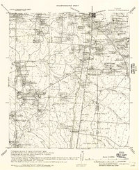 1917 Ben Bolt1956 Print · USGSSouth Texas ranching country comes into focus in this late-frontier era survey centered on the rail hub of Alice. Genealogists can trace family holdings like Hanson Ranch and Lopez Ranch, while finding landmarks like the Sugar Mill and regional Shipping Pens.
 - 1920 Map of San Diego, 1957 Print
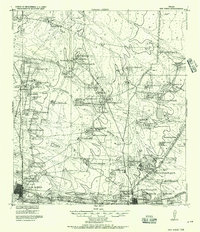 1920 San Diego1957 Print · USGSSouth Texas ranching culture and early rail expansion are captured here at the start of the 1920s. Genealogists and historians can trace family landholdings across the Duval County Line, identifying sites like Luby Ranch, Bentonville, and the Texas Mexican Railroad corridor.
 - 1956 Map of Rosita Ranch
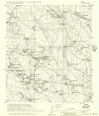 1956 Rosita Ranch1956 Print · USGSSouth Texas cattle country is shown here in the early twentieth century, revealing a landscape of family-owned ranching empires and rail connections. Genealogists and historians can trace lineage and land use through labels like Rosita Ranch, the Mendieto post office, and the path of the T. M. R. R.
 - 1956 Map of Laredo, 1960 Print
 1956 Laredo1960 Print · USGSSouth Texas in the mid-fifties reveals a landscape shaped by border commerce, military aviation, and a booming oil industry. Trace the historic Texas and Mexican RR line through Hebbronville or locate the sprawling Mirando City Oil Field and Laredo AFB.3 unique versions available
 - 1963 Map of San Diego, 1964 Print
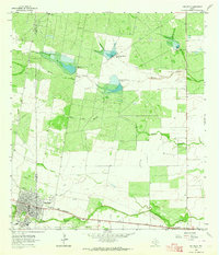 1963 San Diego1964 Print · USGSSan Diego and the surrounding brush country are captured here in the early sixties as the regional water infrastructure was expanding. Genealogists and historians can trace the Texas Mexican rail line, find the local Cem, or locate the series of Chiltipin-San Fernando Dam No 6 reservoirs.2 unique versions available
 - 1963 Map of Ben Bolt NW, 1964 Print
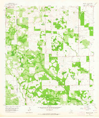 1963 Ben Bolt NW1964 Print · USGSCoastal Bend brush country during the early 1960s reveals a landscape of active energy production along the Duval and Jim Wells county line. Researchers can trace the development of the Ben Bolt Oil Field and Koopman Gas Field alongside the southern edge of San Diego.
 - 1969 Map of Rosita SE, 1972 Print
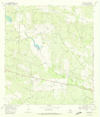 1969 Rosita SE1972 Print · USGSRanching and oil production shaped this Duval County landscape in the late sixties. Researchers can trace family-named landmarks like Robinson Ranch and Sepulveda Cem or locate vintage infrastructure along the Old Seven Sisters Road.
 - 1985 Map of Alice
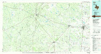 1985 Alice1985 Print · USGSSouth Texas in the mid-eighties was a landscape defined by extensive petroleum development and vital rail corridors. Trace the growth of Alice and San Diego alongside industrial landmarks like the Seven Sisters Oil Field and the Texas Mexican line.2 unique versions available
End of results
Showing maps 1-8 of 8
Top cities near San Diego
Top neighborhoods of San Diego
Frequently asked questions
- What are the different types of historical maps available for San Diego?
- What is the oldest map of San Diego?
- Where can I purchase historical maps of San Diego for my home or office?
- Where can I download high-res historical maps of San Diego?
- Are there historical topographic maps available for San Diego?
- Is there historical aerial imagery available for San Diego?
- Where are historical maps of San Diego sourced from?