1960s Maps of Point Blank, Texas
Explore 2 historic maps of Point Blank from the 1960s. These maps offer a rare glimpse into what life looked like during the 1960s — showing old roads, neighborhoods, homes, and landmarks that have changed or disappeared over time.
Whether you're researching your family's past, planning a metal detecting trip, or studying how Point Blank's landscape evolved across the 1960s, these high-resolution maps are a powerful tool for exploring the history of this region.
- Focus on a specific era: All maps on this page are from the 1960s, giving you a focused view of this time period.
- See what’s changed: Compare century-old streets, trails, and buildings to today's modern landscape using overlays and satellite layers.
- Research with precision: Use these maps for genealogy, historical research, land use analysis, or educational projects.
- View, download, or print: Maps are fully viewable online in high resolution, and can be downloaded or printed for your own records.
Start exploring Point Blank's history through authentic maps from the 1960s. This is your window into the past.
Point Blank, TX maps
(2)- 1960 Map of Carlisle, 1962 Print
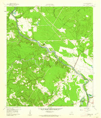 1960 Carlisle1962 Print · USGSThe Trinity River valley at the start of the 1960s reveals a landscape of small churches, family cemeteries, and old transit corridors. Genealogists and local historians can locate the Patricks Ferry site, the Pointblank School, and family landmarks like Darby Hill.3 unique versions available
 - 1960 Map of Stephen Creek, 1962 Print
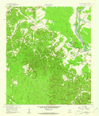 1960 Stephen Creek1962 Print · USGSThe East Texas piney woods and Trinity River bottomlands are captured here at the start of the 1960s. Researchers can locate family landmarks like the Paul Horton Memorial Ch, Liberty Hill Cem, and the Willow Springs Lookout.3 unique versions available
End of results
Showing maps 1-2 of 2
Top cities near Point Blank
Top neighborhoods of Point Blank
Frequently asked questions
- What are the different types of historical maps available for Point Blank?
- What is the oldest map of Point Blank?
- Where can I purchase historical maps of Point Blank for my home or office?
- Where can I download high-res historical maps of Point Blank?
- Are there historical topographic maps available for Point Blank?
- Is there historical aerial imagery available for Point Blank?
- Where are historical maps of Point Blank sourced from?