2020s Maps of Lakeshore Gardens, Texas
Explore 3 historic maps of Lakeshore Gardens from the 2020s. These maps offer a rare glimpse into what life looked like during the 2020s — showing old roads, neighborhoods, homes, and landmarks that have changed or disappeared over time.
Whether you're researching your family's past, planning a metal detecting trip, or studying how Lakeshore Gardens's landscape evolved across the 2020s, these high-resolution maps are a powerful tool for exploring the history of this region.
- Focus on a specific era: All maps on this page are from the 2020s, giving you a focused view of this time period.
- See what’s changed: Compare century-old streets, trails, and buildings to today's modern landscape using overlays and satellite layers.
- Research with precision: Use these maps for genealogy, historical research, land use analysis, or educational projects.
- View, download, or print: Maps are fully viewable online in high resolution, and can be downloaded or printed for your own records.
Start exploring Lakeshore Gardens's history through authentic maps from the 2020s. This is your window into the past.
Lakeshore Gardens, TX maps
(3)- 2022 Map of Mathis, 2022 Print
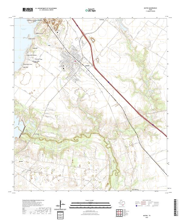 2022 Mathis2022 Print · USGSCoastal Texas life centers on the Nueces River and the reservoir in the early 2020s. Researchers can trace family sites at Tom Mathis Cem and explore established neighborhoods like La Fruta and Edgewater Estates.
 - 2022 Map of Tynan, 2022 Print
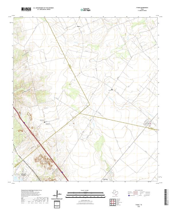 2022 Tynan2022 Print · USGSCoastal Texas ranch lands and the northern reaches of Lake Corpus Christi are mapped here in the early 2020s. Genealogists can locate family landmarks like Waldheim Cem and Argenta, or trace drainage patterns through Mustang Hollow and Papalote Cr.
 - 2022 Map of Dinero, 2022 Print
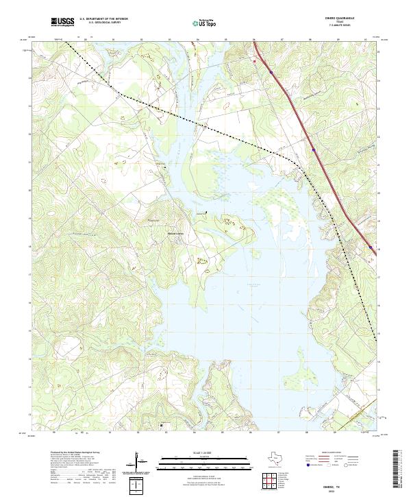 2022 Dinero2022 Print · USGSThe northern reaches of the Coastal Bend are captured here as the twenty-first century begins, centered on the expansive waters of Lake Corpus Christi. Genealogists and researchers can trace local family landmarks and burial sites like Wright Cem, Balania Cem, and the settlement at Mount Lucas.
End of results
Showing maps 1-3 of 3
Top cities near Lakeshore Gardens
Frequently asked questions
- What are the different types of historical maps available for Lakeshore Gardens?
- What is the oldest map of Lakeshore Gardens?
- Where can I purchase historical maps of Lakeshore Gardens for my home or office?
- Where can I download high-res historical maps of Lakeshore Gardens?
- Are there historical topographic maps available for Lakeshore Gardens?
- Is there historical aerial imagery available for Lakeshore Gardens?
- Where are historical maps of Lakeshore Gardens sourced from?