Old Maps of Schleicher County, Texas
Explore 203 old maps of Schleicher County, spanning from 1892 to today. These high-resolution historic maps reveal how streets, neighborhoods, landmarks, and natural features evolved over time — perfect for genealogy, metal detecting, research, and local history exploration.
What you can do with these maps:
- See how Schleicher County changed over time: Compare historical maps to modern-day views to trace roads, homesites, rail lines & more.
- View detailed metadata: Each map includes creators, publishers, year, scale, and archive source.
- Overlay maps with satellite & LiDAR: Visualize the past alongside modern tools to explore terrain & human change.
- Trusted historical sources: Maps sourced from the USGS, Library of Congress, and other archives.
- Access maps your way: View online, download high-res files, or order prints for personal or research use.
Start exploring old maps of Schleicher County to uncover forgotten places, hidden landmarks, and the deep history beneath your feet.
Schleicher County, TX maps
(203)- 1892 Map of San Angelo
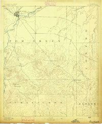 1892 San Angelo1892 Print · USGSSan Angelo and the surrounding West Texas ranch lands appear here in the early 1890s as a vital junction for the river and rail. Researchers can trace early water sources and settlements like Christoval, Lipan Spring, and the G. C. & S. F. Ry. line.3 unique versions available
 - 1893 Map of Fort McKavett
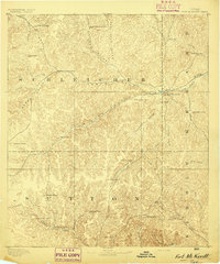 1893 Fort McKavett1893 Print · USGSCentral West Texas ranching life is frozen in time during the 1890s as the frontier era transitions to established livestock spreads. Trace family landholdings and early outposts like Fort McKavett, S.S.S. Ranch, and Henderson Brothers Ranch.4 unique versions available
 - 1895 Map of Sherwood
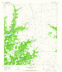
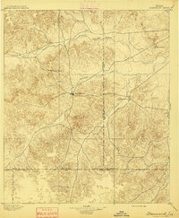 1895 Sherwood1895 Print · USGSCentral West Texas at the close of the nineteenth century centers on the cattle-country hubs of Sherwood and Knickerbocker. Genealogists and researchers can trace early homesteading patterns near Spring Creek, the Middle Concho River, and Lopez Peaks.5 unique versions available
 - 1954 Map of Sonora, 1965 Print
 1954 Sonora1965 Print · USGSThe Edwards Plateau and West Texas ranching country come alive in this mid-century survey of the canyons and plateaus. Genealogists and historians can trace the remote settlements of Pandale and Loma Alta or follow the path of the Panhandle and Santa Fe RR.2 unique versions available
 - 1954 Map of San Angelo, 1967 Print
 1954 San Angelo1967 Print · USGSThe Concho Valley and eastern Permian Basin transition from ranching to a burgeoning oil economy during the mid-twentieth century. Trace the expansion of San Angelo near Goodfellow AFB and locate old crossroads like Stiles, Texon, and Barnhart along the SANTA FE railroad.2 unique versions available
 - 1958 Map of Sonora
 1958 Sonora1958 Print · USGSThe Edwards Plateau and Trans-Pecos region come alive in the late fifties, showing a landscape of remote ranchlands and historic frontier outposts. Trace the legacy of Fort Lancaster Ruins, the limestone depths of Devils Sinkhole Cavern, and the path of the Pecos River.
 - 1958 Map of San Angelo
 1958 San Angelo1958 Print · USGSWest Texas in the late fifties centers on the growing hub of San Angelo and its vital river confluences. Genealogists and historians can trace the paths of the Santa Fe railroad to outposts like Fort Chadbourne, Big Lake, and the specialized community of Sanatorium.
 - 1963 Map of Buffalo Well, 1965 Print
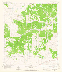
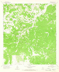
 1963 Buffalo Well1965 Print · USGSThe high plateau country along the Schleicher and Sutton county line comes into focus in the early sixties. Researchers can trace the footprint of the energy industry and cattle ranching through landmarks like Wardlaw Ranch, Humble Camp, and Buffalo Well.2 unique versions available
 - 1963 Map of Buffalo Well NW, 1966 Print
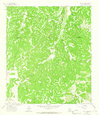
 1963 Buffalo Well NW1966 Print · USGSThe Sutton and Schleicher county line in the early sixties was a landscape of remote ranching outposts and deep limestone draws. Genealogists and researchers can trace family-named estates like Mcintosh Ranch, Cauthorn Ranch, and the small settlement of Allison.2 unique versions available
 - 1963 Map of Adams, 1966 Print
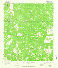
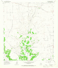
 1963 Adams1966 Print · USGSSchleicher County in the early 1960s was a landscape defined by ranching terrain and the growing energy sector. Genealogists and historians can trace the O Harrow Oil Field and local landmarks like Adams and Montgomery.2 unique versions available
 - 1963 Map of Adams NW, 1966 Print
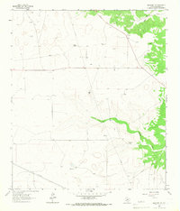
 1963 Adams NW1966 Print · USGSSchleicher County ranching country is captured here in the early sixties, showing the vast livestock holdings of the Texas Edwards Plateau. Researchers can trace historic property boundaries and family landmarks like Robinson Ranch, Burrus Ranch, and Ewing Ranch.2 unique versions available
 - 1963 Map of Adams SE, 1966 Print
 1963 Adams SE1966 Print · USGSSchleicher County ranchlands are documented here in the early sixties, showing a landscape of sprawling family holdings and essential water sources. Genealogists and local historians can locate specific operations like the Figure 3 Ranch or trace landmarks like Panther Bluff Waterhole and Bull Hollow.3 unique versions available
 - 1963 Map of Adams SW, 1966 Print
 1963 Adams SW1966 Print · USGSSchleicher County ranching country is captured here in the early sixties, showing the isolated homesteads and vital water sources of West Texas. Researchers can locate family landmarks like Henderson Ranch or trace the geography of Oak Hollow and Twentymile Waterhole.2 unique versions available
 - 1963 Map of Coal Kiln Draw, 1966 Print
 1963 Coal Kiln Draw1966 Print · USGSThe Schleicher and Sutton county line divides this West Texas ranching country in the early sixties, as mapped by photogrammetric methods. Genealogists and local historians can locate several family holdings including Pope Ranch, U X Ranch, and the Morales Cem.
 - 1963 Map of McKegan Draw NE, 1966 Print
 1963 McKegan Draw NE1966 Print · USGSThe ranchlands at the intersection of Kimble and Menard Counties are captured here in the early sixties. Researchers can trace family legacies at the Lehne Ranch, Graham Ranch, and Johnston Ranch, or locate the Murr Ch at the edge of the creek draws.2 unique versions available
 - 1964 Map of Eldorado NW, 1966 Print
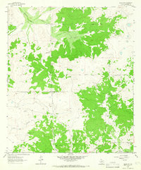
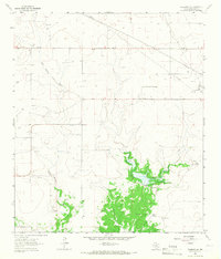
 1964 Eldorado NW1966 Print · USGSSchleicher County ranchlands in the mid-sixties show the intersection of traditional cattle operations and the growing Texas energy industry. Genealogists and local historians can locate specific homesteads like Bearce Ranch and Whitten Ranch or trace the early footprint of the Eldorado Gas Field.2 unique versions available
 - 1964 Map of Sonora NE, 1966 Print
 1964 Sonora NE1966 Print · USGSThe West Texas ranchlands in the mid-1960s are captured here as a network of family estates and water management projects. Researchers can trace land holdings like Logan Ranch and the industrial footprint of the Atchison Topeka and Santa Fe railroad.2 unique versions available
 - 1964 Map of Eldorado SW, 1966 Print
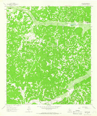
 1964 Eldorado SW1966 Print · USGSSchleicher County ranching and water management are captured in the mid-1960s as the region balanced traditional land use with new infrastructure. Researchers can locate family landmarks like Johnson Ranch and burial sites at Eldorado Cem or Bailey Ranch Cem.2 unique versions available
 - 1964 Map of Oglesby Ranch, 1966 Print
 1964 Oglesby Ranch1966 Print · USGSSchleicher and Crockett counties meet in this 1960s ranching landscape, where the open range is divided by fences and petroleum infrastructure. Researchers can trace the layout of family holdings like Oglesby Ranch and Preston Ranch alongside early Pipelines.
 - 1964 Map of Sonora NW, 1966 Print
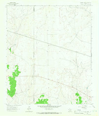
 1964 Sonora NW1966 Print · USGSSchleicher and Sutton counties are captured in the mid-sixties during a period of expanding energy infrastructure and flood control. Researchers can trace family ranching history at the Nixon Ranch and Jones Ranch or locate early industrial features like the Gas Field.2 unique versions available
 - 1964 Map of Coupe Ranch, 1966 Print
 1964 Coupe Ranch1966 Print · USGSSchleicher County ranching country is documented here in the mid-1960s, showing a landscape of family-owned spreads and emerging industry. Trace local genealogy and land use across Coupe Ranch, Mayer Ranch, and the Landing Strip near Granger Draw.2 unique versions available
 - 1964 Map of Eldorado NE, 1966 Print
 1964 Eldorado NE1966 Print · USGSSchleicher County ranching and energy production intersect in the mid-1960s along the Atchison Topeka and Santa Fe line. Trace local landmarks like the Cem near South Concho River and the early Hulldale Oil Field.2 unique versions available
 - 1964 Map of Bailey Draw, 1966 Print
 1964 Bailey Draw1966 Print · USGSThe West Texas ranchlands in the mid-sixties are captured here at the Crockett Co Schleicher Co line. Trace the history of local operations like Willoughby Ranch and Powell Ranch alongside Bailey Draw.2 unique versions available
 - 1964 Map of Eldorado, 1966 Print
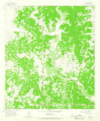
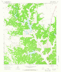
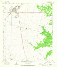 1964 Eldorado1966 Print · USGSEldorado thrived as a railroad and ranching hub in the mid-1960s, centered on the Atchison Topeka and Santa Fe line. Researchers can locate the County Sch, a Fish Hatchery, and mid-century landmarks like the local Drive-In Theater.2 unique versions available
 - 1964 Map of Moore Ranch, 1966 Print
 1964 Moore Ranch1966 Print · USGSSchleicher County ranchlands and oil infrastructure come into focus during the mid-sixties. Genealogists and local historians can trace family holdings like Linthicum Ranch, locate the Bruton Landing Field, and follow old routes like Bootleg Lane.2 unique versions available
Showing maps 1-25 of 203
Top cities of Schleicher County
Frequently asked questions
- What are the different types of historical maps available for Schleicher County?
- What is the oldest map of Schleicher County?
- Where can I purchase historical maps of Schleicher County for my home or office?
- Where can I download high-res historical maps of Schleicher County?
- Are there historical topographic maps available for Schleicher County?
- Is there historical aerial imagery available for Schleicher County?
- Where are historical maps of Schleicher County sourced from?