Loading...
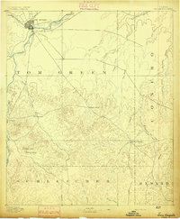
Loading map...1892 Map of San Angelo
USGS Topo · Published 1892About this map
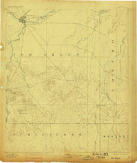
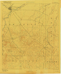
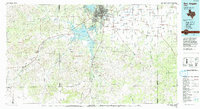
San Angelo sits at the confluence of the North Concho R. and the South Concho River, serving as a vital rail head for the G. C. & S. F. Ry. during the early 1890s. This survey, conducted under director J. W. Powell, reveals a landscape where water sources were the primary drivers of settlement and transit. Important watering points such as Pecan Spring, Lipan Spring, and Kickapoo Spring dot the limestone plateaus, connecting isolated outposts like Christoval to the larger trade networks.
Find a feature on this map
31 named features on this map. Tap any name to fly to it.
Don’t see what you’re looking for? This feature index may not catch every label — zoom into the map to look around manually.
Map Details
Date Portrayed1892
Date Published1892
PublisherU.S. Geological Survey
Map TypeTopographic
Scale1:125,000
Physical Dimensions16.2 x 19.7 inches
Editions of this 1892 San Angelo Map
3 editions found
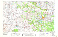
Historical Maps of San Angelo Through Time
5 maps found


Featured Locations
Source Details
SourceU.S. Geological Survey
CopyrightPublic Domain