
1924 Map of San Angelo 2-c
USGS Topo · Published 1924About this map
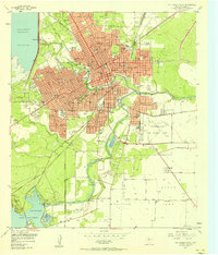
The South Concho River snakes through the western portion of this Tom Green County landscape, defining a valley that contrasts sharply with the dissected plateaus to the east. Surveyed in the mid-1920s by W.H. Griffin and his team for the State of Texas Board of Water Engineers, this map documents the rural infrastructure of the era. The central corridor is dominated by the San Angelo and Christoval Road, a primary artery linking the regional hubs. To the east of this thoroughfare, the terrain rises into upland drainage systems for Nine Mile Creek and Pecan Creek. A key community landmark is the Harmony School, which served the scattered farmsteads of the high ground, while numerous bench marks like BM P Tr 13 2048 indicate the meticulous topographic work performed to manage the region's vital water resources.
Find a feature on this map
10 named features on this map. Tap any name to fly to it.
Don’t see what you’re looking for? This feature index may not catch every label — zoom into the map to look around manually.
Map Details
Editions of this 1924 San Angelo 2-c Map
This is the sole edition of this map. No revisions or reprints were ever made.
Other maps of this area

1892 · San Angelo
USGS Topo · 1:125,000

1895 · Sherwood
USGS Topo · 1:125,000

1924 · Sherwood 1-d
USGS Topo · 1:48,000

1924 · San Angelo 2-b
USGS Topo · 1:48,000

1924 · Sherwood 1-a
USGS Topo · 1:48,000

1928 · Wall
USGS Topo · 1:62,500

1928 · Tankersly
USGS Topo · 1:62,500

1954 · San Angelo
USGS Topo · 1:250,000

1957 · Twin Buttes
USGS Topo · 1:24,000
1957 · San Angelo South
USGS Topo · 1:24,000