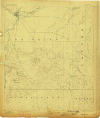
1892 Map of San Angelo
USGS Topo · Published 1898About this map
San Angelo sits at the confluence of the North Concho R. and the South Concho River, serving as a vital regional hub where the G. C. & S. F. Ry. railroad established early connectivity for the livestock and trade economy. To the south, the village of Christoval marks the edge of the more dissected, hilly terrain leading toward the Edwards Plateau.
Find a feature on this map
30 named features on this map. Tap any name to fly to it.
Don’t see what you’re looking for? This feature index may not catch every label — zoom into the map to look around manually.
Map Details
Editions of this 1892 San Angelo Map
3 editions found
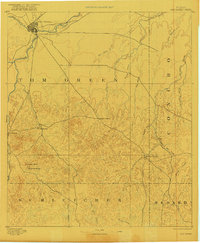
Other maps of this area

1891 · Hayrick
USGS Topo · 1:125,000

1892 · San Angelo
USGS Topo · 1:125,000

1892 · Eden
USGS Topo · 1:125,000

1892 · Ballinger
USGS Topo · 1:125,000

1893 · Fort McKavett
USGS Topo · 1:125,000

1894 · Hayrick
USGS Topo · 1:125,000

1895 · Sherwood
USGS Topo · 1:125,000

1896 · Eden
USGS Topo · 1:125,000

1921 · Lowake
USGS Topo · 1:31,680

1924 · San Angelo 2-c
USGS Topo · 1:48,000