Old Maps of Albany, Texas for Genealogy
Trace your family roots with 11 historic maps of Albany. These high-res maps reveal old neighborhoods, homesites, landmarks, and streets — helping you uncover where your ancestors lived and how the area evolved over time.
- Explore historic neighborhoods: Identify where your relatives may have lived in the 1800s or 1900s.
- Compare maps over time: Trace the changes in streets, buildings, and landmarks for multi-generational research.
- Perfect for genealogy & ancestry research: Used by family historians and researchers to map out lineage and migration.
These maps are an incredible resource for exploring your personal connection to Albany's past.
Albany, TX maps
(11)- 1892 Map of Albany
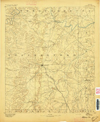
 1892 Albany1892 Print · USGSShackelford County in the late 1880s was a landscape of emerging rail lines and river outposts. Local historians can trace the early path of the Texas Central Railroad through Albany and locate early landmarks like Fort Griffen and Mankins Mill.
 - 1893 Map of Albany
 1893 Albany1893 Print · USGSShackelford County and the surrounding cattle country are captured in the late nineteenth century during the expansion of the Texas Central Railroad. Researchers can locate the frontier site of Fort Griffen, early schools like Shady Grove Ch., and the milling operations at Mankins Mill.5 unique versions available
 - 1954 Map of Abilene, 1966 Print
 1954 Abilene1966 Print · USGSThe Texas Big Country comes into focus in the mid-1950s as petroleum and new water projects reshape the landscape. Local historians can trace the Butterfield Trail, find the Fort Phantom Hill Ruins, and locate numerous small communities along the Texas & Pacific line.2 unique versions available
 - 1958 Map of Abilene
 1958 Abilene1958 Print · USGSMid-century West Texas comes alive in this survey of the Abilene and Stephenville region during a period of steady oil expansion and military growth. Genealogists and local historians can trace the paths of the Texas & Pacific RR through historic towns, locate the Fort Griffin Ruins, and find smaller settlements like Desdemona and Lueders.
 - 1965 Map of Albany, 1967 Print
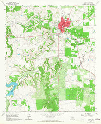 1965 Albany1967 Print · USGSShackelford County's oil and ranching heartland is centered here in the mid-sixties, anchored by the town of Albany. Local historians can trace the paths of the Missouri Kansas Texas railroad and locate landmarks like Taylor Airport and McCarty Lake.
 - 1985 Map of Stamford, 1992 Print
 1985 Stamford1992 Print · USGSMid-century West Texas comes alive in this survey of the Brazos River country, showing a landscape defined by oil production and rail transport. Researchers can locate family landmarks like the Avoca Sch, New Hope Ch, and the frontier history at Fort Griffin State Park.
 - 2010 Map of Albany, 2010 Print
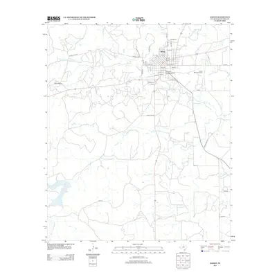
 2010 Albany2010 Print · USGSCovers Albany, including Shackelford County, United States, and other nearby areas
 - 2012 Map of Albany, 2012 Print
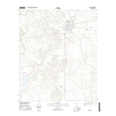
 2012 Albany2012 Print · USGSCovers Albany, including Shackelford County, United States, and other nearby areas
 - 2016 Map of Albany, 2016 Print
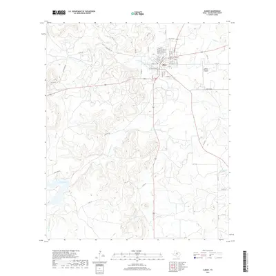
 2016 Albany2016 Print · USGSCovers Albany, including Shackelford County, United States, and other nearby areas
 - 2019 Map of Albany, 2019 Print
 2019 Albany2019 Print · USGSCovers Albany, including Shackelford County, United States, and other nearby areas
 - 2022 Map of Albany, 2022 Print
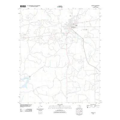
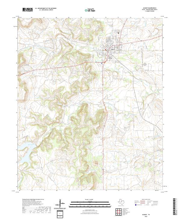 2022 Albany2022 Print · USGSAlbany and its surrounding ranch lands are shown here in recent years, centered on the historic Shackelford County Courthouse. Researchers can trace the town's expansion toward the Albany Municipal Airport and locate sites like the Albany Cem.
End of results
Showing maps 1-11 of 11
Top cities near Albany
Frequently asked questions
- What are the different types of historical maps available for Albany?
- What is the oldest map of Albany?
- Where can I purchase historical maps of Albany for my home or office?
- Where can I download high-res historical maps of Albany?
- Are there historical topographic maps available for Albany?
- Is there historical aerial imagery available for Albany?
- Where are historical maps of Albany sourced from?