Old Maps of Victoria County, Texas for Hiking & Exploration
Hike through history with 171 historic maps of Victoria County. Explore old trails, ghost towns, and forgotten backroads — perfect for outdoor adventurers and local explorers.
- Rediscover forgotten places: Map out old mining camps, roads, and footpaths that no longer exist on modern maps.
- Layer with modern tools: Combine with LiDAR or satellite views to plan hikes through historical terrain.
- Made for exploration: Popular among hikers, overlanders, and local history lovers.
Use these maps to find adventure and explore the hidden past of Victoria County.
Victoria County, TX maps
(171)- 1951 Map of Bloomington, 1953 Print
 1951 Bloomington1953 Print · USGSVictoria County at the start of the fifties was a landscape of expanding oil fields and rail-side settlements. Researchers can trace family history at San Jose Cem or follow the historic Missouri Pacific line through Dernal and Dacosta.2 unique versions available
 - 1951 Map of Inez NW, 1953 Print
 1951 Inez NW1953 Print · USGSVictoria County ranch lands were transitioning into an early energy frontier during the early fifties. Genealogists and historians can trace community hubs like Salem and Mt Pisgah Ch alongside infrastructure like a Gas Collecting Station.2 unique versions available
 - 1951 Map of Inez, 1953 Print
 1951 Inez1953 Print · USGSThe South Texas coastal prairie comes into focus in the early 1950s, centered on the railroad town of Inez. Genealogists and researchers can trace local family landmarks like Hirchhauser Cem and Arenosa Sch along the winding Arenosa Creek.2 unique versions available
 - 1952 Map of Tivoli, 1953 Print
 1952 Tivoli1953 Print · USGSCoastal prairie life in Refugio County during the early fifties revolved around the railroad and river systems. Genealogists and local historians can trace the development of Tivoli and Maudlowe, alongside ranching landmarks like Red Mill Tank and Anaqua Tank.3 unique versions available
 - 1952 Map of Bloomington SW, 1953 Print
 1952 Bloomington SW1953 Print · USGSThe lower reaches of the Guadalupe and San Antonio rivers met in the early fifties amidst a growing coastal oil economy. Trace family landmarks like Rudolph Cem or follow the Missouri Pacific railroad as it crosses Cushman Bayou.4 unique versions available
 - 1952 Map of Edna, 1953 Print
 1952 Edna1953 Print · USGSEdna and the surrounding Texas coastal prairie are captured here in the early fifties during a period of steady civic growth. Local researchers can trace family landmarks like Gideon Ch, locate the historic Site of Camp Independence, and follow the Southern Pacific rail line through El Toro.4 unique versions available
 - 1952 Map of Kamey, 1953 Print
 1952 Kamey1953 Print · USGSAlong the edges of Lavaca Bay in the early fifties, the coastal prairie was a landscape of tide-water marshes and rising energy infrastructure. Researchers can trace the Southern Pacific rail line to Kamey or locate Sixmile Sch and dozens of flowing wells.3 unique versions available
 - 1952 Map of La Salle, 1953 Print
 1952 La Salle1953 Print · USGSThe Texas coastal plains in the early fifties are defined here by the crossing of the Missouri Pacific and the winding Garcitas Creek. Genealogists and researchers can trace the settlement at La Salle and locate numerous family-scale Windmills and Flowing Wells dotting the local Oil Field.3 unique versions available
 - 1952 Map of Marcado Creek, 1953 Print
 1952 Marcado Creek1953 Print · USGSThe mid-century Texas coastal plain comes into focus in this survey of Victoria County's winding waterways and burgeoning oil fields. Genealogists can locate family landmarks like Wood High Cem, Shillerville Cem, and the Wood Sch near the banks of Marcado Creek.2 unique versions available
 - 1952 Map of Placedo, 1953 Print
 1952 Placedo1953 Print · USGSThe Texas coastal plain near Victoria emerges as a center for oil and rail in the early fifties. Genealogists and researchers can trace the industrial footprint of Placedo Field and find historic sites in Placedo, Dacosta, and Carr.2 unique versions available
 - 1952 Map of Victoria East, 1953 Print
 1952 Victoria East1953 Print · USGSVictoria enters the early fifties as a thriving center of energy and education. Trace local family history and industrial growth through sites like Victoria College, the Foster Field airbase, and community hubs like Mt Olive Ch.2 unique versions available
 - 1952 Map of Green Lake, 1953 Print
 1952 Green Lake1953 Print · USGSThe Texas Gulf Coast comes to life in the early fifties, showing a landscape shaped by petroleum and coastal wetlands. Researchers can trace the Heyser Oil Field and the Missouri Pacific rail line through Heyser and Green Lake.2 unique versions available
 - 1953 Map of Beeville
 1953 Beeville1953 Print · USGSThe Texas Coastal Bend in the early fifties shows a landscape of growing regional hubs and vital maritime corridors. Trace the rail-and-river economy through Goliad, locate the Matagorda Lighthouse, and explore the sprawling Aransas National Wildlife Refuge.
 - 1953 Map of Seguin, 1965 Print
 1953 Seguin1965 Print · USGSSouth Texas in the early fifties shows a thriving river-and-rail economy across the Guadalupe and Colorado basins. Genealogists and historians can trace rail routes like the Southern Pacific through Seguin, locate oil wells, or find the Gary AAF near San Marcos.4 unique versions available
 - 1956 Map of Beeville
 1956 Beeville1956 Print · USGSCoastal Texas and the brush country interior are shown in the mid-fifties, from the coastal bays to the inland oil fields. Trace the old rail lines of the Southern Pacific RR or locate the historic Matagorda Lighthouse and the Aransas National Wildlife Refuge.2 unique versions available
 - 1958 Map of Seguin
 1958 Seguin1958 Print · USGSSouth Texas in the late fifties was a network of river-valley settlements and active oilfields tied together by major rail lines. Genealogists and historians can trace family-named sites across Rabb Prairie, locate the Behring Store, or follow the Southern Pacific through Schulenburg.
 - 1960 Map of Beeville
 1960 Beeville1960 Print · USGSCoastal Texas in the mid-fifties reveals a landscape of growing towns and vital military outposts like Foster AFB. Researchers can trace old rail lines including the Missouri Pacific and explore the vast Aransas National Wildlife Refuge.
 - 1962 Map of Fannin, 1963 Print
 1962 Fannin1963 Print · USGSGoliad County in the early 1960s is a landscape of historic battlegrounds and active petroleum production. You can trace family roots at the Swickheimer Ranch or locate the Battlefield Mon and Mallalieu Ch near the town of Fannin.2 unique versions available
 - 1962 Map of Lott Lake, 1963 Print
 1962 Lott Lake1963 Print · USGSIn the early sixties, the San Antonio River meanders through the borders of Goliad and Victoria counties. Researchers can trace family history through sites like Lott Cem and Mt Zion Ch or locate old river crossings at Duke Bridge.2 unique versions available
 - 1962 Map of McFaddin, 1964 Print
 1962 McFaddin1964 Print · USGSThe Texas coastal prairie comes alive in the early sixties as energy extraction meets historic ranchlands along the winding San Antonio River. Genealogists and historians can trace local roots through De la Garza Cem, the settlement of McFaddin, and the extensive Anaqua Oil Field.3 unique versions available
 - 1962 Map of Raisin, 1964 Print
 1962 Raisin1964 Print · USGSThe coastal prairies of Victoria County appear here in the early sixties, as ranching and river geography shaped the local landscape. Genealogists and researchers can trace the area around Raisin and the winding confluence of Coleto Creek and the Guadalupe River.3 unique versions available
 - 1963 Map of Fordtran, 1964 Print
 1963 Fordtran1964 Print · USGSThe rural border of De Witt and Victoria counties comes into focus in the early 1960s as a hub for petroleum and ranching. Researchers can trace the Railroad Grade near Fordtran or locate specific well sites within the Barry Oil Field.2 unique versions available
 - 1963 Map of Meyersville, 1965 Print
 1963 Meyersville1965 Print · USGSMeyersville and Arneckeville appear at a peak of energy production in the early sixties, as gas fields began to overlay the older ranching landscape. Researchers can trace family sites at St Peter and Pauls Ch, the De Witt Sch, and St Joseph Cem.2 unique versions available
 - 1963 Map of Nursery, 1965 Print
 1963 Nursery1965 Print · USGSVictoria County during the early sixties shows a landscape defined by the Guadalupe River and the Southern Pacific rail line. Researchers can locate the settlement of Nursery, the Nursery Cem, and family landmarks like Fordtran Road or the Ball Airport.3 unique versions available
 - 1963 Map of Mission Valley, 1965 Print
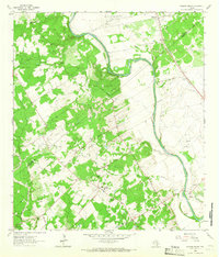 1963 Mission Valley1965 Print · USGSVictoria County enters the mid-sixties as a hub of energy production along the winding Guadalupe River. Researchers can trace old family lands along Arnold Road or locate landmarks like the Guadalupe Cemetery and Thomaston.2 unique versions available
Showing maps 1-25 of 171
Top cities of Victoria County
Frequently asked questions
- What are the different types of historical maps available for Victoria County?
- What is the oldest map of Victoria County?
- Where can I purchase historical maps of Victoria County for my home or office?
- Where can I download high-res historical maps of Victoria County?
- Are there historical topographic maps available for Victoria County?
- Is there historical aerial imagery available for Victoria County?
- Where are historical maps of Victoria County sourced from?