2020s Maps of Brenham, Texas
Explore 3 historic maps of Brenham from the 2020s. These maps offer a rare glimpse into what life looked like during the 2020s — showing old roads, neighborhoods, homes, and landmarks that have changed or disappeared over time.
Whether you're researching your family's past, planning a metal detecting trip, or studying how Brenham's landscape evolved across the 2020s, these high-resolution maps are a powerful tool for exploring the history of this region.
- Focus on a specific era: All maps on this page are from the 2020s, giving you a focused view of this time period.
- See what’s changed: Compare century-old streets, trails, and buildings to today's modern landscape using overlays and satellite layers.
- Research with precision: Use these maps for genealogy, historical research, land use analysis, or educational projects.
- View, download, or print: Maps are fully viewable online in high resolution, and can be downloaded or printed for your own records.
Start exploring Brenham's history through authentic maps from the 2020s. This is your window into the past.
Brenham, TX maps
(3)- 2022 Map of Brenham, 2022 Print
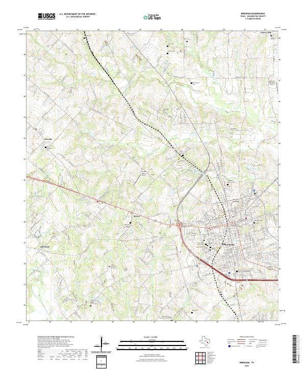 2022 Brenham2022 Print · USGSBrenham and its surrounding Washington County farmlands are captured in this modern survey of central Texas. Researchers can locate numerous family and denominational burial sites, including the Ludwig Lehmann Family Cem and Brenham Masonic Cem, alongside institutions like Blinn College.
 - 2022 Map of Welcome, 2022 Print
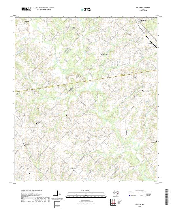 2022 Welcome2022 Print · USGSThe borderlands of Washington and Austin counties come into focus in this recent survey of rural Texas farm country. Genealogists can trace family connections through numerous sites like Bleiblerville, Phillipsburg, and the distinct Welcome Cem locations.
 - 2022 Map of Chappell Hill, 2022 Print
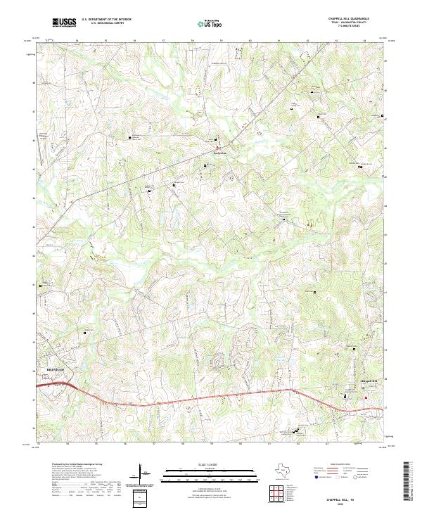 2022 Chappell Hill2022 Print · USGSWashington County during the early 2020s remains a landscape of deep-rooted family legacies and rural communities. Genealogists can trace local history through dozens of sites like the Chappell Hill Community Cem, Masonic Cem, and Earlywine.
End of results
Showing maps 1-3 of 3
Top cities near Brenham
- Bellville historical maps
- Somerville historical maps
- Burton historical maps
- Industry historical maps
- Klump historical maps
Top neighborhoods of Brenham
- Ralston Creek historical maps
- Brenham Downtown Historic District historical maps
- Oak Alley historical maps
Frequently asked questions
- What are the different types of historical maps available for Brenham?
- What is the oldest map of Brenham?
- Where can I purchase historical maps of Brenham for my home or office?
- Where can I download high-res historical maps of Brenham?
- Are there historical topographic maps available for Brenham?
- Is there historical aerial imagery available for Brenham?
- Where are historical maps of Brenham sourced from?