Old Maps of El Cenizo, Texas for Academic Research
Study the evolution of El Cenizo with 15 high-resolution historic maps. Whether you're teaching, researching, or modeling changes in land use, these maps provide essential visual documentation of urban, environmental, and geographic change.
- Analyze long-term change: Track patterns in development, transportation, and natural features.
- Ideal for environmental or urban studies: Support academic projects with primary historical map data.
- Use in the classroom or lab: Educators and researchers rely on these maps to bring historical context to life.
These maps are a powerful tool for teaching, research, and visualizing how El Cenizo has changed over the decades.
El Cenizo, TX maps
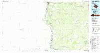
(15)- 1933 Map of Becerra Creek, 1956 Print
 1933 Becerra Creek1956 Print · USGSSouth Texas ranching country along the border comes into focus in the early twentieth century. Genealogists and local historians can trace family landholdings like the Dario Sanchez Pasture or search for roots near the Johnson Settlement and Mann Ranch.
 - 1956 Map of Laredo, 1960 Print
 1956 Laredo1960 Print · USGSSouth Texas in the mid-fifties reveals a landscape shaped by border commerce, military aviation, and a booming oil industry. Trace the historic Texas and Mexican RR line through Hebbronville or locate the sprawling Mirando City Oil Field and Laredo AFB.3 unique versions available
 - 1979 Map of Isla Mesteno
 1979 Isla Mesteno1979 Print · USGSThe Texas-Mexico borderlands come into focus in the late 1970s as the Rio Grande winds past remote ranching settlements and gas fields. Researchers can trace family-named sites like Las Josefinas, the abandoned San Pablo, and the Aduana at La Rivereña.
 - 1979 Map of O'Keefe Lake, 1981 Print
 1979 O'Keefe Lake1981 Print · USGSThe Texas-Mexico borderlands along the Webb and Zapata county lines come into focus in this late-seventies survey. Genealogists and historians can trace small ranching outposts such as Las Josefinas and El Porvenir near the banks of the Falcon Reservoir.
 - 1985 Map of San Ygnacio
 1985 San Ygnacio1985 Print · USGSThe Rio Grande borderlands and South Texas ranch country are captured here in the mid-eighties as the energy industry expanded inland. Researchers can trace historic river settlements like San Ygnacio or the industrial footprints of Mirando City and the Jennings West Oil and Gas Field.3 unique versions available
 - 2010 Map of O'Keefe Lake, 2010 Print
 2010 O'Keefe Lake2010 Print · USGSCovers El Cenizo, including Laredo, Rio Bravo, and other nearby areas
 - 2010 Map of Isla Mesteno, 2010 Print
 2010 Isla Mesteno2010 Print · USGSCovers El Cenizo, including Laredo, Rio Bravo, and other nearby areas
 - 2013 Map of O'Keefe Lake, 2013 Print
 2013 O'Keefe Lake2013 Print · USGSCovers El Cenizo, including Laredo, Rio Bravo, and other nearby areas
 - 2013 Map of Isla Mesteno, 2013 Print
 2013 Isla Mesteno2013 Print · USGSCovers El Cenizo, including Laredo, Rio Bravo, and other nearby areas
 - 2016 Map of O'Keefe Lake, 2016 Print
 2016 O'Keefe Lake2016 Print · USGSCovers El Cenizo, including Laredo, Rio Bravo, and other nearby areas
 - 2016 Map of Isla Mesteno, 2016 Print
 2016 Isla Mesteno2016 Print · USGSCovers El Cenizo, including Laredo, Rio Bravo, and other nearby areas
 - 2019 Map of O'Keefe Lake, 2019 Print
 2019 O'Keefe Lake2019 Print · USGSCovers El Cenizo, including Laredo, Rio Bravo, and other nearby areas
 - 2019 Map of Isla Mesteno, 2019 Print
 2019 Isla Mesteno2019 Print · USGSCovers El Cenizo, including Laredo, Rio Bravo, and other nearby areas
 - 2022 Map of Isla Mesteno, 2022 Print
 2022 Isla Mesteno2022 Print · USGSThe Texas-Mexico borderlands south of Laredo are captured here in the early twenty-first century. Researchers can trace the development of Rio Bravo and El Cenizo, or locate local landmarks like the El Cenzio Cem and the route of Ranch Rd 6050A.
 - 2022 Map of O'Keefe Lake, 2022 Print
 2022 O'Keefe Lake2022 Print · USGSThe Texas-Mexico border country south of Laredo comes into focus in this contemporary survey of the Webb and Zapata county line. Researchers can trace the developed streets of Rio Bravo and El Cenizo or locate rural landmarks like Rancho Blanco Airport and O'Keefe Lake.
End of results
Showing maps 1-15 of 15
Top cities near El Cenizo
Frequently asked questions
- What are the different types of historical maps available for El Cenizo?
- What is the oldest map of El Cenizo?
- Where can I purchase historical maps of El Cenizo for my home or office?
- Where can I download high-res historical maps of El Cenizo?
- Are there historical topographic maps available for El Cenizo?
- Is there historical aerial imagery available for El Cenizo?
- Where are historical maps of El Cenizo sourced from?