Old Maps of Brown Altman, Kermit
Explore 9 old maps of Brown Altman, spanning from 1954 to today. These high-resolution historic maps reveal how streets, neighborhoods, landmarks, and natural features evolved over time — perfect for genealogy, metal detecting, research, and local history exploration.
What you can do with these maps:
- See how Brown Altman changed over time: Compare historical maps to modern-day views to trace roads, homesites, rail lines & more.
- View detailed metadata: Each map includes creators, publishers, year, scale, and archive source.
- Overlay maps with satellite & LiDAR: Visualize the past alongside modern tools to explore terrain & human change.
- Trusted historical sources: Maps sourced from the USGS, Library of Congress, and other archives.
- Access maps your way: View online, download high-res files, or order prints for personal or research use.
Start exploring old maps of Brown Altman to uncover forgotten places, hidden landmarks, and the deep history beneath your feet.
Brown Altman, Kermit maps
(9)- 1954 Map of Pecos, 1964 Print
 1954 Pecos1964 Print · USGSMid-century West Texas reveals a landscape of expanding oil fields and cattle ranching along the winding Pecos River. Local historians can trace family ranch lands like Goodrich Ranch, follow the Texas and Pacific rails, or locate the historic Horsehead Crossing.3 unique versions available
 - 1957 Map of Pecos
 1957 Pecos1957 Print · USGSWest Texas in the mid-fifties is a landscape of desert oil fields and vital rail corridors. Researchers can trace the sprawling Pyote Air Force Base, the historic Horsehead Crossing, and the rail stops at Mentone and Saragosa.
 - 1970 Map of Kermit, 1973 Print
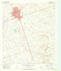 1970 Kermit1973 Print · USGSKermit was a center of West Texas energy production in the early seventies, defined by a dense grid of city streets surrounded by a vast oil and gas field. Genealogists and historians can trace local landmarks like Purple Sage Sch, Robinson Airfield, and the Drive-in Theater.
 - 1986 Map of Kermit
 1986 Kermit1986 Print · USGSWest Texas during the mid-eighties was a landscape defined by the energy industry and the winding Pecos River. Trace the development of Oil Field networks near Kermit, the historic Horsehead Crossing, and the rail lines of the Missouri Pacific.2 unique versions available
 - 2010 Map of Kermit, 2010 Print
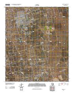 2010 Kermit2010 Print · USGSCovers Brown Altman, including Kermit, Waddell Homestead Ranch, and other nearby areas
 - 2012 Map of Kermit, 2012 Print
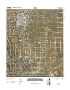 2012 Kermit2012 Print · USGSCovers Brown Altman, including Kermit, Waddell Homestead Ranch, and other nearby areas
 - 2016 Map of Kermit, 2016 Print
 2016 Kermit2016 Print · USGSCovers Brown Altman, including Kermit, Waddell Homestead Ranch, and other nearby areas
 - 2019 Map of Kermit, 2019 Print
 2019 Kermit2019 Print · USGSCovers Brown Altman, including Kermit, Waddell Homestead Ranch, and other nearby areas
 - 2022 Map of Kermit, 2022 Print
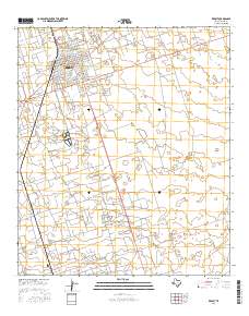
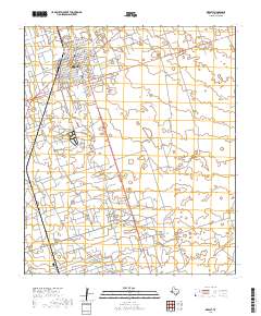
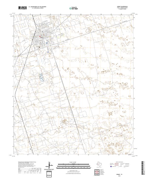 2022 Kermit2022 Print · USGSKermit and the surrounding Winkler County plains are captured in this modern survey of the Permian Basin. Local historians and genealogists can trace the town's street layout around the Winkler County Courthouse and locate the Kermit Cem.
End of results
Showing maps 1-9 of 9
Frequently asked questions
- What are the different types of historical maps available for Brown Altman?
- What is the oldest map of Brown Altman?
- Where can I purchase historical maps of Brown Altman for my home or office?
- Where can I download high-res historical maps of Brown Altman?
- Are there historical topographic maps available for Brown Altman?
- Is there historical aerial imagery available for Brown Altman?
- Where are historical maps of Brown Altman sourced from?