Old Maps of Winkler County, Texas
Explore 128 old maps of Winkler County, spanning from 1954 to today. These high-resolution historic maps reveal how streets, neighborhoods, landmarks, and natural features evolved over time — perfect for genealogy, metal detecting, research, and local history exploration.
What you can do with these maps:
- See how Winkler County changed over time: Compare historical maps to modern-day views to trace roads, homesites, rail lines & more.
- View detailed metadata: Each map includes creators, publishers, year, scale, and archive source.
- Overlay maps with satellite & LiDAR: Visualize the past alongside modern tools to explore terrain & human change.
- Trusted historical sources: Maps sourced from the USGS, Library of Congress, and other archives.
- Access maps your way: View online, download high-res files, or order prints for personal or research use.
Start exploring old maps of Winkler County to uncover forgotten places, hidden landmarks, and the deep history beneath your feet.
Winkler County, TX maps
(128)- 1954 Map of Hobbs, 1963 Print
 1954 Hobbs1963 Print · USGSThe High Plains and Permian Basin transition is captured here at the height of the mid-century energy boom. Genealogists and industrial historians can trace the foundations of Humble City, locate the Potash Mine and Plant, and follow the Texas-New Mexico RR.2 unique versions available
 - 1954 Map of Pecos, 1964 Print
 1954 Pecos1964 Print · USGSMid-century West Texas reveals a landscape of expanding oil fields and cattle ranching along the winding Pecos River. Local historians can trace family ranch lands like Goodrich Ranch, follow the Texas and Pacific rails, or locate the historic Horsehead Crossing.3 unique versions available
 - 1957 Map of Pecos
 1957 Pecos1957 Print · USGSWest Texas in the mid-fifties is a landscape of desert oil fields and vital rail corridors. Researchers can trace the sprawling Pyote Air Force Base, the historic Horsehead Crossing, and the rail stops at Mentone and Saragosa.
 - 1958 Map of Hobbs
 1958 Hobbs1958 Print · USGSThe High Plains of the Texas-New Mexico border are shown here during the height of the mid-century oil boom. Genealogists and historians can trace the development of Hobbs, Lovington, and Jal, alongside ranching landmarks like James Ranch and the early Texas-New Mexico Railway.
 - 1968 Map of Cowden Place, 1971 Print
 1968 Cowden Place1971 Print · USGSThe West Texas dunes and oil fields come into focus in the late sixties at the borders of Winkler, Ector, and Ward Counties. Researchers can trace the water and oil infrastructure of the era through sites like Cowden Place, Little Diamond Windmill, and Williams Ranch.
 - 1968 Map of Wink South, 1971 Print
 1968 Wink South1971 Print · USGSWinkler County ranching and petroleum interests intersect in the Permian Basin during the late sixties. Researchers can trace the layout of the Old Railroad Grade and locate named rural landmarks like Oats Windmill and the Waldron site.2 unique versions available
 - 1968 Map of Soda Lake NE, 1971 Print
 1968 Soda Lake NE1971 Print · USGSWinkler County ranching and oil operations are captured in the late sixties at the intersection of three West Texas counties. Researchers can trace historic water infrastructure and early petroleum sites like Little Joe Oil Field, China Windmill, and Bachelor Windmill.2 unique versions available
 - 1968 Map of China Ranch, 1971 Print
 1968 China Ranch1971 Print · USGSThe high desert of Winkler and Ward counties is shown here during the peak of the late-sixties oil boom. Researchers can trace the industrial footprint of Halley Field, the Texas New Mexico railroad, and family-named landmarks like China Ranch and Mitchell Windmill.2 unique versions available
 - 1969 Map of Pyote NE, 1971 Print
 1969 Pyote NE1971 Print · USGSWinkler and Ward Counties are defined by the mid-century petroleum boom in these expansive West Texas oil fields. Researchers can trace the industrial footprint of the Halley Oil Field and locate remote water sources like Red Tank Windmill and Wildcat Windmill.
 - 1969 Map of Jal, 1972 Print
 1969 Jal1972 Print · USGSSoutheast New Mexico in the late sixties is defined here by the industrial infrastructure of the oil and gas fields. Researchers can trace the town layout of Jal, find the old Drive-in Theater, and follow the Texas New Mexico rail line as it heads toward the border.2 unique versions available
 - 1969 Map of Jal SE, 1973 Print
 1969 Jal SE1973 Print · USGSThe high desert of the Permian Basin comes into focus during the late sixties at the New Mexico and Texas border. Petroleum historians and researchers can trace the industrial footprint of the Dollarhide Oil Field and topographic features like Monument Draw and Shifting Sand.2 unique versions available
 - 1970 Map of Cheyenne Draw, 1973 Print
 1970 Cheyenne Draw1973 Print · USGSThe Texas-New Mexico borderlands in the early seventies reveal an industrial landscape defined by the Permian Basin energy boom. Genealogists and historians can trace family-named landmarks and infrastructure like Magnolia Windmill, Dooley Windmill, and the Crittendon Gas Field.
 - 1970 Map of Wink North, 1973 Print
 1970 Wink North1973 Print · USGSWinkler County ranching and oil country are shown in detail as they appeared in the early seventies. Trace the historic Old RR Grade and find family-named landmarks like Smith Arena or isolated cattle-country outposts like Forty Windmills.
 - 1970 Map of Cheyenne Draw SE, 1973 Print
 1970 Cheyenne Draw SE1973 Print · USGSWinkler County ranching and energy operations are documented here in the early 1970s. Trace the location of family-named sites like Haley Ranch or Yantis Ranch and industrial landmarks including the Pumping Sta and various Drill Holes.2 unique versions available
 - 1970 Map of Vesrue, 1973 Print
 1970 Vesrue1973 Print · USGSThe Texas and New Mexico borderlands come alive in the late 1960s, showing a landscape defined by the energy boom and desert terrain. Trace the industrial footprint of Star Camp, Perry Bass Camp, and the rail point at Vesrue among the Shifting Sand.
 - 1970 Map of Kermit NW, 1973 Print
 1970 Kermit NW1973 Print · USGSThe West Texas and New Mexico borderlands come alive in this early 1970s survey of the Permian Basin industrial landscape. Researchers can trace the ranching and energy history of the region through landmarks like Cheyenne Farms, the Gas Plant, and many named wells and windmills.
 - 1970 Map of Kermit, 1973 Print
 1970 Kermit1973 Print · USGSKermit was a center of West Texas energy production in the early seventies, defined by a dense grid of city streets surrounded by a vast oil and gas field. Genealogists and historians can trace local landmarks like Purple Sage Sch, Robinson Airfield, and the Drive-in Theater.
 - 1971 Map of Notrees, 1974 Print
 1971 Notrees1974 Print · USGSThe West Texas oil patch comes into sharp focus in the early seventies, centered on the small crossroads of Notrees. Researchers can trace the industrial footprint of the T X L Oil Field and map the expanse of Shifting Sand along the county line.
 - 1971 Map of Notrees NW, 1974 Print
 1971 Notrees NW1974 Print · USGSWinkler County was a landscape of industry and dunes in the early seventies, dominated by oil extraction and mobile desert features. Researchers can trace the layout of the Keystone Se Oil Field, locate the Roadside Park, and find remote Oil Wells among the Kermit Sand Hills.
 - 1971 Map of Bedford Ranch, 1974 Print
 1971 Bedford Ranch1974 Print · USGSWinkler and Andrews counties come alive in the early seventies, where the cattle-ranching West meets the industrial Permian Basin. Trace the landscape of the Goldsmith Oil Field and And Ector Oil Field alongside local landmarks like Bedford Ranch and the Green Gate Windmill.
 - 1971 Map of Amburgey Ranch, 1974 Print
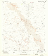 1971 Amburgey Ranch1974 Print · USGSThe West Texas ranchlands of Winkler and Ector Counties are captured here in the early 1970s as the local oil economy expanded across the dunes. Researchers can trace historic water sources and ranching sites like Amburgey Ranch, White Horse Tank, and Wheeler Windmill.
 - 1971 Map of Y T Ranch, 1974 Print
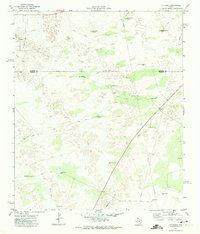 1971 Y T Ranch1974 Print · USGSWinkler and Andrews Counties are shown here in the early 1970s, as the ranching economy of the Permian Basin met the growing petroleum industry. Researchers can locate named landmarks like YT Ranch, the Old Headquarters Windmill, and the East Witcher Windmill.
 - 1971 Map of Wheeler Ranch, 1974 Print
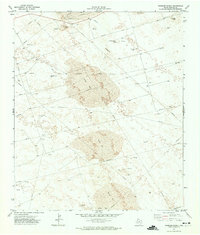 1971 Wheeler Ranch1974 Print · USGSWinkler County ranching and oil extraction meet in the early seventies amidst a landscape of moving dunes. Researchers can trace the industrial layout of the Keystone Se Oil Field and locate family landmarks like Fernandes Ranch and Wheeler Ranch.
 - 1973 Map of Javelina Basin, 1975 Print
 1973 Javelina Basin1975 Print · USGSThe high desert of Lea County, New Mexico, met the Texas border in the early seventies during an era of expanding energy infrastructure. Researchers can trace ranching outposts like Medlin Place alongside industrial oil wells and the essential aqueduct that crossed this arid basin.
 - 1978 Map of Jal, 1979 Print
 1978 Jal1979 Print · USGSSoutheast New Mexico in the late seventies is a landscape shaped by energy production and the rugged Llano Estacado. Genealogists and industrial historians can trace the growth of Jal and Eunice along the Texas-New Mexico RR and across the Jal Oil Field.
Showing maps 1-25 of 128
Top cities of Winkler County
Frequently asked questions
- What are the different types of historical maps available for Winkler County?
- What is the oldest map of Winkler County?
- Where can I purchase historical maps of Winkler County for my home or office?
- Where can I download high-res historical maps of Winkler County?
- Are there historical topographic maps available for Winkler County?
- Is there historical aerial imagery available for Winkler County?
- Where are historical maps of Winkler County sourced from?