1970s Maps of Winkler County, Texas
Explore 14 historic maps of Winkler County from the 1970s. These maps offer a rare glimpse into what life looked like during the 1970s — showing old roads, neighborhoods, homes, and landmarks that have changed or disappeared over time.
Whether you're researching your family's past, planning a metal detecting trip, or studying how Winkler County's landscape evolved across the 1970s, these high-resolution maps are a powerful tool for exploring the history of this region.
- Focus on a specific era: All maps on this page are from the 1970s, giving you a focused view of this time period.
- See what’s changed: Compare century-old streets, trails, and buildings to today's modern landscape using overlays and satellite layers.
- Research with precision: Use these maps for genealogy, historical research, land use analysis, or educational projects.
- View, download, or print: Maps are fully viewable online in high resolution, and can be downloaded or printed for your own records.
Start exploring Winkler County's history through authentic maps from the 1970s. This is your window into the past.
Winkler County, TX maps
(14)- 1970 Map of Cheyenne Draw, 1973 Print
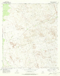
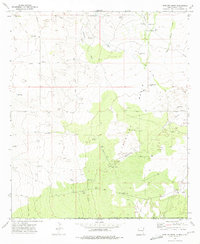
 1970 Cheyenne Draw1973 Print · USGSThe Texas-New Mexico borderlands in the early seventies reveal an industrial landscape defined by the Permian Basin energy boom. Genealogists and historians can trace family-named landmarks and infrastructure like Magnolia Windmill, Dooley Windmill, and the Crittendon Gas Field.
 - 1970 Map of Wink North, 1973 Print
 1970 Wink North1973 Print · USGSWinkler County ranching and oil country are shown in detail as they appeared in the early seventies. Trace the historic Old RR Grade and find family-named landmarks like Smith Arena or isolated cattle-country outposts like Forty Windmills.
 - 1970 Map of Cheyenne Draw SE, 1973 Print
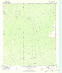
 1970 Cheyenne Draw SE1973 Print · USGSWinkler County ranching and energy operations are documented here in the early 1970s. Trace the location of family-named sites like Haley Ranch or Yantis Ranch and industrial landmarks including the Pumping Sta and various Drill Holes.2 unique versions available
 - 1970 Map of Vesrue, 1973 Print
 1970 Vesrue1973 Print · USGSThe Texas and New Mexico borderlands come alive in the late 1960s, showing a landscape defined by the energy boom and desert terrain. Trace the industrial footprint of Star Camp, Perry Bass Camp, and the rail point at Vesrue among the Shifting Sand.
 - 1970 Map of Kermit NW, 1973 Print
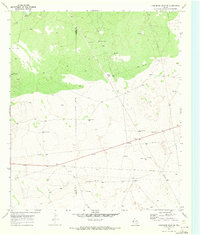
 1970 Kermit NW1973 Print · USGSThe West Texas and New Mexico borderlands come alive in this early 1970s survey of the Permian Basin industrial landscape. Researchers can trace the ranching and energy history of the region through landmarks like Cheyenne Farms, the Gas Plant, and many named wells and windmills.
 - 1970 Map of Kermit, 1973 Print
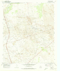
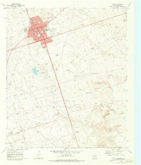 1970 Kermit1973 Print · USGSKermit was a center of West Texas energy production in the early seventies, defined by a dense grid of city streets surrounded by a vast oil and gas field. Genealogists and historians can trace local landmarks like Purple Sage Sch, Robinson Airfield, and the Drive-in Theater.
 - 1971 Map of Notrees, 1974 Print
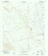 1971 Notrees1974 Print · USGSThe West Texas oil patch comes into sharp focus in the early seventies, centered on the small crossroads of Notrees. Researchers can trace the industrial footprint of the T X L Oil Field and map the expanse of Shifting Sand along the county line.
 - 1971 Map of Notrees NW, 1974 Print
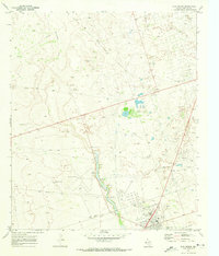
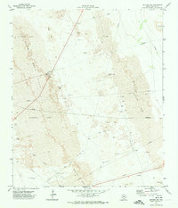 1971 Notrees NW1974 Print · USGSWinkler County was a landscape of industry and dunes in the early seventies, dominated by oil extraction and mobile desert features. Researchers can trace the layout of the Keystone Se Oil Field, locate the Roadside Park, and find remote Oil Wells among the Kermit Sand Hills.
 - 1971 Map of Bedford Ranch, 1974 Print
 1971 Bedford Ranch1974 Print · USGSWinkler and Andrews counties come alive in the early seventies, where the cattle-ranching West meets the industrial Permian Basin. Trace the landscape of the Goldsmith Oil Field and And Ector Oil Field alongside local landmarks like Bedford Ranch and the Green Gate Windmill.
 - 1971 Map of Amburgey Ranch, 1974 Print
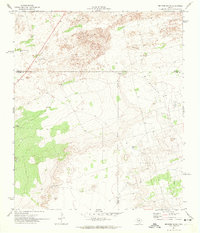
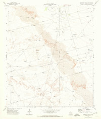 1971 Amburgey Ranch1974 Print · USGSThe West Texas ranchlands of Winkler and Ector Counties are captured here in the early 1970s as the local oil economy expanded across the dunes. Researchers can trace historic water sources and ranching sites like Amburgey Ranch, White Horse Tank, and Wheeler Windmill.
 - 1971 Map of Y T Ranch, 1974 Print
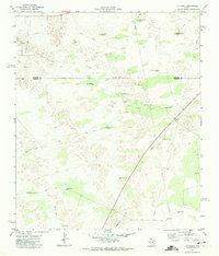 1971 Y T Ranch1974 Print · USGSWinkler and Andrews Counties are shown here in the early 1970s, as the ranching economy of the Permian Basin met the growing petroleum industry. Researchers can locate named landmarks like YT Ranch, the Old Headquarters Windmill, and the East Witcher Windmill.
 - 1971 Map of Wheeler Ranch, 1974 Print
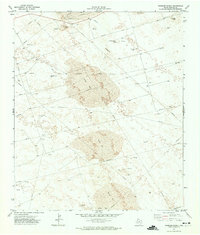 1971 Wheeler Ranch1974 Print · USGSWinkler County ranching and oil extraction meet in the early seventies amidst a landscape of moving dunes. Researchers can trace the industrial layout of the Keystone Se Oil Field and locate family landmarks like Fernandes Ranch and Wheeler Ranch.
 - 1973 Map of Javelina Basin, 1975 Print
 1973 Javelina Basin1975 Print · USGSThe high desert of Lea County, New Mexico, met the Texas border in the early seventies during an era of expanding energy infrastructure. Researchers can trace ranching outposts like Medlin Place alongside industrial oil wells and the essential aqueduct that crossed this arid basin.
 - 1978 Map of Jal, 1979 Print
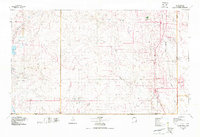 1978 Jal1979 Print · USGSSoutheast New Mexico in the late seventies is a landscape shaped by energy production and the rugged Llano Estacado. Genealogists and industrial historians can trace the growth of Jal and Eunice along the Texas-New Mexico RR and across the Jal Oil Field.
End of results
Showing maps 1-14 of 14
Top cities of Winkler County
Frequently asked questions
- What are the different types of historical maps available for Winkler County?
- What is the oldest map of Winkler County?
- Where can I purchase historical maps of Winkler County for my home or office?
- Where can I download high-res historical maps of Winkler County?
- Are there historical topographic maps available for Winkler County?
- Is there historical aerial imagery available for Winkler County?
- Where are historical maps of Winkler County sourced from?