1960s Maps of Olney, Texas
Explore 3 historic maps of Olney from the 1960s. These maps offer a rare glimpse into what life looked like during the 1960s — showing old roads, neighborhoods, homes, and landmarks that have changed or disappeared over time.
Whether you're researching your family's past, planning a metal detecting trip, or studying how Olney's landscape evolved across the 1960s, these high-resolution maps are a powerful tool for exploring the history of this region.
- Focus on a specific era: All maps on this page are from the 1960s, giving you a focused view of this time period.
- See what’s changed: Compare century-old streets, trails, and buildings to today's modern landscape using overlays and satellite layers.
- Research with precision: Use these maps for genealogy, historical research, land use analysis, or educational projects.
- View, download, or print: Maps are fully viewable online in high resolution, and can be downloaded or printed for your own records.
Start exploring Olney's history through authentic maps from the 1960s. This is your window into the past.
Olney, TX maps
(3)- 1964 Map of True, 1967 Print
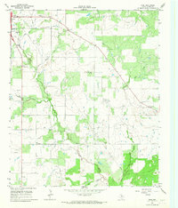 1964 True1967 Print · USGSYoung County's oil-rich landscape is documented here in the early 1960s, showing the intersection of rural life and industrial growth. Researchers can trace family sites at True Cem and Pleasant Valley Ch or locate the town of Olney and its Drive-in Theater.2 unique versions available
 - 1964 Map of Lake Olney, 1967 Print
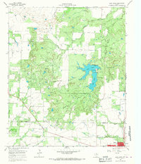 1964 Lake Olney1967 Print · USGSArcher and Young counties in the mid-1960s show a North Texas landscape shaped by oil production and reservoir expansion. Researchers can trace rural genealogy at St Luke Cem or explore the mid-century infrastructure of Lake Olney and the surrounding oil fields.
 - 1964 Map of Olney, 1968 Print
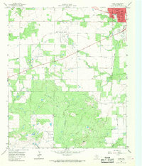 1964 Olney1968 Print · USGSOlney and the surrounding Young County ranchlands are shown in the mid-1960s as the local oil industry flourished. Researchers can trace family roots through the Orth Cemetery or locate old community landmarks like Hamilton Hospital and the Olney Municipal Airport.2 unique versions available
End of results
Showing maps 1-3 of 3
Top cities near Olney
Frequently asked questions
- What are the different types of historical maps available for Olney?
- What is the oldest map of Olney?
- Where can I purchase historical maps of Olney for my home or office?
- Where can I download high-res historical maps of Olney?
- Are there historical topographic maps available for Olney?
- Is there historical aerial imagery available for Olney?
- Where are historical maps of Olney sourced from?