1990s Maps of Farmington Orchards, Farmington
Explore 2 historic maps of Farmington Orchards from the 1990s. These maps offer a rare glimpse into what life looked like during the 1990s — showing old roads, neighborhoods, homes, and landmarks that have changed or disappeared over time.
Whether you're researching your family's past, planning a metal detecting trip, or studying how Farmington Orchards's landscape evolved across the 1990s, these high-resolution maps are a powerful tool for exploring the history of this region.
- Focus on a specific era: All maps on this page are from the 1990s, giving you a focused view of this time period.
- See what’s changed: Compare century-old streets, trails, and buildings to today's modern landscape using overlays and satellite layers.
- Research with precision: Use these maps for genealogy, historical research, land use analysis, or educational projects.
- View, download, or print: Maps are fully viewable online in high resolution, and can be downloaded or printed for your own records.
Start exploring Farmington Orchards's history through authentic maps from the 1990s. This is your window into the past.
Farmington Orchards, Farmington maps
(2)- 1992 Map of Kaysville
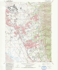 1992 Kaysville1992 Print · USGSThe Wasatch Front underwent significant suburban expansion in the early nineties, centered on the military and agricultural hubs of Davis County. Researchers can trace local development through landmarks like Hill Air Force Base, Layton Sta, and Lakeview Cemetery.2 unique versions available
 - 1998 Map of Kaysville, 2001 Print
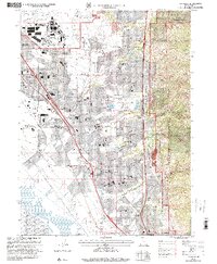 1998 Kaysville2001 Print · USGSDavis County underwent rapid suburban transformation in the late nineties as residential neighborhoods filled the benchlands below the Wasatch Front. Genealogists and local historians can trace the development of Clearfield, Layton, and Kaysville alongside landmarks like Lakeview Cemetery and the Hill Air Force Base.
End of results
Showing maps 1-2 of 2
Top cities near Farmington Orchards
- Salt Lake City historical maps
- Ogden historical maps
- Layton historical maps
- Bountiful historical maps
- Roy historical maps
- Kaysville historical maps
See more
Frequently asked questions
- What are the different types of historical maps available for Farmington Orchards?
- What is the oldest map of Farmington Orchards?
- Where can I purchase historical maps of Farmington Orchards for my home or office?
- Where can I download high-res historical maps of Farmington Orchards?
- Are there historical topographic maps available for Farmington Orchards?
- Is there historical aerial imagery available for Farmington Orchards?
- Where are historical maps of Farmington Orchards sourced from?