Old Maps of Joy, Utah for Metal Detecting
Plan your next treasure hunt with 13 historic maps of Joy. Find old homesites, ghost towns, trails, and gathering spots that may be lost to time — perfect for identifying promising metal detecting locations.
- Locate forgotten sites: Uncover places like long-lost settlements, abandoned rail lines, or gathering spots.
- Plan better hunts: Use map overlays combined with LiDAR or satellite views to narrow in on historically rich areas.
- Made for detectorists: Thousands of hobbyists use these maps to discover relics, coins, and hidden history.
Use these historic maps to boost your research and find new opportunities beneath the surface of Joy.
Joy, UT maps
(13)- 1908 Map of Fish Springs
 1908 Fish Springs1908 Print · USGSWestern Utah at the turn of the century is a land of remote mining camps and desert outposts. Trace family history and early industry at Utah Mine, Joy P.O., and the isolated Butson's Ranch near the Confusion Range.
 - 1910 Map of Fish Springs
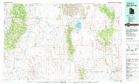
 1910 Fish Springs1910 Print · USGSWestern Utah's high desert and isolated mining districts are mapped here in the early twentieth century, showing a landscape of remote ranching and rugged mineral claims. Local historians can trace family-named outposts like Meecham's Ranch and Thomas' Ranch or locate the Queen of Sheba Mine and Fish Springs.6 unique versions available
 - 1953 Map of Topaz Mtn, 1955 Print
 1953 Topaz Mtn1955 Print · USGSThe West Desert of Utah in the early fifties reveals a landscape shaped by mining and the search for water. Researchers can trace the routes between the Willden Mine, Freighters Well, and the high peaks of Lady Laird Peak.4 unique versions available
 - 1953 Map of Delta, 1969 Print
 1953 Delta1969 Print · USGSWest-central Utah in the early fifties shows a landscape of vast desert playas and rising mountain ranges. Genealogists and historians can trace rail sidings like Champlin Siding, local industry at the Tungsten Mill, and historic outposts such as Fort Deseret.3 unique versions available
 - 1958 Map of Delta
 1958 Delta1958 Print · USGSThe West Desert of Utah comes into sharp focus during the late 1950s, showing the intersection of military ranges, irrigation projects, and historical transit. You can trace the proximity of the Topaz Camp to Delta, or locate the Pony Express Monument and the ruins of Fort Deseret.
 - 1962 Map of Delta
 1962 Delta1962 Print · USGSWest Central Utah in the early sixties reveals a landscape of desert agriculture and military testing grounds. Researchers can trace the Union Pacific line through Delta or locate historic sites like the Pony Express Monument and Silver City.
 - 1979 Map of Fish Springs
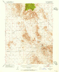
 1979 Fish Springs1979 Print · USGSWestern Utah in the late seventies reveals a landscape of high peaks and desert basins, from the Deep Creek Range to the Great Salt Lake Desert. Researchers can locate remote settlements like Partoun and Callao, or trace old mining operations at the Emma Mine and Bell Hill Mine.4 unique versions available
 - 1988 Map of Lady Laird Peak, 1989 Print
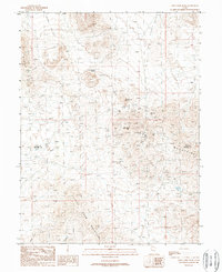 1988 Lady Laird Peak1989 Print · USGSThe Drum Mountains in West Central Utah were a hub of late-twentieth-century mining activity. Historians and researchers can trace the industrial footprint of the Drum Mine, the historic Joy settlement, and old water sources like Freighters Well.
 - 2010 Map of Lady Laird Peak, 2010 Print
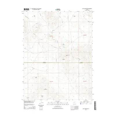
 2010 Lady Laird Peak2010 Print · USGSCovers Joy, including Millard County, Juab County, and other nearby areas
 - 2014 Map of Lady Laird Peak, 2014 Print
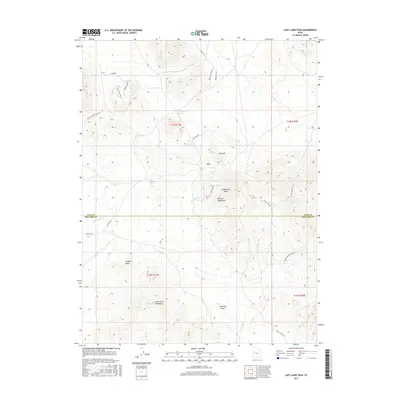
 2014 Lady Laird Peak2014 Print · USGSCovers Joy, including Millard County, Juab County, and other nearby areas
 - 2017 Map of Lady Laird Peak, 2017 Print
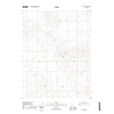
 2017 Lady Laird Peak2017 Print · USGSCovers Joy, including Millard County, Juab County, and other nearby areas
 - 2020 Map of Lady Laird Peak, 2020 Print
 2020 Lady Laird Peak2020 Print · USGSCovers Joy, including Millard County, Juab County, and other nearby areas
 - 2023 Map of Lady Laird Peak, 2023 Print
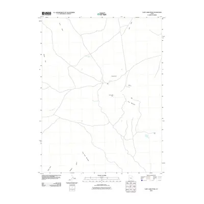
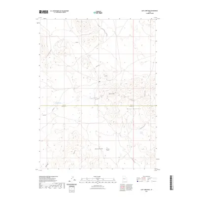 2023 Lady Laird Peak2023 Print · USGSThe Juab and Millard county line crosses this high-desert terrain near the settlement of Joy. Genealogists and historians can trace old mining routes like Gold Mine Rd and locate remote landmarks such as Schoenburger Spring and Lady Laird Peak.
End of results
Showing maps 1-13 of 13
Frequently asked questions
- What are the different types of historical maps available for Joy?
- What is the oldest map of Joy?
- Where can I purchase historical maps of Joy for my home or office?
- Where can I download high-res historical maps of Joy?
- Are there historical topographic maps available for Joy?
- Is there historical aerial imagery available for Joy?
- Where are historical maps of Joy sourced from?