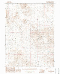
1988 Map of Lady Laird Peak
USGS Topo · Published 1989About this map
The Drum Mountains define the character of this West Central Utah landscape, where the extraction of ore shaped the local geography throughout the late 20th century. At the center of this industrial activity lies the Drum Mine, surrounded by a network of older operations including the Black Boy Mine and the Ibex Mine. These sites, along with numerous unnamed shafts and dumps, indicate a region deeply tied to the minerals of the Great Basin.
Find a feature on this map
22 named features on this map. Tap any name to fly to it.
Don’t see what you’re looking for? This feature index may not catch every label — zoom into the map to look around manually.
Map Details
Editions of this 1988 Lady Laird Peak Map
This is the sole edition of this map. No revisions or reprints were ever made.
Other maps of this area

1885 · Sevier Desert
USGS Topo · 1:250,000

1908 · Fish Springs
USGS Topo · 1:250,000

1910 · Fish Springs
USGS Topo · 1:250,000

1953 · Topaz Mtn
USGS Topo · 1:62,500

1953 · Delta
USGS Topo · 1:250,000

1958 · Delta
USGS Topo · 1:250,000

1962 · Delta
USGS Topo · 1:250,000

1971 · Picture Rock Hills
USGS Topo · 1:24,000

1971 · Drum Mts Well
USGS Topo · 1:24,000
1971 · Smelter Knolls West
USGS Topo · 1:24,000