Old Maps of Morgan County, Utah for Metal Detecting
Plan your next treasure hunt with 182 historic maps of Morgan County. Find old homesites, ghost towns, trails, and gathering spots that may be lost to time — perfect for identifying promising metal detecting locations.
- Locate forgotten sites: Uncover places like long-lost settlements, abandoned rail lines, or gathering spots.
- Plan better hunts: Use map overlays combined with LiDAR or satellite views to narrow in on historically rich areas.
- Made for detectorists: Thousands of hobbyists use these maps to discover relics, coins, and hidden history.
Use these historic maps to boost your research and find new opportunities beneath the surface of Morgan County.
Morgan County, UT maps
(182)- 1885 Map of Salt Lake
 1885 Salt Lake1885 Print · USGSThe Wasatch Front and surrounding high valleys appear here in the mid-1880s during a period of rapid mining and rail expansion. Genealogists and historians can trace early town sites and mining camps including Alta, Silver City, and the military grounds of Fort Douglass.7 unique versions available
 - 1900 Map of Coalville, 1955 Print
 1900 Coalville1955 Print · USGSThe high valleys of Summit and Wasatch counties are captured at the turn of the century as the silver and coal industries flourished. Researchers can trace early settlements like Rockport and Hailstone or locate the industrial Ontario Drain Tunnel near Park City.2 unique versions available
 - 1903 Map of Coalville, 1921 Print
 1903 Coalville1921 Print · USGSUpper Utah at the turn of the century reveals a landscape defined by mining corridors and valley settlements. Genealogists and historians can trace the early path of the Union Pacific R. R. through Coalville or locate family-named sites like Rigby's Ranch and the Ontario Drain Tunnel.2 unique versions available
 - 1925 Map of Ft. Douglas
 1925 Ft. Douglas1925 Print · USGSThe Wasatch Range in the mid-1920s shows a landscape of mining camps and early mountain tourism. Genealogists and researchers can trace the old paths of the Lincoln Highway and locate vanished stops like Gogorza, Kimballs, and the Pacific Mine.
 - 1928 Map of Ft. Douglas
 1928 Ft. Douglas1928 Print · USGSIn the mid-1920s, the high country east of Salt Lake was a hive of mining and early canyon tourism. Trace old claim sites like the Pacific Mine or visit early retreats such as Pinecrest Inn and the YWCA Camp during the mining era.2 unique versions available
 - 1950 Map of Fort Douglas, 1958 Print
 1950 Fort Douglas1958 Print · USGSThe eastern benches of Salt Lake City meet the Wasatch foothills in the early fifties, showing a city expanding toward the canyons. Genealogists and historians can locate the City Cemetery, the University of Utah, and the This Is the Place Monument.
 - 1951 Map of Fort Douglas
 1951 Fort Douglas1951 Print · USGSSalt Lake City's eastern neighborhoods and the Wasatch foothills are captured in the early fifties, showing the city's growth toward the mountains. Researchers can find precise locations for the University of Utah, the City Cemetery, and the Fort Douglas military grounds.
 - 1952 Map of Bountiful Peak, 1954 Print
 1952 Bountiful Peak1954 Print · USGSThe foothills of the Wasatch Range in the early fifties show the expanding street grids of Centerville and Bountiful City. Local historians can trace early civic landmarks like Bountiful High School or follow the narrow Skyline Drive into the mountains.5 unique versions available
 - 1954 Map of Salt Lake City, 1964 Print
 1954 Salt Lake City1964 Print · USGSThe Wasatch Front and Uinta Mountains are captured here in the mid-fifties, showing the industrial heart of Utah and its high mountain wilderness. Researchers can locate vanished infrastructure and landmarks like the Geneva Steel Plant, Bingham Canyon Mine, and the Utah State Prison.4 unique versions available
 - 1954 Map of Ogden, 1967 Print
 1954 Ogden1967 Print · USGSThe northern Utah corridor and Wyoming borderlands are captured here in the mid-1950s, showing the region's transition from mountain wilderness to settled valleys. Researchers can trace historic institutions like Utah State University or locate vanished points like Church Butte Station and the Trappist Monastery.3 unique versions available
 - 1955 Map of Ogden, 1956 Print
 1955 Ogden1956 Print · USGSOgden thrived as a rail and military hub in the mid-fifties, squeezed between the river basins and the high peaks of the Wasatch Range. Genealogists and researchers can trace the urban development of South Ogden and Riverdale or locate family sites near the City Cemetery and Sacred Heart Academy.5 unique versions available
 - 1955 Map of Peterson, 1956 Print
 1955 Peterson1956 Print · USGSThe Morgan Valley and Wasatch crest meet in this mid-century survey of the river-and-rail corridor. Trace local landmarks like Peterson Cem and the Union Pacific line, or follow the heights of Francis Peak and Skyline Drive.5 unique versions available
 - 1955 Map of Snow Basin, 1956 Print
 1955 Snow Basin1956 Print · USGSThe Wasatch Range and Weber Canyon are documented here during the mid-1950s, showing early ski infrastructure and mountain industry. Trace local genealogy at the Mtn Green Cemetery or locate the Strawberry Mine and Union Pacific rail line.3 unique versions available
 - 1958 Map of Ogden
 1958 Ogden1958 Print · USGSNorthern Utah and southwestern Wyoming are captured here during a period of steady growth and military expansion. You can trace the Union Pacific rail lines and early road networks connecting Ogden and Logan to Bear Lake and Evanston.
 - 1958 Map of Salt Lake City
 1958 Salt Lake City1958 Print · USGSThe Wasatch Front and Uinta Basin are captured during a period of significant post-war growth and industrial development. Researchers can trace the mid-century rail lines of the Bamberger RR and locate sites like the Kiegley Limestone Quarry and Camp Williams Military Reservation.
 - 1960 Map of Ogden
 1960 Ogden1960 Print · USGSIn the mid-1950s, this region of the American West balanced military expansion with frontier history along the Union Pacific RR. Genealogists and historians can trace old settlements like Fort Bridger, the residential growth of Washington Terrace, and industrial sites from the Hill AFB complex to the coal mines of Kemmerer.
 - 1960 Map of Salt Lake City
 1960 Salt Lake City1960 Print · USGSThe Wasatch Front and High Uintas are captured mid-century as the Salt Lake Valley underwent significant postwar expansion. Genealogists and historians can trace rail lines like the Union Pacific and locate established landmarks such as Fort Douglas, Camp Williams, and the Bingham Canyon Mine.
 - 1961 Map of Devils Slide, 1963 Print
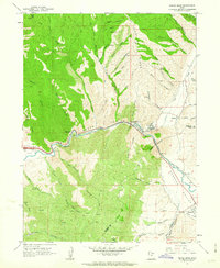 1961 Devils Slide1963 Print · USGSThe Weber River corridor in the early 1960s shows a landscape of heavy industry and pioneer history. Trace the Donner Party Route as it moves through Henefer Valley past the Cement Plant and Devils Slide Mine.2 unique versions available
 - 1961 Map of East Canyon Reservoir, 1963 Print
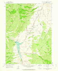 1961 East Canyon Reservoir1963 Print · USGSMorgan and Summit Counties are shown here in the early sixties, a landscape where pioneer trails meet modern water works. Researchers can trace the Mormon Pioneers and Donner-Reed Party Route or locate the Site of Dixie Hollow Pony Express Sta and Grants Grave.2 unique versions available
 - 1961 Map of Porterville, 1963 Print
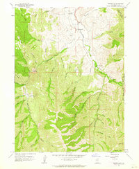 1961 Porterville1963 Print · USGSIn the early sixties, the high mountain valleys of Morgan County were defined by water management and isolated ranching terrain. Genealogists and historians can trace local family landmarks like Whites Crossing, Joe Durrant Hollow, and the Porterville Cem.3 unique versions available
 - 1961 Map of Big Dutch Hollow, 1963 Print
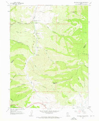 1961 Big Dutch Hollow1963 Print · USGSThe Wasatch Range in the early 1960s reveals the deep history of western expansion along the Donner-Reed Party trail. Genealogists and historians can trace the paths of early travelers through Little Emigration Canyon and locate Historic Ruins or the Mormon Flat Historical Marker.3 unique versions available
 - 1961 Map of Mountain Dell, 1963 Print
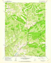 1961 Mountain Dell1963 Print · USGSThe high Wasatch ridges east of Salt Lake City are captured here in the early 1960s, showing a landscape defined by pioneer history and modern utility. Trace the Route of Donner-Reed Party and the Mormon Trail near monuments like Last Camp.4 unique versions available
 - 1961 Map of Morgan, 1963 Print
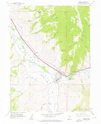 1961 Morgan1963 Print · USGSThe Weber River valley in the early sixties shows a landscape of rail-connected farming communities and mountain canyons. Trace the development of Morgan, Enterprise, and Littleton alongside the Union Pacific line and Como Springs.3 unique versions available
 - 1961 Map of Morgan, 1963 Print
 1961 Morgan1963 Print · USGSThe Weber River valley in the early sixties was a critical junction of rail industry and mountain agriculture. Local historians can trace the industrial footprint of the Cement Plant near Devils Slide and find vanished rural landmarks like the Monastery and Como Springs.2 unique versions available
 - 1963 Map of Fort Douglas, 1964 Print
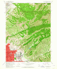 1963 Fort Douglas1964 Print · USGSSalt Lake City and the Wasatch foothills meet in the early sixties, as the city pushes eastward against the national forest. Genealogists and local historians can trace the grounds of Fort Douglas, the City Cemetery, and landmarks like the This is the Place Monument.5 unique versions available
Showing maps 1-25 of 182
Top cities of Morgan County
Frequently asked questions
- What are the different types of historical maps available for Morgan County?
- What is the oldest map of Morgan County?
- Where can I purchase historical maps of Morgan County for my home or office?
- Where can I download high-res historical maps of Morgan County?
- Are there historical topographic maps available for Morgan County?
- Is there historical aerial imagery available for Morgan County?
- Where are historical maps of Morgan County sourced from?