Old Maps of Alta, Utah for Genealogy
Trace your family roots with 21 historic maps of Alta. These high-res maps reveal old neighborhoods, homesites, landmarks, and streets — helping you uncover where your ancestors lived and how the area evolved over time.
- Explore historic neighborhoods: Identify where your relatives may have lived in the 1800s or 1900s.
- Compare maps over time: Trace the changes in streets, buildings, and landmarks for multi-generational research.
- Perfect for genealogy & ancestry research: Used by family historians and researchers to map out lineage and migration.
These maps are an incredible resource for exploring your personal connection to Alta's past.
Alta, UT maps
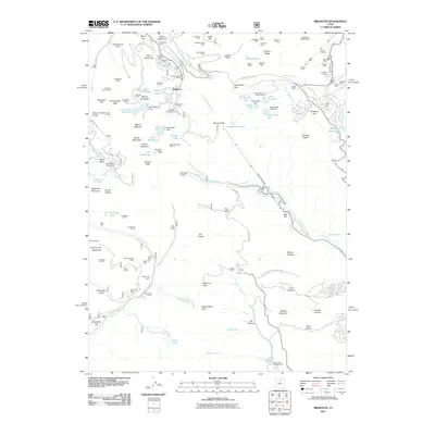
(21)- 1885 Map of Salt Lake
 1885 Salt Lake1885 Print · USGSThe Wasatch Front and surrounding high valleys appear here in the mid-1880s during a period of rapid mining and rail expansion. Genealogists and historians can trace early town sites and mining camps including Alta, Silver City, and the military grounds of Fort Douglass.7 unique versions available
 - 1925 Map of Ft. Douglas
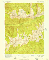
 1925 Ft. Douglas1925 Print · USGSThe Wasatch Range in the mid-1920s shows a landscape of mining camps and early mountain tourism. Genealogists and researchers can trace the old paths of the Lincoln Highway and locate vanished stops like Gogorza, Kimballs, and the Pacific Mine.
 - 1928 Map of Ft. Douglas
 1928 Ft. Douglas1928 Print · USGSIn the mid-1920s, the high country east of Salt Lake was a hive of mining and early canyon tourism. Trace old claim sites like the Pacific Mine or visit early retreats such as Pinecrest Inn and the YWCA Camp during the mining era.2 unique versions available
 - 1954 Map of Salt Lake City, 1964 Print
 1954 Salt Lake City1964 Print · USGSThe Wasatch Front and Uinta Mountains are captured here in the mid-fifties, showing the industrial heart of Utah and its high mountain wilderness. Researchers can locate vanished infrastructure and landmarks like the Geneva Steel Plant, Bingham Canyon Mine, and the Utah State Prison.4 unique versions available
 - 1955 Map of Brighton, 1957 Print
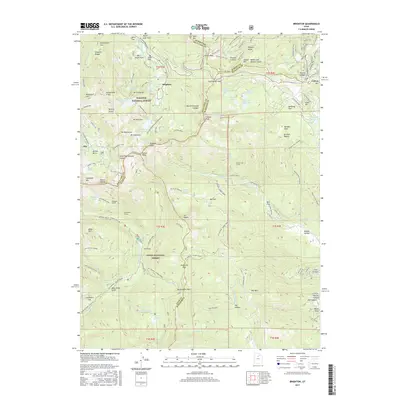
 1955 Brighton1957 Print · USGSThe high Wasatch peaks are captured in the mid-1950s as a landscape defined by deep-shaft mining and emerging alpine recreation. Researchers can trace historic extraction sites like the Daly West Mine and Dutchman Mine alongside early camps such as Redman Forest Camp.4 unique versions available
 - 1955 Map of Dromedary Peak, 1957 Print
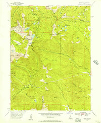
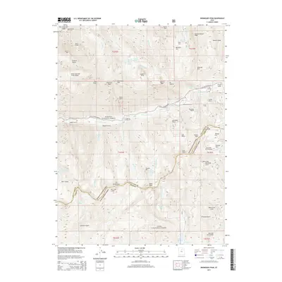
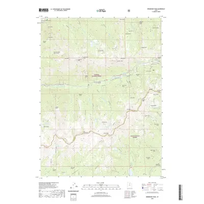
 1955 Dromedary Peak1957 Print · USGSThe silver mining district around Alta reached a period of transition in the mid-1950s, as traditional claims met modern wilderness management. Researchers can trace decades of subterranean history through detailed labels for the Cardiff Mine, Emma Tunnel, and Flagstaff Mine.6 unique versions available
 - 1958 Map of Salt Lake City
 1958 Salt Lake City1958 Print · USGSThe Wasatch Front and Uinta Basin are captured during a period of significant post-war growth and industrial development. Researchers can trace the mid-century rail lines of the Bamberger RR and locate sites like the Kiegley Limestone Quarry and Camp Williams Military Reservation.
 - 1960 Map of Salt Lake City
 1960 Salt Lake City1960 Print · USGSThe Wasatch Front and High Uintas are captured mid-century as the Salt Lake Valley underwent significant postwar expansion. Genealogists and historians can trace rail lines like the Union Pacific and locate established landmarks such as Fort Douglas, Camp Williams, and the Bingham Canyon Mine.
 - 1980 Map of Salt Lake City
 1980 Salt Lake City1980 Print · USGSSalt Lake City and the surrounding Wasatch Range are shown in the early eighties during a period of rapid suburban growth. Genealogists and historians can trace old mining operations like the Ontario Mine and Wasatch Mine or follow the path of the Union Pacific through the canyons.3 unique versions available
 - 1998 Map of Brighton, 2001 Print
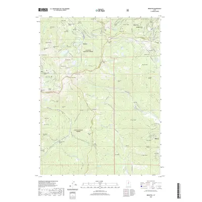
 1998 Brighton2001 Print · USGSThe high Wasatch Range in the late nineties shows the convergence of alpine recreation and historic silver mining. Trace the shafts of the Daly West Mine and Flagstaff Mine or locate the Silver Lake Info and Rec Area at Brighton.
 - 1998 Map of Dromedary Peak, 2001 Print
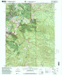
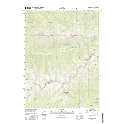
 1998 Dromedary Peak2001 Print · USGSThe high Wasatch Range at the close of the twentieth century reveals a rugged intersection of heavy mining history and mountain recreation. Local researchers can trace old tunnel systems and claims like the Wasatch Mine, Cardiff Mine, and the historic settlement at Alta.
 - 2011 Map of Dromedary Peak, 2011 Print
 2011 Dromedary Peak2011 Print · USGSCovers Alta, including Salt Lake County, Utah County, and other nearby areas
 - 2011 Map of Brighton, 2011 Print
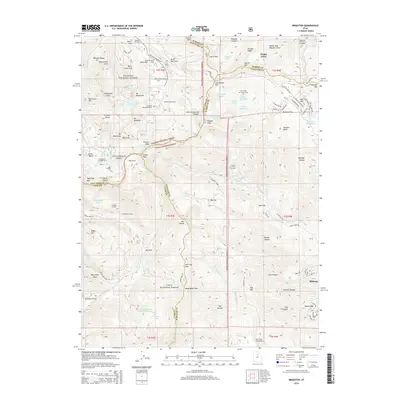
 2011 Brighton2011 Print · USGSCovers Alta, including Park City, Midway, and other nearby areas
 - 2014 Map of Brighton, 2014 Print
 2014 Brighton2014 Print · USGSCovers Alta, including Park City, Midway, and other nearby areas
 - 2014 Map of Dromedary Peak, 2014 Print
 2014 Dromedary Peak2014 Print · USGSCovers Alta, including Salt Lake County, Utah County, and other nearby areas
 - 2017 Map of Dromedary Peak, 2017 Print
 2017 Dromedary Peak2017 Print · USGSCovers Alta, including Salt Lake County, Utah County, and other nearby areas
 - 2017 Map of Brighton, 2017 Print
 2017 Brighton2017 Print · USGSCovers Alta, including Park City, Midway, and other nearby areas
 - 2020 Map of Brighton, 2020 Print
 2020 Brighton2020 Print · USGSCovers Alta, including Park City, Midway, and other nearby areas
 - 2020 Map of Dromedary Peak, 2020 Print
 2020 Dromedary Peak2020 Print · USGSCovers Alta, including Salt Lake County, Utah County, and other nearby areas
 - 2023 Map of Brighton, 2023 Print
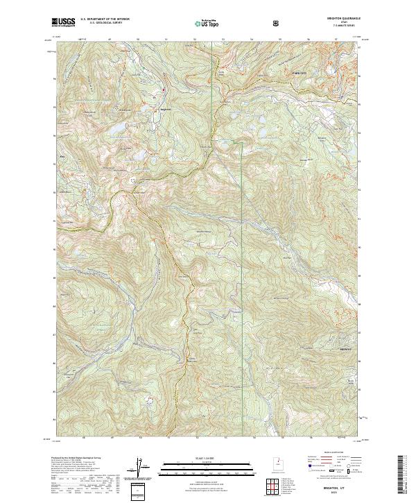 2023 Brighton2023 Print · USGSThe high peaks of the Wasatch Range come into sharp focus in this 2023 survey of the area between Brighton and Alta. Trace old mining routes like the Miller Hill Mining Trl and alpine passages such as Guardsman Pass and Scotts Pass.
 - 2023 Map of Dromedary Peak, 2023 Print
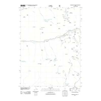
 2023 Dromedary Peak2023 Print · USGSThe high Wasatch Range at the head of Little Cottonwood Canyon comes into focus in this contemporary survey of the Utah mountains. Researchers can trace the layout of Alta, locate the Alta City Cem, and follow historical paths like the Quarry Trl and Mineral Fork Trl.
End of results
Showing maps 1-21 of 21
Top cities near Alta
- Salt Lake City historical maps
- Sandy historical maps
- Lehi historical maps
- Millcreek historical maps
- Murray historical maps
- Draper historical maps
See more
Frequently asked questions
- What are the different types of historical maps available for Alta?
- What is the oldest map of Alta?
- Where can I purchase historical maps of Alta for my home or office?
- Where can I download high-res historical maps of Alta?
- Are there historical topographic maps available for Alta?
- Is there historical aerial imagery available for Alta?
- Where are historical maps of Alta sourced from?