Old Maps of West Jordan, Utah for Academic Research
Study the evolution of West Jordan with 25 high-resolution historic maps. Whether you're teaching, researching, or modeling changes in land use, these maps provide essential visual documentation of urban, environmental, and geographic change.
- Analyze long-term change: Track patterns in development, transportation, and natural features.
- Ideal for environmental or urban studies: Support academic projects with primary historical map data.
- Use in the classroom or lab: Educators and researchers rely on these maps to bring historical context to life.
These maps are a powerful tool for teaching, research, and visualizing how West Jordan has changed over the decades.
West Jordan, UT maps
(25)- 1885 Map of Salt Lake
 1885 Salt Lake1885 Print · USGSThe Wasatch Front and surrounding high valleys appear here in the mid-1880s during a period of rapid mining and rail expansion. Genealogists and historians can trace early town sites and mining camps including Alta, Silver City, and the military grounds of Fort Douglass.7 unique versions available
 - 1885 Map of Tooele Valley
 1885 Tooele Valley1885 Print · USGSThe valleys and ranges west of the Wasatch are captured here in the mid-1880s, showcasing the early mining and rail infrastructure of the region. Genealogists can trace early settlements like Grantsville, Ophir, and Stockton, or the route of the Utah and Nevada R. R.6 unique versions available
 - 1925 Map of Ft. Douglas
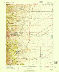
 1925 Ft. Douglas1925 Print · USGSThe Wasatch Range in the mid-1920s shows a landscape of mining camps and early mountain tourism. Genealogists and researchers can trace the old paths of the Lincoln Highway and locate vanished stops like Gogorza, Kimballs, and the Pacific Mine.
 - 1928 Map of Ft. Douglas
 1928 Ft. Douglas1928 Print · USGSIn the mid-1920s, the high country east of Salt Lake was a hive of mining and early canyon tourism. Trace old claim sites like the Pacific Mine or visit early retreats such as Pinecrest Inn and the YWCA Camp during the mining era.2 unique versions available
 - 1951 Map of Salt Lake City South, 1953 Print
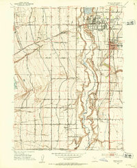
 1951 Salt Lake City South1953 Print · USGSThe Salt Lake Valley undergoes post-war expansion in the early fifties as the urban grid begins to overtake surrounding farmlands. Trace the development of Murray and Kearns, and locate historic landmarks like the Taylorsville Cemetery and Falcon Field.
 - 1951 Map of Midvale, 1953 Print
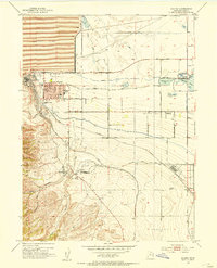
 1951 Midvale1953 Print · USGSThe Salt Lake Valley in the early fifties shows a landscape of busy rail corridors and irrigation canals before the onset of modern suburban sprawl. Trace the industrial heritage of the Sugar Factory or locate family roots near Jordan High Sch and the Midvale rail sidings.
 - 1952 Map of Magna, 1954 Print
 1952 Magna1954 Print · USGSSalt Lake County is seen during a period of heavy industrial growth and rail expansion in the early fifties. Genealogists can trace the residential blocks of Magna and Hunter, while historians can locate industrial landmarks like the Magna Mill and the Powder Plant at Bacchus.6 unique versions available
 - 1952 Map of Lark, 1954 Print
 1952 Lark1954 Print · USGSThe mining and farming communities of the Oquirrh foothills are captured here in the early fifties, documenting the height of the regional copper era. Local researchers can trace family landmarks like Bingham High Sch, the Herriman Cem, and several named mine portals including the Butterfield Tunnel.5 unique versions available
 - 1953 Map of Tooele, 1968 Print
 1953 Tooele1968 Print · USGSTooele County is shown here in the 1950s, a vast landscape transitioning between the industrial growth of the Salt Lake Valley and isolated military testing grounds. Researchers can trace the routes of the Western Pacific railroad and locate historic outposts like Iosepa Ranch and St John Station.3 unique versions available
 - 1954 Map of Salt Lake City, 1964 Print
 1954 Salt Lake City1964 Print · USGSThe Wasatch Front and Uinta Mountains are captured here in the mid-fifties, showing the industrial heart of Utah and its high mountain wilderness. Researchers can locate vanished infrastructure and landmarks like the Geneva Steel Plant, Bingham Canyon Mine, and the Utah State Prison.4 unique versions available
 - 1955 Map of Tooele, 1958 Print
 1955 Tooele1958 Print · USGSTooele County and the Great Salt Lake are captured here during the mid-fifties, an era of burgeoning military testing and industrial mining. Researchers can trace the rail sidings at Salduro Station, the grounds of the Deseret Chemical Corps Depot, and the International Smelting Co facilities.3 unique versions available
 - 1958 Map of Salt Lake City
 1958 Salt Lake City1958 Print · USGSThe Wasatch Front and Uinta Basin are captured during a period of significant post-war growth and industrial development. Researchers can trace the mid-century rail lines of the Bamberger RR and locate sites like the Kiegley Limestone Quarry and Camp Williams Military Reservation.
 - 1960 Map of Salt Lake City
 1960 Salt Lake City1960 Print · USGSThe Wasatch Front and High Uintas are captured mid-century as the Salt Lake Valley underwent significant postwar expansion. Genealogists and historians can trace rail lines like the Union Pacific and locate established landmarks such as Fort Douglas, Camp Williams, and the Bingham Canyon Mine.
 - 1963 Map of Midvale, 1964 Print
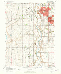 1963 Midvale1964 Print · USGSThe Salt Lake Valley undergoes a mid-century transformation as suburban growth reaches into agricultural corridors along the Jordan River. Genealogists and historians can trace family plots at Wite Fort Cem or study the industrial rail infrastructure serving the Sugar Refinery.3 unique versions available
 - 1963 Map of Salt Lake City South, 1965 Print
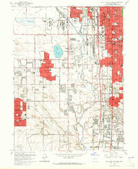 1963 Salt Lake City South1965 Print · USGSThe Salt Lake Valley in the early sixties shows the rapid expansion of suburbs like Kearns and Granger along the Jordan River. Genealogists and historians can trace numerous neighborhood landmarks, including Redwood Memorial Estates and the Utah Central Airport.4 unique versions available
 - 1979 Map of Tooele, 1980 Print
 1979 Tooele1980 Print · USGSTooele and the eastern Oquirrh foothills appear here in the late seventies, showing a landscape defined by massive industrial works and military sites. Researchers can trace the rail corridors of the Western Pacific or locate the historic Monarch Mine and the vast Open Pit Mine near Bingham.
 - 1980 Map of Salt Lake City
 1980 Salt Lake City1980 Print · USGSSalt Lake City and the surrounding Wasatch Range are shown in the early eighties during a period of rapid suburban growth. Genealogists and historians can trace old mining operations like the Ontario Mine and Wasatch Mine or follow the path of the Union Pacific through the canyons.3 unique versions available
 - 1999 Map of Salt Lake City South, 2001 Print
 1999 Salt Lake City South2001 Print · USGSSalt Lake Valley settlement reached a peak of suburban development by the late nineties, filling the space between the river and the western benches. Researchers can trace the evolution of neighborhoods like Taylorsville and Kearns, or locate landmarks such as Franklin Covey Field and Redwood Mem Estates.
 - 1999 Map of Copperton, 2001 Print
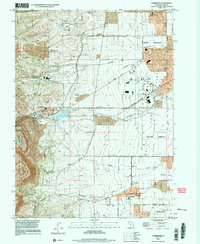 1999 Copperton2001 Print · USGSThe southwestern Salt Lake Valley was rapidly suburbanizing at the end of the century, even as the massive copper operations remained active. Genealogists and local historians can trace the early footprints of Herriman and Copperton, locating sites like the Bingham City Cem and Fort Herriman Historical Marker.
 - 1999 Map of Magna, 2001 Print
 1999 Magna2001 Print · USGSThe Salt Lake Valley at the end of the century shows a unique blend of heavy industry and suburban growth. Trace family roots at Pleasant Green Cem or find local landmarks like the Magna Mill and the Utah Olympic Oval.
 - 1999 Map of Midvale, 2001 Print
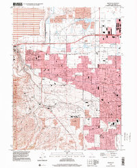
 1999 Midvale2001 Print · USGSThe Salt Lake Valley at the turn of the millennium reveals a landscape of rapid suburban growth and major public institutions. Genealogists and local historians can trace family locations near the South Jordan Cemetery or find early school sites like Oquirrh Sch and Welby Sch.
 - 2023 Map of Magna, 2023 Print
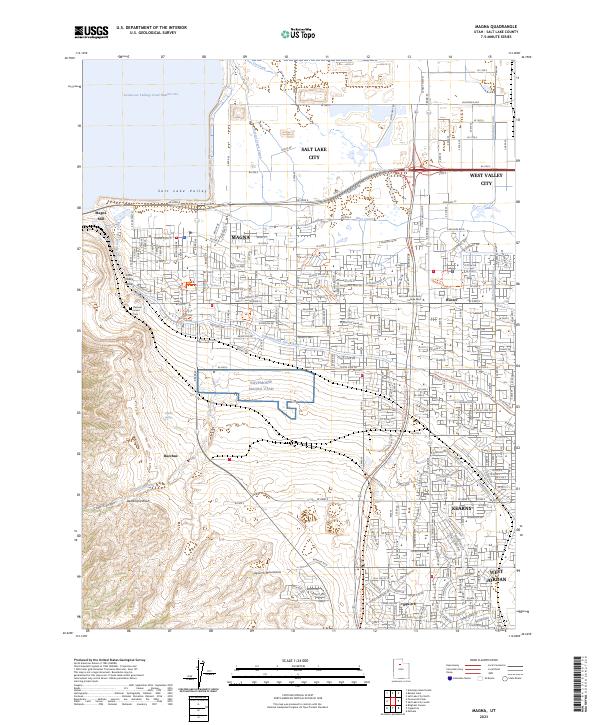 2023 Magna2023 Print · USGSThe western edge of the Salt Lake Valley is captured here during a period of significant suburban expansion and industrial persistence. Genealogists and local historians can locate Pleasant Green Cem and trace the influence of the Magna Mill and the historic Utah and Salt Lake Canal across the landscape.
 - 2023 Map of Copperton, 2023 Print
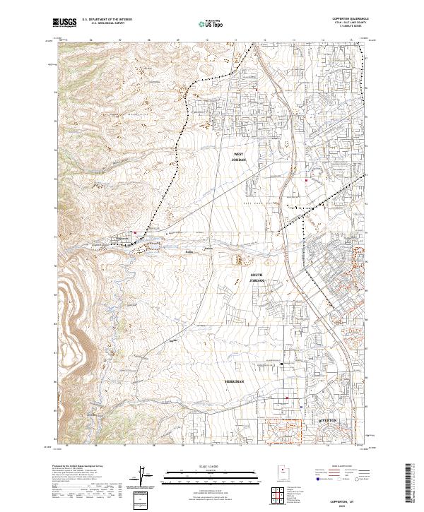 2023 Copperton2023 Print · USGSThe foothills of the Oquirrh Mountains meet the suburban Salt Lake Valley in this recent survey. Researchers can trace the industrial footprint of Bingham Canyon alongside the Bingham City Cem and the small settlement of Dalton.
 - 2023 Map of Salt Lake City South, 2023 Print
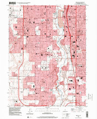
 2023 Salt Lake City South2023 Print · USGSThe Salt Lake Valley in the early 2020s shows a landscape defined by its historic canal systems and rapid urban growth. Researchers can trace local landmarks from South Valley Regional Airport to the campus of SLCC and the grounds of Redwood Memorial Cem.
 - 2023 Map of Midvale, 2023 Print
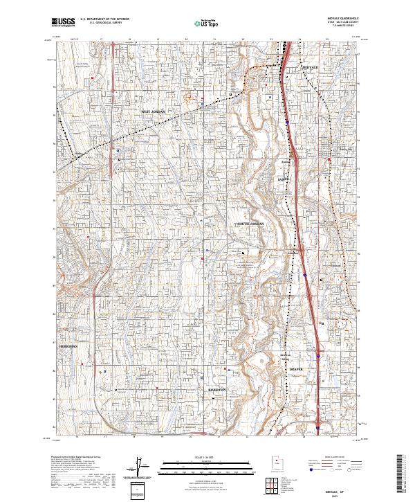 2023 Midvale2023 Print · USGSMidvale and the Salt Lake Valley corridor are shown in high detail during a period of modern expansion. Researchers can trace historic irrigation routes like the Utah and Salt Lake Canal and locate family history sites at Wights Fort Cem and Midvale City Cem.
End of results
Showing maps 1-25 of 25
Top cities near West Jordan
- Salt Lake City historical maps
- West Valley City historical maps
- Sandy historical maps
- Lehi historical maps
- South Jordan historical maps
- Millcreek historical maps
See more
Top neighborhoods of West Jordan
- Oquirrh Shadows historical maps
- The Wood historical maps
- Festival historical maps
- Copper Valley Estates historical maps
- Wescall historical maps
- Country Squire historical maps
See more
Frequently asked questions
- What are the different types of historical maps available for West Jordan?
- What is the oldest map of West Jordan?
- Where can I purchase historical maps of West Jordan for my home or office?
- Where can I download high-res historical maps of West Jordan?
- Are there historical topographic maps available for West Jordan?
- Is there historical aerial imagery available for West Jordan?
- Where are historical maps of West Jordan sourced from?