2000s (21st Century) Maps of Oak Creek, Utah
Explore 6 historic maps of Oak Creek from the 2000s (21st Century). These maps offer a rare glimpse into what life looked like during the 2000s — showing old roads, neighborhoods, homes, and landmarks that have changed or disappeared over time.
Whether you're researching your family's past, planning a metal detecting trip, or studying how Oak Creek's landscape evolved across the 2000s, these high-resolution maps are a powerful tool for exploring the history of this region.
- Focus on a specific era: All maps on this page are from the 2000s, giving you a focused view of this time period.
- See what’s changed: Compare century-old streets, trails, and buildings to today's modern landscape using overlays and satellite layers.
- Research with precision: Use these maps for genealogy, historical research, land use analysis, or educational projects.
- View, download, or print: Maps are fully viewable online in high resolution, and can be downloaded or printed for your own records.
Start exploring Oak Creek's history through authentic maps from the 2000s. This is your window into the past.
Oak Creek, UT maps
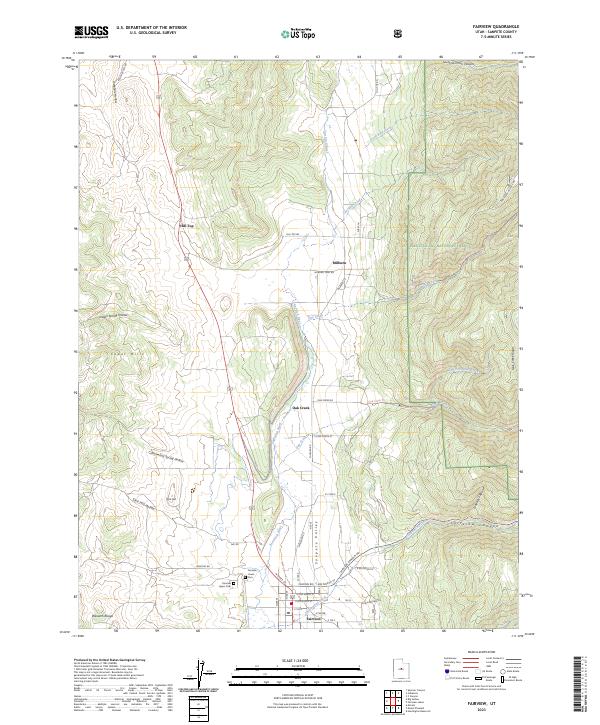
(6)- 2001 Map of Fairview, 2004 Print
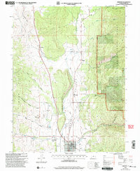 2001 Fairview2004 Print · USGSThe Sanpete Valley near the turn of the millennium shows a landscape defined by the San Pitch River and the rising slopes of the Cedar Hills. Genealogists and local historians can trace the town layouts of Fairview and Milburn, locate the Fairview Cem, or find rural landmarks like the Powerplant and Hill Top.
 - 2011 Map of Fairview, 2011 Print
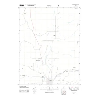 2011 Fairview2011 Print · USGSCovers Oak Creek, including Fairview, Hill Top, and other nearby areas
 - 2014 Map of Fairview, 2014 Print
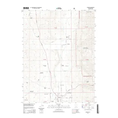 2014 Fairview2014 Print · USGSCovers Oak Creek, including Fairview, Hill Top, and other nearby areas
 - 2017 Map of Fairview, 2017 Print
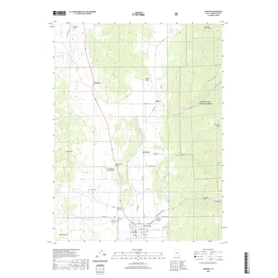
 2017 Fairview2017 Print · USGSCovers Oak Creek, including Fairview, Hill Top, and other nearby areas
 - 2020 Map of Fairview, 2020 Print
 2020 Fairview2020 Print · USGSCovers Oak Creek, including Fairview, Hill Top, and other nearby areas
 - 2023 Map of Fairview, 2023 Print
 2023 Fairview2023 Print · USGSSanpete Valley life continues along the San Pitch River as the high Wasatch peaks look on. Researchers can locate family sites near the Fairview Lower Cem, explore the small community of Milburn, or trace the winding Fairview Canyon Rd.
End of results
Showing maps 1-6 of 6
Top cities near Oak Creek
- Mount Pleasant historical maps
- Moroni historical maps
- Fairview historical maps
- Spring City historical maps
- Fountain Green historical maps
- Wales historical maps
Frequently asked questions
- What are the different types of historical maps available for Oak Creek?
- What is the oldest map of Oak Creek?
- Where can I purchase historical maps of Oak Creek for my home or office?
- Where can I download high-res historical maps of Oak Creek?
- Are there historical topographic maps available for Oak Creek?
- Is there historical aerial imagery available for Oak Creek?
- Where are historical maps of Oak Creek sourced from?