Loading...
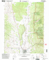
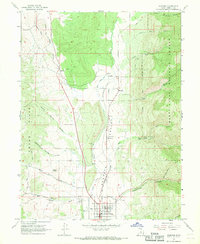
Loading map...2001 Map of Fairview
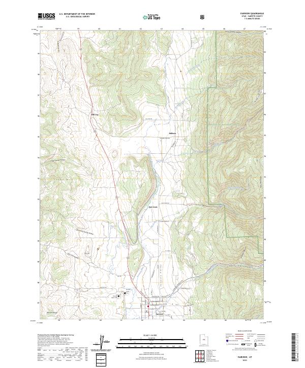
USGS Topo · Published 2004About this map
The Sanpete Valley floor serves as a agricultural and residential hub in this 2001 revision, centered on the historic town of Fairview. The landscape is defined by the San Pitch River and its numerous tributaries, including Oak Creek and Fairview Canyon Creek, which flow westward out of the Manti La Sal National Forest. To the west, the Cedar Hills rise above the valley, marked by a network of drainage systems like Josephine Hollow and Cottonwood Spring Hollow.
Find a feature on this map
39 named features on this map. Tap any name to fly to it.
Don’t see what you’re looking for? This feature index may not catch every label — zoom into the map to look around manually.
Map Details
Date Portrayed2001
Date Published2004
PublisherU.S. Geological Survey
Map TypeTopographic
Scale1:24,000
Physical Dimensions21.8 x 26.6 inches
Editions of this 2001 Fairview Map
This is the sole edition of this map. No revisions or reprints were ever made.
Historical Maps of Fairview Through Time
3 maps found
Featured Locations
Source Details
SourceU.S. Geological Survey
CopyrightPublic Domain