
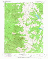
1965 Map of Huntington Reservoir
USGS Topo · Published 1968About this map
Skyline Drive traverses the high ridge of the Manti National Forest in this mid-1960s survey, serving as a central spine for the numerous canyons and watercourses that drain the Utah landscape. The map highlights a localized industrial and utility footprint, featuring the Upper Mt Pleasant Powerplant and Lower Mt Pleasant Powerplant along Pleasant Creek. These facilities, connected by an aqueduct, represent the region's historical reliance on gravity-fed hydroelectric systems.
Find a feature on this map
43 named features on this map. Tap any name to fly to it.
Don’t see what you’re looking for? This feature index may not catch every label — zoom into the map to look around manually.
Map Details
Editions of this 1965 Huntington Reservoir Map
2 editions found
Other maps of this area

1885 · Manti
USGS Topo · 1:250,000

1895 · Manti
USGS Topo · 1:250,000

1923 · Scofield
USGS Topo · 1:62,500

1923 · Hiawatha
USGS Topo · 1:62,500

1925 · Scofield
USGS Topo · 1:62,500

1925 · Hiawatha
USGS Topo · 1:62,500

1956 · Price
USGS Topo · 1:250,000

1960 · Price
USGS Topo · 1:250,000

1962 · Price
USGS Topo · 1:250,000

1965 · Fairview Lakes
USGS Topo · 1:24,000