
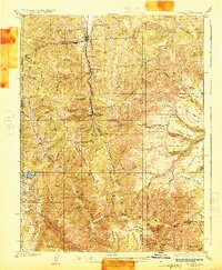
1925 Map of Scofield
USGS Topo · Published 1925About this map
The Denver and Rio Grande Western RR (Pleasant Valley Branch) threads through the heart of the Wasatch Plateau, serving the intensive coal mining operations that define this region in the mid-1920s. Centered on the settlement of Scofield, the landscape is a network of industrial extraction points, from the Gibson Mine in the north to the Wattis Mine near the southern border. The high-altitude terrain is marked by steep ridges and flat-topped benches like Cedar Bench and Horse Bench, which isolate mining camps and cattle operations. Evidence of rural life and early ranching persists at Seeley Ranch and Omans Ranch, while the Cleveland Reservoir provides a critical water source in the elevated basin. This survey documents the specific moment when these mountain drainages were dominated by the rail-and-coal economy, punctuated by isolated outposts such as Gentry Cabin and the mining village of Clear Creek.
Find a feature on this map
88 named features on this map. Tap any name to fly to it.
Don’t see what you’re looking for? This feature index may not catch every label — zoom into the map to look around manually.
Map Details
Editions of this 1925 Scofield Map
2 editions found
Other maps of this area

1885 · Manti
USGS Topo · 1:250,000

1886 · Price River
USGS Topo · 1:250,000

1895 · Manti
USGS Topo · 1:250,000

1896 · Price River
USGS Topo · 1:250,000

1914 · Castle Gate
USGS Topo · 1:62,500

1916 · Castle Gate
USGS Topo · 1:62,500

1923 · Scofield
USGS Topo · 1:62,500

1923 · Hiawatha
USGS Topo · 1:62,500

1925 · Hiawatha
USGS Topo · 1:62,500

1939 · Soldier Summit
USGS Topo · 1:62,500