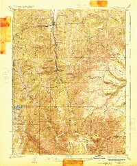
1925 Map of Scofield
USGS Topo · Published 1925About this map
The coal-rich high country of the Wasatch Plateau is documented here at a time of heavy industrial activity. The Denver and Rio Grande Western Railroad Branch serves as the primary artery for this mountain corridor, connecting coal camps and operations such as Scofield and Clear Creek to broader markets. The landscape is defined by its deep drainages and named ridges, where mining complexes like the Clear Creek Mines No 4 No 3 and the Wattis Mine operate alongside smaller family holdings.
Find a feature on this map
89 named features on this map. Tap any name to fly to it.
Don’t see what you’re looking for? This feature index may not catch every label — zoom into the map to look around manually.
Map Details
Editions of this 1925 Scofield Map
2 editions found
Other maps of this area

1885 · Manti
USGS Topo · 1:250,000

1886 · Price River
USGS Topo · 1:250,000

1895 · Manti
USGS Topo · 1:250,000

1896 · Price River
USGS Topo · 1:250,000

1914 · Castle Gate
USGS Topo · 1:62,500

1916 · Castle Gate
USGS Topo · 1:62,500

1923 · Scofield
USGS Topo · 1:62,500

1923 · Hiawatha
USGS Topo · 1:62,500

1925 · Scofield
USGS Topo · 1:62,500

1925 · Hiawatha
USGS Topo · 1:62,500