Old Maps of Ibapah, Utah for Metal Detecting
Plan your next treasure hunt with 11 historic maps of Ibapah. Find old homesites, ghost towns, trails, and gathering spots that may be lost to time — perfect for identifying promising metal detecting locations.
- Locate forgotten sites: Uncover places like long-lost settlements, abandoned rail lines, or gathering spots.
- Plan better hunts: Use map overlays combined with LiDAR or satellite views to narrow in on historically rich areas.
- Made for detectorists: Thousands of hobbyists use these maps to discover relics, coins, and hidden history.
Use these historic maps to boost your research and find new opportunities beneath the surface of Ibapah.
Ibapah, UT maps
(11)- 1925 Map of Gold Hill, 1955 Print
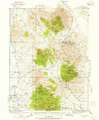 1925 Gold Hill1955 Print · USGSThe mining landscape of western Utah is preserved here during the mid-1920s, showing the high-desert settlements and remote mineral claims. Researchers can trace early mining operations at Gold Hill Mine or find historical family homesteads like Erickson Ranch and Sheridan Ranch.3 unique versions available
 - 1928 Map of Gold Hill
 1928 Gold Hill1928 Print · USGSThe Tooele County mining district comes into sharp focus during the late 1920s as industry pushed into the high desert. Genealogists and historians can trace the foundations of Gold Hill and Ibapah, alongside the historic Overland Trail and numerous shafts like the Midas Mine.2 unique versions available
 - 1953 Map of Tooele, 1968 Print
 1953 Tooele1968 Print · USGSTooele County is shown here in the 1950s, a vast landscape transitioning between the industrial growth of the Salt Lake Valley and isolated military testing grounds. Researchers can trace the routes of the Western Pacific railroad and locate historic outposts like Iosepa Ranch and St John Station.3 unique versions available
 - 1955 Map of Tooele, 1958 Print
 1955 Tooele1958 Print · USGSTooele County and the Great Salt Lake are captured here during the mid-fifties, an era of burgeoning military testing and industrial mining. Researchers can trace the rail sidings at Salduro Station, the grounds of the Deseret Chemical Corps Depot, and the International Smelting Co facilities.3 unique versions available
 - 1973 Map of Ibapah, 1977 Print
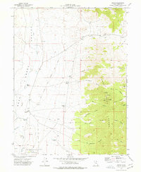 1973 Ibapah1977 Print · USGSThe western desert of Tooele County comes into focus in the 1970s, centered on the Goshute Indian Reservation and the historic town of Ibapah. Local historians can trace the Pony Express Overland Stage Route and find ranching outposts like Nicholes Ranch.3 unique versions available
 - 1979 Map of Wildcat Mountain
 1979 Wildcat Mountain1979 Print · USGSTooele County’s western reaches are shown here in the late seventies, where isolated mining districts meet sprawling military test ranges. Genealogists and historians can trace old operations at Gold Hill or locate remote sites like the Garrison Mines and Ibapah.2 unique versions available
 - 2010 Map of Ibapah, 2010 Print
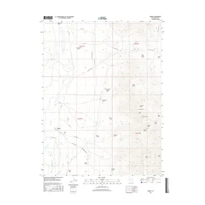
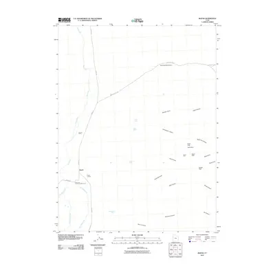 2010 Ibapah2010 Print · USGSCovers Ibapah, including Tooele County, United States, and other nearby areas
 - 2014 Map of Ibapah, 2014 Print
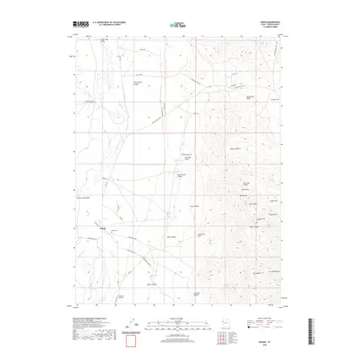
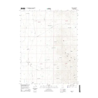 2014 Ibapah2014 Print · USGSCovers Ibapah, including Tooele County, United States, and other nearby areas
 - 2017 Map of Ibapah, 2017 Print
 2017 Ibapah2017 Print · USGSCovers Ibapah, including Tooele County, United States, and other nearby areas
 - 2020 Map of Ibapah, 2020 Print
 2020 Ibapah2020 Print · USGSCovers Ibapah, including Tooele County, United States, and other nearby areas
 - 2023 Map of Ibapah, 2023 Print
 2023 Ibapah2023 Print · USGSWestern Tooele County shows its deep transit history in this recent survey of the Deep Creek Valley. Researchers can trace the path of the Old Lincoln Hwy and Pony Express Canyon or locate local landmarks like the Ibapah Cem.
End of results
Showing maps 1-11 of 11
Frequently asked questions
- What are the different types of historical maps available for Ibapah?
- What is the oldest map of Ibapah?
- Where can I purchase historical maps of Ibapah for my home or office?
- Where can I download high-res historical maps of Ibapah?
- Are there historical topographic maps available for Ibapah?
- Is there historical aerial imagery available for Ibapah?
- Where are historical maps of Ibapah sourced from?