Old Maps of Tooele County, Utah
Explore 1,047 old maps of Tooele County, spanning from 1885 to today. These high-resolution historic maps reveal how streets, neighborhoods, landmarks, and natural features evolved over time — perfect for genealogy, metal detecting, research, and local history exploration.
What you can do with these maps:
- See how Tooele County changed over time: Compare historical maps to modern-day views to trace roads, homesites, rail lines & more.
- View detailed metadata: Each map includes creators, publishers, year, scale, and archive source.
- Overlay maps with satellite & LiDAR: Visualize the past alongside modern tools to explore terrain & human change.
- Trusted historical sources: Maps sourced from the USGS, Library of Congress, and other archives.
- Access maps your way: View online, download high-res files, or order prints for personal or research use.
Start exploring old maps of Tooele County to uncover forgotten places, hidden landmarks, and the deep history beneath your feet.
Tooele County, UT maps
(1,047)- 1885 Map of Sevier Desert
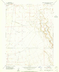
 1885 Sevier Desert1885 Print · USGSMining districts and desert outposts across central Utah come to life in the mid-1880s as the railroad pushes through the canyon. Researchers can trace early industrial footprints at Silver City, locate the riverside settlement of Deseret, and follow the original Central Pacific Railroad line.5 unique versions available
 - 1885 Map of Tooele Valley
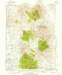
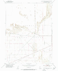
 1885 Tooele Valley1885 Print · USGSThe valleys and ranges west of the Wasatch are captured here in the mid-1880s, showcasing the early mining and rail infrastructure of the region. Genealogists can trace early settlements like Grantsville, Ophir, and Stockton, or the route of the Utah and Nevada R. R.6 unique versions available
 - 1908 Map of Fish Springs
 1908 Fish Springs1908 Print · USGSWestern Utah at the turn of the century is a land of remote mining camps and desert outposts. Trace family history and early industry at Utah Mine, Joy P.O., and the isolated Butson's Ranch near the Confusion Range.
 - 1910 Map of Fish Springs
 1910 Fish Springs1910 Print · USGSWestern Utah's high desert and isolated mining districts are mapped here in the early twentieth century, showing a landscape of remote ranching and rugged mineral claims. Local historians can trace family-named outposts like Meecham's Ranch and Thomas' Ranch or locate the Queen of Sheba Mine and Fish Springs.6 unique versions available
 - 1915 Map of Fairfield, 1957 Print
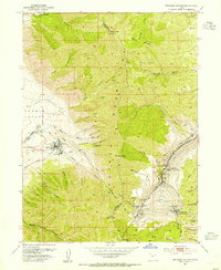
 1915 Fairfield1957 Print · USGSThe Oquirrh Mountains and Cedar Valley come alive in this early twentieth-century survey of Utah's mining and military landscapes. Genealogists and historians can trace rail stops at Fairfield Sta, mining claims at Queen Mine, and the National Cemetery.
 - 1917 Map of Fairfield
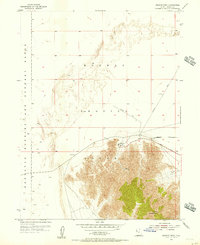
 1917 Fairfield1917 Print · USGSThe Oquirrh Mountains and Cedar Valley appear here just before the close of the first World War. Genealogists and industrial historians can trace the mining networks of Ophir, Mercur, and the Chloride Point Mine alongside the early Fairfield settlement.2 unique versions available
 - 1918 Map of Stockton
 1918 Stockton1918 Print · USGSTooele County mining and ranching culture are caught in detail just before the close of the Great War. Genealogists and historians can trace the rail lines connecting Stockton and Ophir, as well as named family properties like Bales Ranch and Johnson Ranch.4 unique versions available
 - 1925 Map of Gold Hill, 1955 Print
 1925 Gold Hill1955 Print · USGSThe mining landscape of western Utah is preserved here during the mid-1920s, showing the high-desert settlements and remote mineral claims. Researchers can trace early mining operations at Gold Hill Mine or find historical family homesteads like Erickson Ranch and Sheridan Ranch.3 unique versions available
 - 1928 Map of Gold Hill
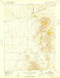
 1928 Gold Hill1928 Print · USGSThe Tooele County mining district comes into sharp focus during the late 1920s as industry pushed into the high desert. Genealogists and historians can trace the foundations of Gold Hill and Ibapah, alongside the historic Overland Trail and numerous shafts like the Midas Mine.2 unique versions available
 - 1947 Map of Fivemile Pass, 1953 Print
 1947 Fivemile Pass1953 Print · USGSUtah's high desert reveals its mining and transit legacy in the late 1940s as the East Tintic Mountains hum with mineral extraction. Trace the storied Pony Express Route or locate historic operations like the Lehi Tintic Mine and the settlement of Topliff.
 - 1947 Map of Boulter Peak, 1958 Print
 1947 Boulter Peak1958 Print · USGSThe East Tintic Mountains meet the desert basins of Tooele and Juab counties in the late 1940s. Researchers can trace historical mining claims and rugged transportation routes like the Scranton Mine, Twelvemile Pass, and Silver Dollar Mine.2 unique versions available
 - 1949 Map of Fivemile Pass
 1949 Fivemile Pass1949 Print · USGSTooele and Utah County lines intersect here in the late 1940s, revealing a landscape shaped by strategic desert passes and shifting rail lines. Trace the industrial footprint of the (Dismantled Railroad) leading to Topliff or follow the Union Pacific through Fivemile Pass.2 unique versions available
 - 1952 Map of Bingham Canyon, 1954 Print
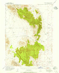
 1952 Bingham Canyon1954 Print · USGSBingham Canyon was the heart of Utah copper mining in the early fifties, showing the massive Copper Pit and its surrounding rail networks. Researchers can trace vanished residential pockets like Highland Boy and Copperfield or locate landmarks like the Central Sch.5 unique versions available
 - 1952 Map of Antelope Island South, 1954 Print
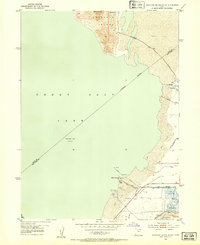 1952 Antelope Island South1954 Print · USGSThe southern shores of the Great Salt Lake are captured here in the early fifties, showcasing a blend of industrial salt works and lakeside recreation. Researchers can trace the layout of the Saltair Resort, locate the historic Roller Coaster, and explore the vast Salt Evaporators along the Garfield and Western Base Line.2 unique versions available
 - 1952 Map of Garfield, 1954 Print
 1952 Garfield1954 Print · USGSThe industrial corridor of the southern Great Salt Lake comes alive in the early fifties, showing the massive milling and smelting operations at Garfield and Arthur. Trace historical sites like the Site of First Utah Smelter alongside the rail networks of the Western Pacific Railroad.
 - 1953 Map of Dugway Range NE, 1955 Print
 1953 Dugway Range NE1955 Print · USGSThe high desert of western Utah is documented here in the early fifties, showing the dramatic elevations of the Dugway Range. Researchers can locate remote water sources like Fandangle Well and Monument Reservoir along a network of old jeep trails.
 - 1953 Map of Dugway Range, 1955 Print
 1953 Dugway Range1955 Print · USGSJuab County in the early 1950s is a rugged landscape of mining prospects and historic trail corridors. Researchers can trace the original Pony Express Route past the Dugway Pony Express Sta and locate remote operations like the Rainbow Mines and Four Metal Mine.3 unique versions available
 - 1953 Map of Dugway Range NW, 1955 Print
 1953 Dugway Range NW1955 Print · USGSThe western Utah desert at the mid-century reveals a landscape of industrial extraction and high-altitude terrain. Metal detectorists and researchers can trace the locations of the Rainbow Mines, Four Metal Mine, and several prospect sites.2 unique versions available
 - 1953 Map of Tooele, 1968 Print
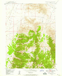
 1953 Tooele1968 Print · USGSTooele County is shown here in the 1950s, a vast landscape transitioning between the industrial growth of the Salt Lake Valley and isolated military testing grounds. Researchers can trace the routes of the Western Pacific railroad and locate historic outposts like Iosepa Ranch and St John Station.3 unique versions available
 - 1953 Map of Delta, 1969 Print
 1953 Delta1969 Print · USGSWest-central Utah in the early fifties shows a landscape of vast desert playas and rising mountain ranges. Genealogists and historians can trace rail sidings like Champlin Siding, local industry at the Tungsten Mill, and historic outposts such as Fort Deseret.3 unique versions available
 - 1954 Map of Wig Mtn SW, 1955 Print
 1954 Wig Mtn SW1955 Print · USGSTooele County's high desert was a restricted landscape of military testing and vast salt flats during the mid-fifties. Researchers can trace the boundaries of the Wendover Bombing and Gunnery Range and Dugway Proving Ground.4 unique versions available
 - 1954 Map of Dugway Proving Ground SE, 1955 Print
 1954 Dugway Proving Ground SE1955 Print · USGSDugway Proving Ground and the high desert of Tooele County appear in the mid-1950s as a specialized military landscape. Researchers can trace the desert topography along the Old Riverbed Trail and follow the path of Granite Peak Rd across the flats.4 unique versions available
 - 1954 Map of Dugway Proving Ground NE, 1956 Print
 1954 Dugway Proving Ground NE1956 Print · USGSIn the Great Salt Lake Desert during the mid-fifties, this military survey captures the restricted landscape of the Dugway Proving Ground. Researchers can trace the early road network including Goodyear Road and the localized Baker Area.4 unique versions available
 - 1954 Map of Wildcat Mtn, 1956 Print
 1954 Wildcat Mtn1956 Print · USGSThe mid-century Utah desert comes into focus on this sheet, centered on the military operations at the Wendover Bombing and Gunnery Range. Researchers can trace the isolation of Wildcat Mountain and locate high-altitude Prospects and a Tunnel tucked among the peaks.4 unique versions available
 - 1954 Map of Granite Peak, 1956 Print
 1954 Granite Peak1956 Print · USGSTooele County's military and desert landscape is captured here in the mid-fifties, showing the intersection of vast testing ranges. Researchers can trace restricted-access infrastructure including the Landing Strip, Goodyear Road, and the prominent Granite Peak.2 unique versions available
Showing maps 1-25 of 1,047
Top cities of Tooele County
- Tooele historical maps
- Grantsville historical maps
- Stansbury Park historical maps
- Erda historical maps
- Lake Point historical maps
- Wendover historical maps
See more
Frequently asked questions
- What are the different types of historical maps available for Tooele County?
- What is the oldest map of Tooele County?
- Where can I purchase historical maps of Tooele County for my home or office?
- Where can I download high-res historical maps of Tooele County?
- Are there historical topographic maps available for Tooele County?
- Is there historical aerial imagery available for Tooele County?
- Where are historical maps of Tooele County sourced from?