1960s Maps of Tooele County, Utah
Explore 26 historic maps of Tooele County from the 1960s. These maps offer a rare glimpse into what life looked like during the 1960s — showing old roads, neighborhoods, homes, and landmarks that have changed or disappeared over time.
Whether you're researching your family's past, planning a metal detecting trip, or studying how Tooele County's landscape evolved across the 1960s, these high-resolution maps are a powerful tool for exploring the history of this region.
- Focus on a specific era: All maps on this page are from the 1960s, giving you a focused view of this time period.
- See what’s changed: Compare century-old streets, trails, and buildings to today's modern landscape using overlays and satellite layers.
- Research with precision: Use these maps for genealogy, historical research, land use analysis, or educational projects.
- View, download, or print: Maps are fully viewable online in high resolution, and can be downloaded or printed for your own records.
Start exploring Tooele County's history through authentic maps from the 1960s. This is your window into the past.
Tooele County, UT maps
(26)- 1961 Map of Wells
 1961 Wells1961 Print · USGSNortheastern Nevada's high basin and range country is captured here during the early sixties, showing the vital rail corridors and ranching outposts. Researchers can trace the heritage of remote settlements like Metropolis, locate the Delano Mines, and follow the path of the Southern Pacific through the Pequop Mountains.
 - 1962 Map of Elko
 1962 Elko1962 Print · USGSNortheastern Nevada in the early sixties is a landscape of mountain ranges and rail corridors, where the river valleys support ranching and transit. Locate old mining operations like Battle Creek Mine, rural stops like Moleen, and the sprawling Wendover Bombing and Gunnery Range.
 - 1962 Map of Brigham City
 1962 Brigham City1962 Print · USGSNorthern Utah in the early sixties reveals a landscape of vast salt flats and growing towns along the Wasatch Front. Researchers can trace the Southern Pacific line past the Golden Spike Monument or locate landmarks like Indian Cave and Donner-Reed Pass.
 - 1962 Map of Delta
 1962 Delta1962 Print · USGSWest Central Utah in the early sixties reveals a landscape of desert agriculture and military testing grounds. Researchers can trace the Union Pacific line through Delta or locate historic sites like the Pony Express Monument and Silver City.
 - 1963 Map of Ely
 1963 Ely1963 Print · USGSEastern Nevada's high basins and mountain ranges are captured here in the early sixties, showing a landscape defined by mining and ranching. Trace family roots at the Thompson Ranch or follow the Nevada Northern Railroad through Steptoe Valley.
 - 1963 Map of Sabie Mountain, 1964 Print
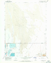
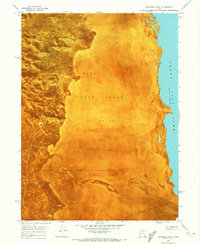
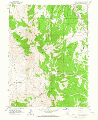 1963 Sabie Mountain1964 Print · USGSThe high desert of the Tooele and Juab county border is captured here during the early 1960s. Researchers can trace historic water sources like Boulter Springs and Keg Spring, or locate seasonal outposts such as Summer Ranch and Dry Farm.2 unique versions available
 - 1963 Map of Dutch Peak, 1964 Print
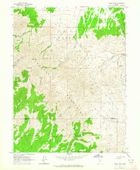 1963 Dutch Peak1964 Print · USGSThe Sheeprock Mountains at the Tooele and Juab County line are captured here in the early 1960s. Researchers can locate remote mining sites and prospects near Dutch Peak or trace seasonal water sources like Chokecherry Spring and Indian Springs.3 unique versions available
 - 1965 Map of Elko
 1965 Elko1965 Print · USGSElko and the northeastern Nevada desert are captured here in the mid-1960s, showcasing a landscape of high ranges and essential rail corridors. Researchers can trace the path of the Western Pacific railroad through small stops like Tobar and Ventosa, or locate remote sites like Shanty Town near the Ruby Lake wetlands.
 - 1967 Map of Pilot Peak, 1971 Print
 1967 Pilot Peak1971 Print · USGSThe high desert of Elko County and the Nevada-Utah border are captured here in the late 1960s. Researchers can trace the remote ranching life at Bar O Ranch or map the water sources and drainage patterns through Horse Canyon and Bettridge Creek.2 unique versions available
 - 1967 Map of Fish Springs NW, 1971 Print
 1967 Fish Springs NW1971 Print · USGSTooele County’s high desert meets managed wetlands in the late sixties, tracing the historic corridor of the Pony Express Road. Researchers can locate desert water sources like Wilson Health Springs and Deadman Spring or explore the Fish Springs National Wildlife Refuge.2 unique versions available
 - 1967 Map of Fish Springs NE, 1971 Print
 1967 Fish Springs NE1971 Print · USGSThe high desert of western Utah is captured here in the late sixties, where conservation land meets a sprawling military range. Trace the historic route of the Pony Express Road past the Black Rock Pony Express Station Historical Monument and the managed waters of Gadwall Pool.4 unique versions available
 - 1967 Map of Crater Island SW, 1972 Print
 1967 Crater Island SW1972 Print · USGSThe western edge of the Great Salt Lake Desert comes into focus in the late sixties at the foot of the mountains. Follow the historic path of the Donner-Reed Trail and locate vital water sources like Donner Spring and South Patterson Spring.2 unique versions available
 - 1968 Map of Mercur, 1970 Print
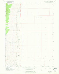
 1968 Mercur1970 Print · USGSThe Oquirrh Mountains mining district comes into sharp focus during the late 1960s, revealing a landscape of industrial extraction and high-altitude settlements. Trace the legacy of gold and silver production at the Geyser Marion Mine or locate the historical footprints of Sunshine (Site) and Manning (Site).2 unique versions available
 - 1968 Map of Lowe Peak, 1971 Print
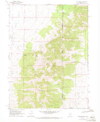
 1968 Lowe Peak1971 Print · USGSThe Oquirrh Mountains at the end of the sixties reveal a landscape defined by military boundaries and mining history. Trace the high-altitude Old Military Road or locate historical extraction sites like the Old Mayflower Mine and Queen Mine.
 - 1968 Map of Plug Peak SE, 1972 Print
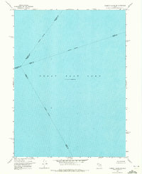
 1968 Plug Peak SE1972 Print · USGSThe northern reaches of the Great Salt Lake are captured here in the late sixties, showing the water levels at a specific historical moment. Researchers can trace the tri-county meeting point and locate a prominent Mud Flat along the shore.
 - 1968 Map of Plug Peak NW, 1972 Print
 1968 Plug Peak NW1972 Print · USGSThe western waters of the Great Salt Lake are captured here in the late sixties, showing the remote shoreline of Tooele County. Local researchers can trace the rugged edge of Pass Canyon and locate isolated water sources like Pass Canyon Spring and several Salt Springs.
 - 1968 Map of Carrington Island SW, 1972 Print
 1968 Carrington Island SW1972 Print · USGSThe northern reaches of the Great Salt Lake are captured here in the late sixties, showing the vast transition between water and land. Researchers can trace the Indefinite Boundary across the Mud Flat terrain of the lake bed.
 - 1968 Map of Fremont Island SW, 1972 Print
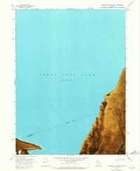
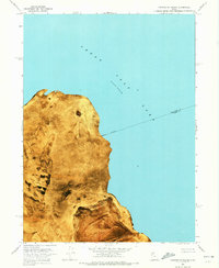
 1968 Fremont Island SW1972 Print · USGSThe open waters of the Great Salt Lake are captured in the late sixties at a documented elevation of 4,193 feet. Researchers can trace the intersection of four counties along the Weber-Davis and Tooele-Davis indefinite boundaries.
 - 1968 Map of Poverty Point, 1973 Print
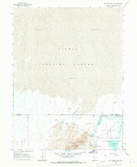
 1968 Poverty Point1973 Print · USGSThe Great Salt Lake desert landscape of the late sixties comes alive through this orthophoto survey of Tooele County. Researchers can trace the legacy of regional transit and water management at Poverty Point and the Timpie Springs Waterfowl Management Area.
 - 1968 Map of Deardens Knoll, 1973 Print
 1968 Deardens Knoll1973 Print · USGSThe western shoreline of the Great Salt Lake meets military testing grounds in the late sixties. Researchers can trace the rugged terrain of the Lakeside Mountains and identify landforms like Deardens Knoll within the Hill Air Force Range.
 - 1968 Map of Badger Island NW, 1973 Print
 1968 Badger Island NW1973 Print · USGSThe eastern edge of Lakeside Valley is shown in the late sixties, where the desert meets the Great Salt Lake. Researchers can trace the path of the Protective Drainage Ditch and study the extent of the surrounding Mud Flat.
 - 1968 Map of Badger Island, 1973 Print
 1968 Badger Island1973 Print · USGSThe Great Salt Lake shoreline in the late sixties reveals a landscape of shifting waters and desert isolation. Researchers can trace the Jeep Trail along Stansbury Island or locate the remote Pumping Station and Gravel Pit.
 - 1968 Map of Corral Canyon, 1973 Print
 1968 Corral Canyon1973 Print · USGSThe Great Salt Lake shoreline in the late sixties reveals a landscape of industrial mineral extraction and wildlife conservation. Researchers can trace the Salt Evaporators, find the Pumping Station, and explore the Timpie Springs Waterfowl Management Area.
 - 1968 Map of Carrington Island, 1973 Print
 1968 Carrington Island1973 Print · USGSThe northern reaches of the Great Salt Lake are captured in the late sixties, showing the stark boundary between brine and basin. Researchers can trace the shifting shorelines around Carrington Island and identify landmarks like Hat Island and Lambournes Rock.
 - 1968 Map of Craner Peak, 1973 Print
 1968 Craner Peak1973 Print · USGSThe high-desert terrain of Tooele County in the late sixties shows a landscape defined by rugged peaks and isolated industrial sites. Local researchers can trace the reach of the Marblehead Quarry and Monarch Mine or locate historical water sources like Craner Spring.2 unique versions available
Showing maps 1-25 of 26
Top cities of Tooele County
- Tooele historical maps
- Grantsville historical maps
- Stansbury Park historical maps
- Erda historical maps
- Lake Point historical maps
- Wendover historical maps
See more
Frequently asked questions
- What are the different types of historical maps available for Tooele County?
- What is the oldest map of Tooele County?
- Where can I purchase historical maps of Tooele County for my home or office?
- Where can I download high-res historical maps of Tooele County?
- Are there historical topographic maps available for Tooele County?
- Is there historical aerial imagery available for Tooele County?
- Where are historical maps of Tooele County sourced from?