1990s Maps of Tooele County, Utah
Explore 81 historic maps of Tooele County from the 1990s. These maps offer a rare glimpse into what life looked like during the 1990s — showing old roads, neighborhoods, homes, and landmarks that have changed or disappeared over time.
Whether you're researching your family's past, planning a metal detecting trip, or studying how Tooele County's landscape evolved across the 1990s, these high-resolution maps are a powerful tool for exploring the history of this region.
- Focus on a specific era: All maps on this page are from the 1990s, giving you a focused view of this time period.
- See what’s changed: Compare century-old streets, trails, and buildings to today's modern landscape using overlays and satellite layers.
- Research with precision: Use these maps for genealogy, historical research, land use analysis, or educational projects.
- View, download, or print: Maps are fully viewable online in high resolution, and can be downloaded or printed for your own records.
Start exploring Tooele County's history through authentic maps from the 1990s. This is your window into the past.
Tooele County, UT maps
(81)- 1991 Map of Lucin 4 SE
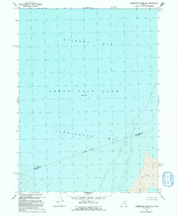
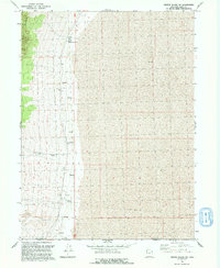
 1991 Lucin 4 SE1991 Print · USGSThe Great Salt Lake Desert's expanse is documented in the early nineties, where salt flats meet restricted military zones. Trace the limits of the Utah Test and Training Range North as it crosses the Newfoundland Evaporation Basin.2 unique versions available
 - 1991 Map of Big Pass
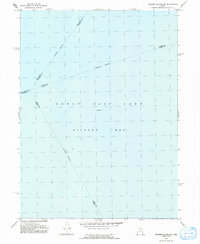
 1991 Big Pass1991 Print · USGSIn the early 1990s, the Great Salt Lake Desert was a realm of military testing and geological isolation. Researchers can trace the rugged contours of the Newfoundland Mountains and locate the remote Landing Strip and Big Pass.
 - 1991 Map of Carrington Island
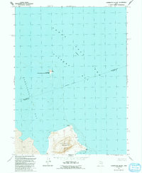 1991 Carrington Island1991 Print · USGSCarrington Island and the southern waters of the Great Salt Lake are captured here in the early nineties, showing a landscape defined by isolation and wildlife. Trace the rocky terrain of Carrington Island and find Lambournes Rock or Hat Island.
 - 1991 Map of Deardens Knoll
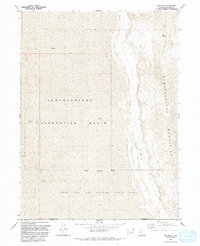
 1991 Deardens Knoll1991 Print · USGSThe western shores of the Great Salt Lake are documented here in the early nineties, revealing a landscape shaped by military use and natural shifts. Researchers can trace remote routes across the Utah Test and Training Range or locate landmarks like Deardens Knoll and Richins Knoll.
 - 1991 Map of Carrington Island SW
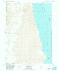
 1991 Carrington Island SW1991 Print · USGSThe Great Salt Lake shoreline and Gilbert Bay are captured here in the early nineties, showing a landscape defined entirely by water and salt flats. Researchers can trace the Box Elder Co Tooele Co line and the wide mudflats of Carrington Bay.
 - 1991 Map of Fremont Island SW
 1991 Fremont Island SW1991 Print · USGSThe waters of Gilbert Bay are the primary focus of this late-century survey of the Great Salt Lake. Researchers can trace the convergence of several underwater county lines, including the Weber Co Davis Co and Davis Co Tooele Co boundaries.
 - 1991 Map of Keller Well
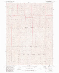
 1991 Keller Well1991 Print · USGSThe Newfoundland Mountains rise from the Great Salt Lake Desert in the early 1990s. Researchers can trace the boundary of the Utah Test and Training Range and locate remote outposts like Keller Well and its Storage Bins.
 - 1991 Map of Lucin 4 SW
 1991 Lucin 4 SW1991 Print · USGSThe high desert of Box Elder County is captured here in the early nineties, showing a landscape defined by mining and salt flats. Geologists and researchers can trace old mineral sites near Crater Island or follow a Pack Trail into the Silver Island Mountains.2 unique versions available
 - 1991 Map of Crater Island SW, 1992 Print
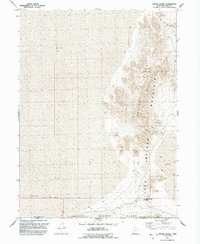
 1991 Crater Island SW1992 Print · USGSThe Great Salt Lake Desert frontier is captured here in the early nineties, where the mountain slopes meet the mudflats. Trace the historic Donner-Reed Trail and locate vital desert water sources like Donner Spring and South Patterson Spring.
 - 1991 Map of Crater Island, 1992 Print
 1991 Crater Island1992 Print · USGSThe Great Salt Lake Desert was a formidable barrier in the 1840s, as seen here where the historic Donner-Reed Trail crosses through Donner-Reed Pass. Relive the pioneer journey by tracing the old route past Flowing Well and the scattered Prospects of the Crater Island Mountains.
 - 1991 Map of Wildcat Mountain SE, 1994 Print
 1991 Wildcat Mountain SE1994 Print · USGSThe Great Salt Lake Desert was defined by vast military testing ranges and natural expanses in the early 1990s. Trace the boundaries of the Dugway Proving Ground and Wendover Air Force Range amidst a landscape of Sand Dunes and shifting mud flats.
 - 1992 Map of Tintic Junction
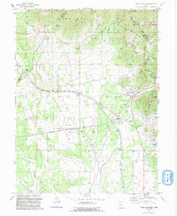 1992 Tintic Junction1992 Print · USGSThe Tintic Mining District is shown in the late twentieth century as it transitioned from an industrial powerhouse to a quieter rural landscape. Researchers can trace the heritage of local families and the ore economy through Silver City, Mammoth, and the Victoria Gold Mine.
 - 1993 Map of Tabbys Peak SE
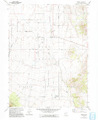
 1993 Tabbys Peak SE1993 Print · USGSSkull Valley at the start of the nineties is a landscape of high-desert basins and restricted frontiers. Researchers can trace the military boundaries of the Dugway Proving Ground and the Skull Indian Reservation.
 - 1993 Map of Onaqui Mts South
 1993 Onaqui Mts South1993 Print · USGSThe historic Pony Express and Stage Route traverses this part of the eastern Great Basin in the early nineties. Researchers can trace the path of the overland trail past Skull Faust Canyon Springs and early Quarries near the Onaqui Mountains.
 - 1993 Map of Tabbys Peak
 1993 Tabbys Peak1993 Print · USGSSkull Valley and the Cedar Mountains are captured here in the early nineties, showing a landscape of high desert passes and remote water sources. Researchers can trace the Old Railroad Grade and locate historic points like Rydalch Pass and Tabbys Spring.
 - 1993 Map of Vernon
 1993 Vernon1993 Print · USGSThe high desert of Tooele County is documented here during the early nineties, centered on the ranching community of Vernon. Genealogists and researchers can locate the Chief Green Jacket Grave, the Vernon Cem, and the former location of Benmore (Site).
 - 1993 Map of Mercur
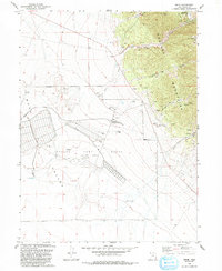
 1993 Mercur1993 Print · USGSThe Oquirrh Mountains in the 1990s show a landscape shaped by Utah's mining legacy. Genealogists and historians can trace the remnants of historic camps like Mercur (Site) and Sunshine (Site) alongside the massive Open Pit Mine.
 - 1993 Map of Lofgreen
 1993 Lofgreen1993 Print · USGSRush Valley and the high desert of Tooele County are captured here in the early nineties, showing a landscape of remote ranching and mining. Researchers can trace the Union Pacific line to old sites like Lofgreen and the vanished mining camp of Scranton.
 - 1993 Map of Camels Back Ridge SW
 1993 Camels Back Ridge SW1993 Print · USGSTooele County's desert reaches appear in the early nineties, dominated by military restricted zones and ancient geological features. Trace the path of the Old River Bed past Camels Back Ridge and the isolated Simpson Butte.
 - 1993 Map of Lowe Peak
 1993 Lowe Peak1993 Print · USGSThe Oquirrh Mountains at the end of the twentieth century reveal a terrain shaped by mining and high-altitude geography. Genealogists and historians can trace old resource leads at the Queen Mine Prospects, locate the settlement of Ophir, and follow rugged trails through Piney Pass.
 - 1993 Map of Ophir
 1993 Ophir1993 Print · USGSThe mining heights of the Oquirrh Mountains meet the broad Rush Valley in this 1990s record of Utah's industrial and military heritage. Researchers can trace the extensive mine works around Ophir, find the Cemetery, and locate the Tooele Army Depot (South Area).
 - 1993 Map of Saint John
 1993 Saint John1993 Print · USGSRush Valley in the early nineties shows the meeting point of rural ranching life and large-scale military operations. Genealogists and historians can trace family locations in Saint John and Clover, or locate the historic Saint John Sta and local Cem markers.
 - 1993 Map of Indian Peaks
 1993 Indian Peaks1993 Print · USGSSkull Valley and the surrounding peaks are captured in the early 1990s, preserving the path of the high-desert frontier. You can trace the historic Pony Express and Overland Stage Route as it passes James Ranch and the Simpson Mountains.
 - 1993 Map of Boulter Peak
 1993 Boulter Peak1993 Print · USGSThe East Tintic Mountains at the triple junction of Tooele, Utah, and Juab counties show a landscape defined by decades of mining. Researchers can trace historic industrial sites like the Scranton Mine, New Bullion Mine, and the high summit of Boulter Peak.
 - 1993 Map of Fivemile Pass
 1993 Fivemile Pass1993 Print · USGSTooele and Utah Counties are shown in the 1990s as a landscape shaped by mining and historic transit corridors. Trace the path of the Pony Express and Overland Stage Route past Topliff, Fivemile Pass, and numerous Open Pit Mines.2 unique versions available
Showing maps 1-25 of 81
Top cities of Tooele County
- Tooele historical maps
- Grantsville historical maps
- Stansbury Park historical maps
- Erda historical maps
- Lake Point historical maps
- Wendover historical maps
See more
Frequently asked questions
- What are the different types of historical maps available for Tooele County?
- What is the oldest map of Tooele County?
- Where can I purchase historical maps of Tooele County for my home or office?
- Where can I download high-res historical maps of Tooele County?
- Are there historical topographic maps available for Tooele County?
- Is there historical aerial imagery available for Tooele County?
- Where are historical maps of Tooele County sourced from?