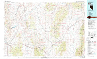
1980s Maps of Tooele County, Utah
Explore 25 historic maps of Tooele County from the 1980s. These maps offer a rare glimpse into what life looked like during the 1980s — showing old roads, neighborhoods, homes, and landmarks that have changed or disappeared over time.
Whether you're researching your family's past, planning a metal detecting trip, or studying how Tooele County's landscape evolved across the 1980s, these high-resolution maps are a powerful tool for exploring the history of this region.
- Focus on a specific era: All maps on this page are from the 1980s, giving you a focused view of this time period.
- See what’s changed: Compare century-old streets, trails, and buildings to today's modern landscape using overlays and satellite layers.
- Research with precision: Use these maps for genealogy, historical research, land use analysis, or educational projects.
- View, download, or print: Maps are fully viewable online in high resolution, and can be downloaded or printed for your own records.
Start exploring Tooele County's history through authentic maps from the 1980s. This is your window into the past.
Tooele County, UT maps
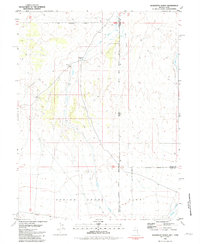
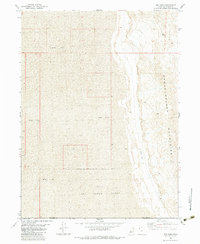
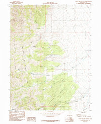
(25)- 1980 Map of Saint John
 1980 Saint John1980 Print · USGSRush Valley in the early 1980s reveals a unique intersection of military infrastructure and rural ranching life. Researchers can trace the Union Pacific line through Saint John Sta to the Tooele Army Depot and the settlement of Clover.
 - 1980 Map of Stockton
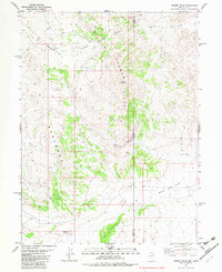
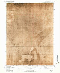
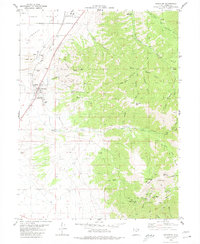 1980 Stockton1980 Print · USGSThe northern Oquirrh Mountains near the turn of the 1980s show a landscape shaped by mining and military industry. Trace family history at Stockton, or locate high-country mining claims like the Calumet Mine and Hidden Treasure Mine.2 unique versions available
 - 1980 Map of Ophir
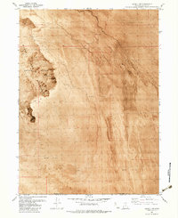
 1980 Ophir1980 Print · USGSOphir and the surrounding Oquirrh Mountains are shown in the late 1970s as a landscape of intensive mining and military operations. Researchers can locate the Montana Mine and the extensive grounds of the Tooele Army Depot alongside local landmarks like Bates Ranch.2 unique versions available
 - 1980 Map of South Mountain
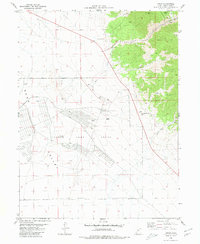
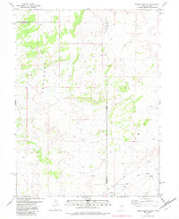
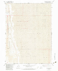
 1980 South Mountain1980 Print · USGSRush Valley and the high-desert terrain of Tooele County are captured here in the late twentieth century. Researchers can trace the industrial footprint of the Tooele Army Depot and follow the Union Pacific line as it passes Rush Lake.2 unique versions available
 - 1981 Map of Wells
 1981 Wells1981 Print · USGSNortheast Nevada during the early 1980s reveals a landscape shaped by transcontinental rail lines and remote desert outposts. Trace the historic paths of the Southern Pacific and Western Pacific near the settlements of Wells, Cobre, and Montello.2 unique versions available
 - 1981 Map of Georgetta Ranch
 1981 Georgetta Ranch1981 Print · USGSThe Nevada-Utah borderlands are captured in the early eighties as a landscape of remote ranching and desert transit. Genealogists and historians can trace the foundations of Georgetta Ranch, the route of Whiskey Road, and the extent of the Goshute Indian Reservation.
 - 1982 Map of Ferber Peak
 1982 Ferber Peak1982 Print · USGSCrossing the Nevada and Utah border in the early eighties, this survey captures a remote basin-and-range mining landscape. Genealogists and historians can trace old Mines and Prospects near Ferber Peak or follow a Jeep Trail through the Badlands.
 - 1982 Map of Ferber Peak SE
 1982 Ferber Peak SE1982 Print · USGSThe Nevada-Utah borderlands are captured here in the early 1980s, showing a rugged landscape defined by high-desert hydrology. Genealogists and desert explorers can trace early routes like the Jeep Trail and locate vital water sources including the Flowing Well and West Creek.
 - 1983 Map of Lucin 4 SW
 1983 Lucin 4 SW1983 Print · USGSThe western edges of the Great Salt Lake Desert are captured in the early eighties, showcasing a landscape of stark geological formations. Trace the remote Jeep Trail through the Silver Island Mountains and locate a solitary mine overlooking the vast Mud Flat.
 - 1983 Map of Big Pass
 1983 Big Pass1983 Print · USGSThe high desert of western Utah was a landscape of military range and rugged ridges in the early 1980s. Researchers can trace the boundaries of the Hill Air Force Range and locate remote infrastructure like the Landing Strip near Big Pass.
 - 1983 Map of Keller Well
 1983 Keller Well1983 Print · USGSThe Great Salt Lake Desert's western reaches are captured here in the early eighties, where the Newfoundland Mountains meet the vast Mud Flat. Researchers can trace remote desert infrastructure like Keller Well and the boundaries of the Hill Air Force Range.
 - 1983 Map of Lucin 4 SE
 1983 Lucin 4 SE1983 Print · USGSBox Elder and Tooele counties meet in this stark desert corridor during the early 1980s. Researchers of military and western land use can trace the perimeter of the Air Force Range as it crosses the vast Mud Flat and lone Hill.
 - 1985 Map of Salt Mountain
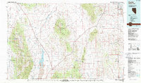
 1985 Salt Mountain1985 Print · USGSThe high desert of Tooele County meets the rugged peaks of the Wasatch National Forest in the mid-1980s. Genealogists and historians can locate a secluded Cem in the valley floor near water sources like Horseshoe Springs and Kanaka Lake.
 - 1985 Map of Johnson Pass
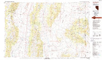
 1985 Johnson Pass1985 Print · USGSTooele County in the mid-1980s is captured here at the intersection of the Stansbury Mountains and the Onaqui Mountains. Researchers can map the rugged terrain around Johnson Pass, locating remote sites like Terra, Stookey Spring, and the narrow passage of Devils Gate Narrows.
 - 1985 Map of Flux
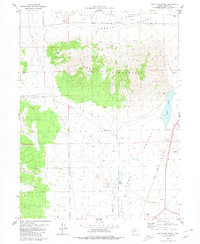
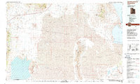
 1985 Flux1985 Print · USGSThe Tooele Valley in the mid-eighties shows a rugged landscape shaped by salt production and canyon drainage. Genealogists and historians can trace industrial sites at Flux and Dolomite or locate family landmarks near Grantsville and Miners Canyon.
 - 1985 Map of Deseret Peak West
 1985 Deseret Peak West1985 Print · USGSTooele County in the mid-1980s reveals the striking boundary between tribal lands and the high wilderness of the Stansbury Mountains. Trace the rugged topography from the floor of Skull Valley up to Deseret Peak and the alpine South Willow Lake.
 - 1985 Map of Wendover
 1985 Wendover1985 Print · USGSThe high desert borderlands of Utah and Nevada are captured here during the mid-eighties, dominated by vast salt flats and isolated mountain ranges. Researchers can trace the sprawling Wendover Air Force Auxiliary Field, old rail stops like Shafter, and remote workings at the Monarch Mine.
 - 1985 Map of Timpie
 1985 Timpie1985 Print · USGSSkull Valley and the Stansbury Mountains are shown here in the mid-1980s, detailing a harsh but managed desert landscape. Researchers can trace the layout of the Timpie Springs Waterfowl Management Area and locate landmarks like Lone Rock and Big Spring.
 - 1985 Map of Terra
 1985 Terra1985 Print · USGSSkull Valley and the slopes of the Stansbury Mountains are captured here in the mid-1980s, documenting a landscape of isolated springs and high-country forest. Researchers can locate the settlement of Terra and trace water sources like Jenning Springs or the boundaries of the Indian Reservation.
 - 1985 Map of North Willow Canyon
 1985 North Willow Canyon1985 Print · USGSThe eastern slopes of the Stansbury Mountains come into sharp focus in the mid-1980s, revealing a landscape defined by mining and forest management. Hikers and historians can trace the network of Mines, Prospects, and high-country water sources like North Willow Lake and Pope Canyon Spring.2 unique versions available
 - 1985 Map of Deseret Peak East
 1985 Deseret Peak East1985 Print · USGSThe high Stansbury Mountains come into sharp focus in the 1980s, revealing a landscape of alpine lakes and steep canyon passes. Researchers can trace historic mining activity near North Willow Lake or locate remote landmarks like State Rock Peak and Vickory Mountain.
 - 1987 Map of Currie
 1987 Currie1987 Print · USGSElko County at the end of the 1980s reveals a vast basin-and-range landscape centered on the remote outpost of Currie. Genealogists and historians can trace the Nevada Northern rail line, identify family-named water sources like Boone Spring, and locate the Goshute Indian Reservation boundary.
 - 1987 Map of Promontory Point
 1987 Promontory Point1987 Print · USGSThe Wasatch Front meets the great salt desert in the late eighties, showing the rapid growth of towns from Brigham City to Layton. Follow the Southern Pacific (Lucin Cutoff) across the water and explore the remote terrain of Antelope Island and Promontory Point.
 - 1988 Map of Newfoundland Mountains
 1988 Newfoundland Mountains1988 Print · USGSBox Elder County at the edge of the desert during the late 1980s reveals a landscape of isolated ranges and military testing grounds. Researchers can trace the Old Railroad Grade past Lucin and locate historic water sources like Donner Spring.3 unique versions available
 - 1988 Map of Kern Mountains
 1988 Kern Mountains1988 Print · USGSThe high-desert basins of the Nevada-Utah border are captured here in the late eighties, documenting a remote landscape of mining and ranching. Researchers can trace historic travel routes through Schellbourne Pass or locate the site of Cherry Creek Station and Stonehouse.2 unique versions available
End of results
Showing maps 1-25 of 25
Top cities of Tooele County
- Tooele historical maps
- Grantsville historical maps
- Stansbury Park historical maps
- Erda historical maps
- Lake Point historical maps
- Wendover historical maps
See more
Frequently asked questions
- What are the different types of historical maps available for Tooele County?
- What is the oldest map of Tooele County?
- Where can I purchase historical maps of Tooele County for my home or office?
- Where can I download high-res historical maps of Tooele County?
- Are there historical topographic maps available for Tooele County?
- Is there historical aerial imagery available for Tooele County?
- Where are historical maps of Tooele County sourced from?