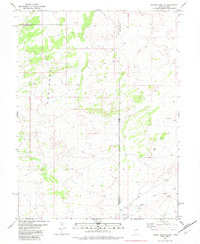
1982 Map of Ferber Peak SE
USGS Topo · Published 1982About this map
Nevada and Utah meet at a high-desert boundary defined by complex topography and scarce water sources in this early 1980s survey. The landscape is dominated by the deeply eroded Badlands to the northwest, where the border between Elko and White Pine counties is also established. This arid environment is mapped with a focus on hydrology and movement, highlighting essential water points like the Flowing Well, several Springs, and a lone Spring near the eastern edge. Settlement is absent here, replaced by a network of seasonal routes and utility, as evidenced by the Jeep Trail winding through the foothills. Along the southern boundary, the course of West Creek provides a rare drainage feature in an otherwise high, broken terrain where White Pine County meets Tooele County.
Find a feature on this map
10 named features on this map. Tap any name to fly to it.
Don’t see what you’re looking for? This feature index may not catch every label — zoom into the map to look around manually.
Map Details
Editions of this 1982 Ferber Peak SE Map
This is the sole edition of this map. No revisions or reprints were ever made.
Other maps of this area

1908 · Fish Springs
USGS Topo · 1:250,000

1910 · Fish Springs
USGS Topo · 1:250,000

1925 · Gold Hill
USGS Topo · 1:62,500

1928 · Gold Hill
USGS Topo · 1:62,500

1953 · Tooele
USGS Topo · 1:250,000

1953 · Delta
USGS Topo · 1:250,000

1955 · Tooele
USGS Topo · 1:250,000

1955 · Elko
USGS Topo · 1:250,000

1956 · Ely
USGS Topo · 1:250,000

1958 · Elko
USGS Topo · 1:250,000