1970s Maps of Tooele County, Utah
Explore 87 historic maps of Tooele County from the 1970s. These maps offer a rare glimpse into what life looked like during the 1970s — showing old roads, neighborhoods, homes, and landmarks that have changed or disappeared over time.
Whether you're researching your family's past, planning a metal detecting trip, or studying how Tooele County's landscape evolved across the 1970s, these high-resolution maps are a powerful tool for exploring the history of this region.
- Focus on a specific era: All maps on this page are from the 1970s, giving you a focused view of this time period.
- See what’s changed: Compare century-old streets, trails, and buildings to today's modern landscape using overlays and satellite layers.
- Research with precision: Use these maps for genealogy, historical research, land use analysis, or educational projects.
- View, download, or print: Maps are fully viewable online in high resolution, and can be downloaded or printed for your own records.
Start exploring Tooele County's history through authentic maps from the 1970s. This is your window into the past.
Tooele County, UT maps
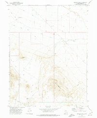
(87)- 1970 Map of Crater Island, 1972 Print
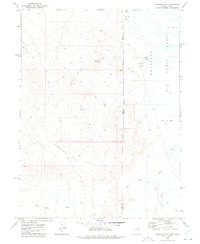
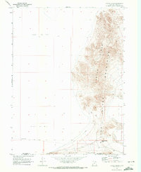 1970 Crater Island1972 Print · USGSThe Great Salt Lake Desert in the early 1970s reveals a harsh landscape of salt flats and isolated peaks. Historians can trace the legendary Donner-Reed Trail as it crosses through Donner-Reed Pass near the Crater Island Mountains.
 - 1971 Map of Vernon NE, 1974 Print
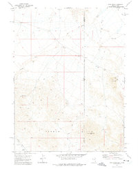
 1971 Vernon NE1974 Print · USGSTooele County's high-desert landscape is captured here in the early seventies, centered on the historic Rush Valley. Researchers can locate the Site of Rush Valley Pony Express Station or trace the Union Pacific line as it skirts the Vernon Hills.
 - 1971 Map of Faust, 1974 Print
 1971 Faust1974 Print · USGSRush Valley in the early seventies preserves the path of the Old West alongside modern rail infrastructure. Trace the historic route of the Pony Express Road past the Pony Express Station and the Union Pacific line near Faust.
 - 1971 Map of Erickson Knoll, 1974 Print
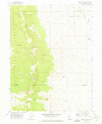
 1971 Erickson Knoll1974 Print · USGSThe Sheeprock Mountains and the Tooele-Juab county line are captured here in the early 1970s, showing a remote landscape of mining and ranching. Genealogists and researchers can trace family-named sites like Wright Ranch and the historical Utah Mine.
 - 1971 Map of Silver Island Pass, 1974 Print
 1971 Silver Island Pass1974 Print · USGSTooele County’s high desert landscape is frozen in time during the early seventies, showcasing the stark boundary between salt flats and mountains. Researchers can trace the path through Silver Island Pass or locate remote water sources like Springs and the lonely Jeep Trail.
 - 1971 Map of Onaqui Mts South, 1974 Print
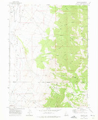
 1971 Onaqui Mts South1974 Print · USGSIn the early 1970s, this section of Tooele County shows the intersection of historic western trails and modern infrastructure. Genealogists and historians can trace the Pony Express Road past Little Mountain and locate remote water sources like Hellhole Spring.
 - 1971 Map of Miners Canyon, 1974 Print
 1971 Miners Canyon1974 Print · USGSThe Nevada and Utah borderlands at the start of the 1970s reveal a landscape of high desert springs and mountain trails. Researchers can trace the path of the Aqueduct through the foothills or locate remote landmarks like Window Rock, Miners Spring, and Halls Meadow.2 unique versions available
 - 1971 Map of Vernon, 1974 Print
 1971 Vernon1974 Print · USGSRanching and federal land management define this portion of Tooele County during the early seventies. Genealogists and historians can locate Vernon Cem, the historical Benmore (Site), and the unique Chief Green Jacket Grave.
 - 1971 Map of Lookout Pass, 1974 Print
 1971 Lookout Pass1974 Print · USGSIn the early 1970s, this portion of Tooele County remained a rugged landscape defined by the historic path of the Pony Express Road. Historians can trace the Site of Lookout Pass Pony Express Station and find remote landmarks like Stepladder Trough and Lion Hill.
 - 1971 Map of Lofgreen, 1974 Print
 1971 Lofgreen1974 Print · USGSRush Valley and the settlement of Lofgreen are captured here in the early 1970s, during an era when the railroad and ranching still dictated the pace of life. Researchers can trace the Union Pacific route and locate specific landmarks like the Water Tank and Scranton Well.
 - 1971 Map of Leppy Peak, 1974 Print
 1971 Leppy Peak1974 Print · USGSThe Nevada-Utah borderlands at the start of the 1970s showcase a high-desert landscape defined by the Leppy Hills and remote caves. Geologists and local historians can trace the topography of Danger Cave State Park, Leppy Pass, and several Jeep Trails through the sand dunes.2 unique versions available
 - 1971 Map of Graham Peak, 1974 Print
 1971 Graham Peak1974 Print · USGSThe Silver Island Mountains rose above the salt flats in the early 1970s, marking a transition between the desert floor and high peaks. Researchers can locate scattered Ruins, various Mines, and several Caves tucked away in Donner Canyon.
 - 1971 Map of Tetzlaff Peak, 1977 Print
 1971 Tetzlaff Peak1977 Print · USGSThe Silver Island Mountains meet the legendary speedways of Tooele County in the early seventies. Trace the foundations of the International Bonneville Hot Rod Racetrack and the ancient site at Danger Cave State Park.
 - 1971 Map of Bonneville Racetrack, 1977 Print
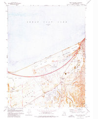
 1971 Bonneville Racetrack1977 Print · USGSTooele County in the early seventies is defined by the stark expanse of the Bonneville Salt Flats. Racing enthusiasts and historians can trace the exact layout of the International Racetrack Hot Rod Track alongside a remote Landing Strip and Brine Test Wells.
 - 1972 Map of Plug Peak NE, 1973 Print
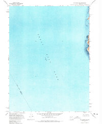 1972 Plug Peak NE1973 Print · USGSThe waters of the Great Salt Lake and the western edge of Antelope Island are captured in this early seventies orthophoto survey. Genealogists and researchers can trace the submerged Davis Co and Tooele Co county line across the lake floor.
 - 1972 Map of Antelope Island South, 1974 Print
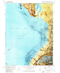 1972 Antelope Island South1974 Print · USGSThe southern shore of the Great Salt Lake in the early seventies shows a landscape shaped by salt production and recreation. Trace the footprint of the Saltair Resort (Site) and follow the Salt Lake Garfield and Western line across the mud flats.2 unique versions available
 - 1972 Map of Mills Junction, 1974 Print
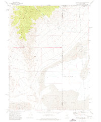
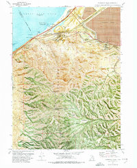
 1972 Mills Junction1974 Print · USGSTooele Valley sits at a crossroads of salt extraction and suburban emergence in the early seventies. Genealogists and historians can trace family roots at Lake Point Cem or explore early landmarks like Adobe Rock Historical Marker and Mills Junction.2 unique versions available
 - 1972 Map of Burmester, 1974 Print
 1972 Burmester1974 Print · USGSTooele Valley meets the salt flats in the early 1970s, showcasing a landscape of rail transport and industrial salt works. Genealogists and historians can trace the Western Pacific corridor and find local landmarks like Burmester, Warm Springs, and Blue Lakes.
 - 1972 Map of Farnsworth Peak, 1974 Print
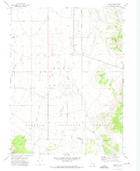
 1972 Farnsworth Peak1974 Print · USGSThe industrial shoreline of the Salt Lake Valley meets the high Oquirrh peaks in the early seventies, capturing a landscape of massive mines and vital rail corridors. Researchers can trace the legacy of the Garfield townsite, the sprawling tailings ponds, and the operations at Arthur and Lake Point.4 unique versions available
 - 1972 Map of Ferguson Flat, 1975 Print
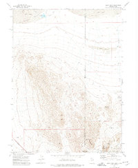
 1972 Ferguson Flat1975 Print · USGSThe Nevada-Utah borderlands in the early seventies reveal a desert landscape defined by military ranges and mining prospects. Trace historical land use through Lead Mine Hills, the Wendover Air Force Range, and local Ruins.
 - 1972 Map of Utah Peak, 1975 Print
 1972 Utah Peak1975 Print · USGSThe Nevada and Utah borderlands are captured here in the early seventies, a landscape of mineral prospecting and high-desert ranching. Trace early energy exploration and livestock management through Well No 1 (Oil), Jerry Well, and a Corral set among the Ferber Hills.
 - 1972 Map of Goshute Canyon, 1975 Print
 1972 Goshute Canyon1975 Print · USGSThe Deep Creek Range in the early 1970s reveals a landscape defined by mining history and early western transit routes. You can trace the Pony Express and Overland Stage Route and locate high-altitude workings like the Eagles Nest Mine and Oro del Rey Mine.3 unique versions available
 - 1972 Map of Goshute, 1975 Print
 1972 Goshute1975 Print · USGSThe High Desert borderlands of Tooele and Juab counties are captured here in the early 1970s, focused on the Goshute Indian Reservation. Genealogists and researchers can trace remote landmarks like the Cem and Skinner Springs among the vast network of Jeep Trails.3 unique versions available
 - 1972 Map of Elephant Knoll, 1975 Print
 1972 Elephant Knoll1975 Print · USGSTooele County's high desert landscape comes into focus during the early seventies, showing a world of isolated ranching and rail history. Trace the Old RR Grade and find remote landmarks like Last Chance Ranch or the distinctive Rock Window.2 unique versions available
 - 1972 Map of Wendover, 1977 Print
 1972 Wendover1977 Print · USGSWendover and the surrounding desert landscape are captured here in the early seventies as a primary node for military testing and transit. Researchers can trace the massive Wendover Air Force Auxiliary Field, the historic Western Pacific rail line, and sites like Danger Cave State Park.
Showing maps 1-25 of 87
Top cities of Tooele County
- Tooele historical maps
- Grantsville historical maps
- Stansbury Park historical maps
- Erda historical maps
- Lake Point historical maps
- Wendover historical maps
See more
Frequently asked questions
- What are the different types of historical maps available for Tooele County?
- What is the oldest map of Tooele County?
- Where can I purchase historical maps of Tooele County for my home or office?
- Where can I download high-res historical maps of Tooele County?
- Are there historical topographic maps available for Tooele County?
- Is there historical aerial imagery available for Tooele County?
- Where are historical maps of Tooele County sourced from?