1960s Maps of Vernal, Utah
Explore 3 historic maps of Vernal from the 1960s. These maps offer a rare glimpse into what life looked like during the 1960s — showing old roads, neighborhoods, homes, and landmarks that have changed or disappeared over time.
Whether you're researching your family's past, planning a metal detecting trip, or studying how Vernal's landscape evolved across the 1960s, these high-resolution maps are a powerful tool for exploring the history of this region.
- Focus on a specific era: All maps on this page are from the 1960s, giving you a focused view of this time period.
- See what’s changed: Compare century-old streets, trails, and buildings to today's modern landscape using overlays and satellite layers.
- Research with precision: Use these maps for genealogy, historical research, land use analysis, or educational projects.
- View, download, or print: Maps are fully viewable online in high resolution, and can be downloaded or printed for your own records.
Start exploring Vernal's history through authentic maps from the 1960s. This is your window into the past.
Vernal, UT maps
(3)- 1960 Map of Vernal
 1960 Vernal1960 Print · USGSNortheastern Utah was a rugged frontier of mineral extraction and federal conservation in the mid-twentieth century. Genealogists and historians can trace the growth of Vernal, locate Gilsonite mining operations near Bonanza, and explore the 1950s boundaries of Dinosaur National Monument.
 - 1964 Map of Vernal NE, 1965 Print
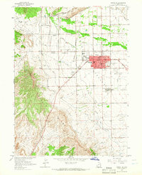 1964 Vernal NE1965 Print · USGSThe Ashley Valley thrived in the mid-sixties as a hub of irrigation and industry, centered on the growing community of Vernal. Researchers can locate family sites near Rock Point Cem, trace the complex Steinaker Canal system, or find the old Drive-in Theater.2 unique versions available
 - 1965 Map of Naples, 1967 Print
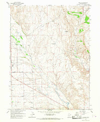 1965 Naples1967 Print · USGSNaples and the surrounding Ashley Valley are shown here during a period of industrial and utility expansion in the mid-1960s. Genealogists and local historians can locate early infrastructure like the Vernal Substation, Mantle Gulch, and the Vernal Golf Course.2 unique versions available
End of results
Showing maps 1-3 of 3
Top cities near Vernal
Frequently asked questions
- What are the different types of historical maps available for Vernal?
- What is the oldest map of Vernal?
- Where can I purchase historical maps of Vernal for my home or office?
- Where can I download high-res historical maps of Vernal?
- Are there historical topographic maps available for Vernal?
- Is there historical aerial imagery available for Vernal?
- Where are historical maps of Vernal sourced from?