Old Maps of Lyman, Utah for Academic Research
Study the evolution of Lyman with 11 high-resolution historic maps. Whether you're teaching, researching, or modeling changes in land use, these maps provide essential visual documentation of urban, environmental, and geographic change.
- Analyze long-term change: Track patterns in development, transportation, and natural features.
- Ideal for environmental or urban studies: Support academic projects with primary historical map data.
- Use in the classroom or lab: Educators and researchers rely on these maps to bring historical context to life.
These maps are a powerful tool for teaching, research, and visualizing how Lyman has changed over the decades.
Lyman, UT maps
(11)- 1885 Map of Fish Lake
 1885 Fish Lake1885 Print · USGSThe high plateaus and early canyon settlements of central Utah are documented here in the mid-1880s, shortly after the Powell Survey. Genealogists and historians can trace early families in Salina, Antimony, and Cousharem, or locate remote sites like Bean Spring.
 - 1896 Map of Fish Lake, 1899 Print
 1896 Fish Lake1899 Print · USGSSouthern Utah in the late nineteenth century is a land of high plateaus and isolated river settlements. Trace early pioneer outposts like Thurber, Teardale, and Antimony alongside geological marvels such as Fish Lake and the Water Pocket Flexure.4 unique versions available
 - 1952 Map of Loa 1 NE, 1973 Print
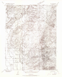 1952 Loa 1 NE1973 Print · USGSWayne County ranching and remote mountain terrain define this mid-century survey of the Utah high plateaus. Genealogists and historians can trace irrigation networks like the High Line Ditch and find landmarks such as the Lyman Cemetery and Fremont village.
 - 1956 Map of Salina
 1956 Salina1956 Print · USGSCentral Utah in the mid-fifties reveals a landscape of high plateaus and desert basins before the modern highway era. Researchers can trace the ranching and mining roots of Hanksville and Loa or locate the Lucky Strike Mine near the San Rafael Swell.5 unique versions available
 - 1960 Map of Salina
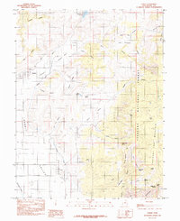
 1960 Salina1960 Print · USGSThe high plateaus and canyonlands of south-central Utah appear in the early sixties as a region of remote ranching towns and developing parklands. Researchers can trace historic settlements like Fruita and Loa or locate the uranium mines and the tracks of the Denver and Rio Grande Western RR.2 unique versions available
 - 1962 Map of Salina
 1962 Salina1962 Print · USGSSevier County and the surrounding desert wilderness appear here in the early sixties as a network of isolated river valley towns and high-altitude forests. Researchers can locate remote landmarks like Fruita, trace the Denver & Rio Grande Western RR, and find backcountry sites like the Aquarius Ranger Station.
 - 1967 Map of Lyman, 1973 Print
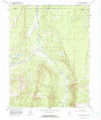 1967 Lyman1973 Print · USGSThe high country of the Uinta and Summit County border is captured here in the late sixties as the Meeks Cabin Reservoir began to fill. Researchers can locate the Old Blacks Fork Commissary, the Youth Camp at Lyman Lake, and the remote East Fork Blacks Fork Guard Station.
 - 1980 Map of Loa
 1980 Loa1980 Print · USGSCentral Utah's high plateaus and the Fremont River corridor are captured here during the 1980s, showcasing a landscape of high-elevation reservoirs and remote ranching outposts. Genealogists can trace family names and early settlements from Loa and Teasdale to the orchards of Fruita.2 unique versions available
 - 1985 Map of Lyman
 1985 Lyman1985 Print · USGSWayne County settlements and high desert water systems are captured in the mid-eighties as ranchers managed the eastern edge of the plateau. Local historians can trace early water infrastructure like the Highline Ditch and family-named landmarks including Tidwell Spring and Burnt Springs.
 - 2001 Map of Lyman, 2003 Print
 2001 Lyman2003 Print · USGSThe Fremont River valley and the eastern slopes of Thousand Lake Mountain are documented here at the turn of the millennium. Researchers can locate the local Cem, trace the HIGHLINE DITCH, and map high-altitude landmarks like Blind Lake.
 - 2023 Map of Lyman, 2023 Print
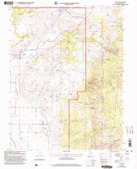
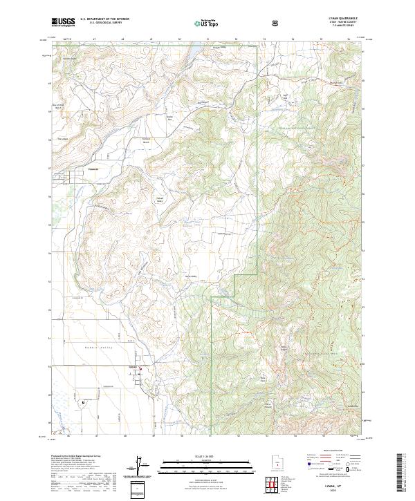 2023 Lyman2023 Print · USGSWayne County ranching and irrigation systems are preserved in this contemporary survey of the high plateau country. Genealogists and local historians can locate family landmarks such as Lyman Cem and trace the vital water networks of High Line Ditch and Tidwell Reservoir.
End of results
Showing maps 1-11 of 11
Top cities near Lyman
Frequently asked questions
- What are the different types of historical maps available for Lyman?
- What is the oldest map of Lyman?
- Where can I purchase historical maps of Lyman for my home or office?
- Where can I download high-res historical maps of Lyman?
- Are there historical topographic maps available for Lyman?
- Is there historical aerial imagery available for Lyman?
- Where are historical maps of Lyman sourced from?