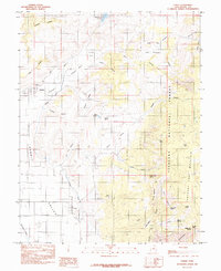
1985 Map of Lyman
USGS Topo · Published 1985About this map
Lyman and Fremont anchor this mid-1980s landscape at the edge of the Fishlake National Forest, where high plateaus drop toward the alluvial plains of Rabbit Valley. The engineering of the high desert is visible through systems like the Highline Ditch and the Loa Ditch, which redirect water from the Fremont River to sustain local agriculture on the Fremont Bench. The map details a complex network of springs and reservoirs, including Mill Meadow Reservoir and Tidwell Reservoir, essential for the ranching and farming operations that have historically defined Wayne County. To the east, the terrain rises sharply toward the timbered slopes of Thousand Lake Mountain, marked by landmarks such as Blind Lake and Saddle Pass. This survey illustrates the delicate balance of water management and topography in a region where local livelihoods are tied directly to the drainage of the Mormon Fork and Horse Valley.
Find a feature on this map
41 named features on this map. Tap any name to fly to it.
Don’t see what you’re looking for? This feature index may not catch every label — zoom into the map to look around manually.
Map Details
Editions of this 1985 Lyman Map
This is the sole edition of this map. No revisions or reprints were ever made.
Other maps of this area

1885 · Fish Lake
USGS Topo · 1:250,000

1896 · Fish Lake
USGS Topo · 1:250,000

1952 · Notom 2 NW
USGS Topo · 1:24,000

1952 · Loa 1 SE
USGS Topo · 1:24,000

1952 · Notom 2 SW
USGS Topo · 1:24,000

1952 · Torrey
USGS Topo · 1:62,500

1952 · Loa 1 NE
USGS Topo · 1:24,000

1956 · Salina
USGS Topo · 1:250,000

1960 · Salina
USGS Topo · 1:250,000

1962 · Salina
USGS Topo · 1:250,000